Starting point: Rotek (968 m)
| Lat/Lon: | 46,2272°N 14,032°E |
| |
Time of walking: 1 h 15 min
Difficulty: easy unmarked way
Altitude difference: 358 m
Altitude difference po putu: 358 m
Map: Škofjeloško in Cerkljansko hribovje 1:50.000
Recommended equipment (summer):
Recommended equipment (winter): ice axe, crampons
Views: 690
 | 2 people like this post |
Access to the starting point:
a) First drive to Škofja Loka, then continue driving in the direction of Železniki and Tolmin. A few kilometres after Zali Log we reach a crossroads at Podrošt, where we continue straight on in the direction of Sorica and Soriška planina (Petrovo Brdo and Tolmin on the left). When the road from Petrovo Brda joins us above Sorica from the left, we continue to the right, and then drive towards Soriška planina only as far as a crossroads, where the roads to Zgornji and Spodnje Danje branch off to the right. Park in a suitable place on the roadside. Recently, the road Podrošt - Sorica is often closed due to the rehabilitation of the road. In this case, use the detour by continuing towards Tolmin at Podrošt and then turning right at the first crossroads. After a fairly steep road, you will arrive in Sorica, where you will join the main road back to Soriška planina.
b) From the direction of Baška grapa, drive to Petrovo Brda, and from there turn left towards Soriška planina. Shortly after joining the road from Sorice, you will reach a crossroads where the roads to Zgornji and Spodnje Danje branch off to the right. Park in a suitable place on the roadside.
c) From Bohinjska Bistrica, continue driving towards Soriška planina, and from there start descending towards Sorice. After a few kilometres of descending to the left, the roads to Zgornji and Spodnje Danje branch off and park at a suitable roadside location.
Path description:
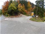
From the starting point, continue along the road in the direction of Zgornje Danje and Ratitovec, which initially opens up a view towards St Mark's Church in Spodnje Danje, but after crossing the power line, the road turns into a forest, through which it climbs crosswise. After a few minutes, a wide cart track road branches off the road slightly to the left, after which the cross-climb continues. At first, cart track runs completely alongside the road, then moves slightly away from it. At a few crossroads, continue straight ahead or keep to the right. A little higher up, on a short, slightly more scenic section, we are joined on the right by cart track, which leads from the village Spodnje Danje, and we continue in the same direction. After this crossroads, cart track becomes a little steeper, and it also turns into a steeper slope. Further on, cart track turns more and more to the left and then quickly becomes a small valley, which leads to a forest road leading from Soriška planina towards Valant's Edge.
When you reach the road, follow it to the left, then start climbing, first gently and then moderately. After a long left turn, the road flattens out, but does not flatten out. At the beginning of the right-hand serpentine, the road forks off in a straight line, cart track, and continues along it. A little further on, on a small wall, the overgrown cart track branches off to the right, leading to the summit of Tonderškofel, and cart track continues in a straight direction towards the summit of Erbelc.
Continue right along the initially quite overgrown cart track, then cart track turns left and becomes less overgrown. A semicircular ascent follows and cart track leads to the base of Tonderškoflo, the top of which is reached after a few steps on a pathless track.
Description and pictures refer to the situation in 2015 (October).

Pictures:
 1
1 2
2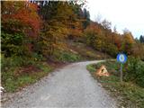 3
3 4
4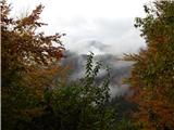 5
5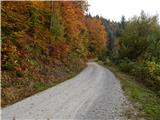 6
6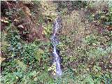 7
7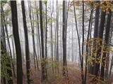 8
8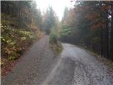 9
9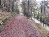 10
10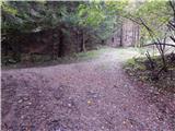 11
11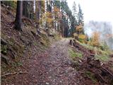 12
12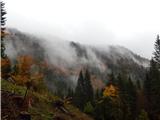 13
13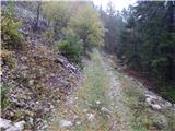 14
14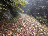 15
15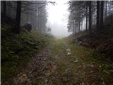 16
16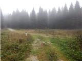 17
17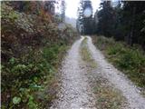 18
18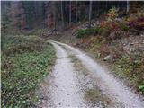 19
19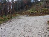 20
20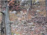 21
21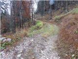 22
22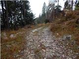 23
23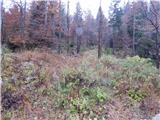 24
24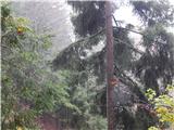 25
25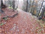 26
26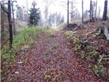 27
27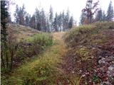 28
28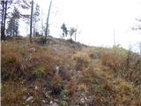 29
29 30
30
Discussion about the trail Rotek - Tonderškofel