Starting point: Rosstratte (1732 m)
| Lat/Lon: | 46,5929°N 13,7113°E |
| |
Time of walking: 45 min
Difficulty: easy marked way
Altitude difference: 224 m
Altitude difference po putu: 224 m
Map:
Recommended equipment (summer):
Recommended equipment (winter): ice axe, crampons
Views: 2.433
 | 1 person likes this post |
Access to the starting point:
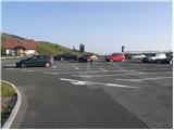
First we drive to Kranjska Gora, then we continue driving towards Rateče. When you reach Podkoren, leave the main road and continue driving to the right towards Korenski sedlo. From the saddle, descend to the Austrian side, where you turn right in the valley towards Bialjak / Villach. Continue through the village of Ločilo / Hart to Bialek, where signs for Spittal direct you to the bypass road past the town. The road then soon leads to Judendorf (a suburb of Belgrade), and just ahead we see signs for the Beljac Alpine Road / Villacher Alpenstrasse. Here we turn right and follow the road to the parking lot, which is located at 1732 m (the road is toll road €14 car and €8 motorbike, July 2012).
From the Koren saddle to the top of the Beljaška cesta is about 32 km.
Path description:
From the parking lot, continue along the narrow asphalt road, which is closed to public traffic by a traffic sign. The asphalt soon ends and the road leads past a pasture fence to a marked crossroads, where a marked trail to Plajberk near Bialjak / Bad Bleiberg branches off to the right, and we continue to the left and follow the ascending dirt road leading to the top of Dobrač. After a short climb, we reach a sharp right turn, in the middle of which an unmarked path branches off, leading to Dobratsch, and we continue for a short distance along a relatively steep and increasingly scenic road. Higher up, where the slope flattens out a little, we reach a marked crossroads. At this crossroads, leave the road and continue slightly left on the marked path, which begins to climb steeply up the grassy slope. The not too steep path then leads us quickly past a bench to the top of Zehnernock, which we recognise by the hut at the top.
Pictures:
 1
1 2
2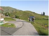 3
3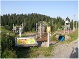 4
4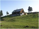 5
5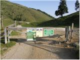 6
6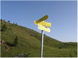 7
7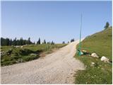 8
8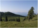 9
9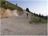 10
10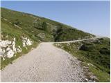 11
11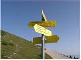 12
12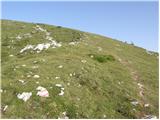 13
13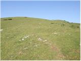 14
14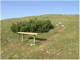 15
15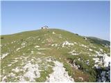 16
16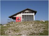 17
17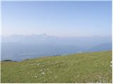 18
18 19
19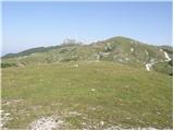 20
20
Discussion about the trail Rosstratte - Zehnernock