Ristorante Pietofana - Tofana di Mezzo (Via Ferrata Gianni Aglio)
Starting point: Ristorante Pietofana (1675 m)
| Lat/Lon: | 46,54074°N 12,09882°E |
| |
Name of path: Via Ferrata Gianni Aglio
Time of walking: 7 h 35 min
Difficulty: extremely difficult marked way
Ferata: D
Altitude difference: 1569 m
Altitude difference po putu: 1708 m
Map: Tabacco 03 1:25.000
Recommended equipment (summer): helmet, self belay set
Recommended equipment (winter): helmet, self belay set, ice axe, crampons
Views: 3.442
 | 2 people like this post |
Access to the starting point:
Access from Gorenjska: Via Border crossing Rateče or Predel to Trbiž / Tarvisio and then along the motorway towards Udine to the Tolmezzo exit. From Tolmezzo, follow the road towards Ampezzo and the Passo della Mauria mountain pass. The road then descends and leads to a crossroads where you turn left (possibly right) towards Cortina d'Ampezzo. At all subsequent junctions, follow the signs for Cortina d'Ampezzo.
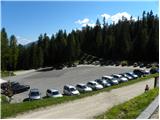
In Cortina d'Ampezzo, follow the signs for the Passo di Falzarego Alpine pass. Follow this ascending road to a crossroads where a narrower road branches off to the right towards the Pie Tofana restaurant and the Col Druscie hut. The crossroads are at the bottom of the road towards the Passo Falzarego pass. At this junction, turn right and follow the asphalted road until you reach the large parking lot of the Pietofana restaurant.
From the coastal side: Take the motorway towards Venice/Venezia. At Portogruaro, leave the motorway towards Venice and turn right on the motorway towards Pordenone. At the next motorway junction near Conegliano, turn right towards Belluno. The motorway ends near Belluno and we continue towards Cortina d'Ampezzo at the next junctions. Continue as described above.
Path description:
From the parking lot, continue along the asphalted road and then turn left onto the dirt road after the signs "Rifugio Pomedes, Forcella Ra Valles". The dirt road, which is closed to traffic, begins to climb and quickly leads to a marked crossroads where a path branches off to the right towards the notch Forcella Ra Valles
At the crossroads, we continue straight ahead on the road which leads us out of the forest by the ski resort. Here we climb alongside the cable car for a while, then the road turns left across the ski slope. Once the road crosses the ski slope, pay attention as our route here branches off to the right onto the ski slope. The path along the ski slope is at first quite faint and leads you back to the right side of the ski lift. The trail continues to climb quite steeply up the ski slope, all the time passing slightly to the right of the cable car. The fairly steep ski slope turns slowly to the left, and then becomes flatter as you get near hut Rifugio Duca d'Aosta.
From here, turn left off the slope and it's an easy walk to the hut, from which you have a nice view of the mountains above Cortina d'Ampezzo.
From the hut, continue along the ski slope, which runs on the left side of the cable car. A cross-path branches off to the left towards the Dibona hut, and we continue along the ski slope, which soon becomes quite steep. The grassy slopes are replaced by sand, which requires a little caution in places. The path then becomes less steep and we can see towards the Pomedes hut. Here the path turns slightly to the right towards the cable car and there is only a short climb up to the hut.
The Rifugio Pomedes hut can also be reached by chairlift, saving a 1h 45min walk.
From the hut, continue straight ahead following the signs "Via Ferrata Punta Anna". The trail passes the top station of the cable car and then climbs up the scree to enter the climbing part of the trail.
The climbing route crosses the wall slightly to the left in the first part of the ascent and climbs steeply a few times. The route then becomes slightly more difficult and climbs almost vertically towards the ridge. The climb then follows a ridge which is very scenic and also exposed. The difficulty continues unabated and the route continues to follow the ridge for the most part, only in a few places the ridge retreats to the left west side. Later, the ridge only becomes slightly less steep and there follows a slightly less difficult but unprotected climb to the top of Punta Anna From the top, continue along the ridge and soon the path from the Camillo Giussani hut joins from the left. From the crossroads, walk along the ridge for a short distance, then the trail turns right and climbs steeply across a steep chute. The path then leads to the eastern, less steep slopes, where it soon reaches a crossroads. To the right, the Giuseppe Olivieri trail leads back down towards the Pomedes hut and the Ra Valles hut, where there is an intermediate gondola stop.
We continue left on the Ferrata Gianni Aglio, where we are directed by the sign "cima". A less demanding climb up to the ridge follows. On the ridge, continue right and the path becomes slightly more difficult again. There are a few vertical climbs and a few crampons and ladders to help you. The path then follows the ridge to the left and leads to a notch at the base of Tower Torre Aglio. From the notch there is a challenging vertical climb and then a short exposed traverse on wedges, which leads to a crossroads.
At the crossroads, continue straight on past the Tofana markers, and steeply uphill to the left leads to Torre Aglio, which is only a few minutes' steep climb along a steel cable.
The path then leads to an extremely exposed traverse of the wall of the Torre Aglio tower, aided by a rope and a couple of wedges to cross the vertical wall. After crossing, you reach the north side of the tower and descend quite steeply along the rope. After descending, we reach a crossroads where a path branches off to the right downhill towards the Bus de Tofana window (the window is only a few minutes away). At the crossroads, we continue slightly to the left and cross the scree. The path then climbs again a little more steeply and leads us past avalanche barriers. The path is a little less well protected in this part. There are again some steep climbs along the steel cable on the more difficult parts, and a ladder is also helpful. This path then leads us to a ridge along which we soon reach the top.
The route described is extremely difficult and is suitable only for experienced mountaineers with sufficient strength in their arms and plenty of fitness. The route is very long, so it is advisable to use the gondola to descend.

Pictures:
 1
1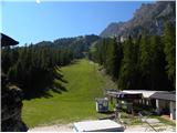 2
2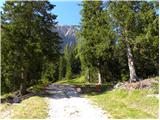 3
3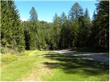 4
4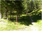 5
5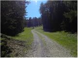 6
6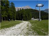 7
7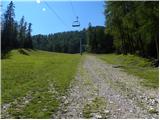 8
8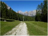 9
9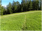 10
10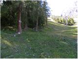 11
11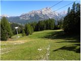 12
12 13
13 14
14 15
15 16
16 17
17 18
18 19
19 20
20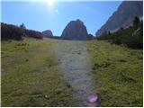 21
21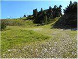 22
22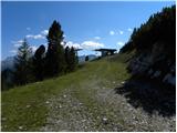 23
23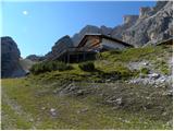 24
24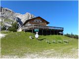 25
25 26
26 27
27 28
28 29
29 30
30 31
31 32
32 33
33 34
34 35
35 36
36 37
37 38
38 39
39 40
40 41
41 42
42 43
43 44
44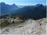 45
45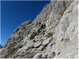 46
46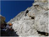 47
47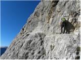 48
48 49
49 50
50 51
51 52
52 53
53 54
54 55
55 56
56 57
57 58
58 59
59 60
60 61
61 62
62 63
63 64
64 65
65 66
66 67
67 68
68 69
69 70
70 71
71 72
72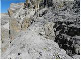 73
73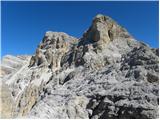 74
74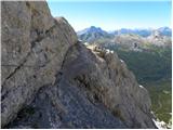 75
75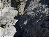 76
76 77
77 78
78 79
79 80
80 81
81 82
82 83
83 84
84 85
85 86
86 87
87 88
88 89
89 90
90 91
91 92
92 93
93 94
94 95
95 96
96 97
97 98
98 99
99 100
100 101
101 102
102 103
103 104
104 105
105 106
106 107
107 108
108 109
109 110
110 111
111 112
112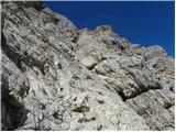 113
113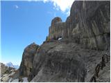 114
114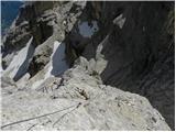 115
115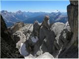 116
116 117
117 118
118 119
119 120
120 121
121 122
122 123
123 124
124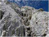 125
125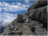 126
126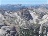 127
127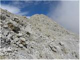 128
128 129
129 130
130 131
131 132
132 133
133 134
134
Discussion about the trail Ristorante Pietofana - Tofana di Mezzo (Via Ferrata Gianni Aglio)