Rifugio Bai de Dones - Rifugio Nuvolau (via Rifugio Cinque Torri)
Starting point: Rifugio Bai de Dones (1889 m)
| Lat/Lon: | 46,5189°N 12,0379°E |
| |
Name of path: via Rifugio Cinque Torri
Time of walking: 2 h 35 min
Difficulty: easy marked way
Altitude difference: 686 m
Altitude difference po putu: 705 m
Map: Tabacco 03 1:25.000
Recommended equipment (summer):
Recommended equipment (winter): ice axe, crampons
Views: 2.920
 | 1 person likes this post |
Access to the starting point:
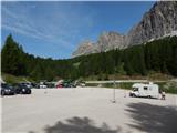
a) From Kranjska Gora via the Koren saddle to Austria, where at the first major junction continue left towards Podkloštro / Arnoldstein and Trbiz / Tarvisio. At the end of Podklošter, signs for Šmohor / Hermagor direct you to the right on the regional road, which takes you past the town to the end of the Ziljska valley, or more precisely to Kötschach-Mauthen, where you turn right towards Oberdrauburg. The road continues over the Gailbergsattel Alpine pass (982 m), after which you descend into the above-mentioned town. After crossing a bridge over the River Drava, turn left towards Lienz. At the main roundabout in Lienz, turn left towards Sillian and Itali. Next, cross the national border between Austria and Itali and follow the main road to Dobbiaco/Toblach, where you turn left towards Cortina d'Ampezzo. Once in Cortina d'Ampezzo, follow the signs for the Passo Falzarego Alpine pass. The road starts to climb steeply above Cortina d'Ampezzo, and we follow it for some time, more precisely to the point where, just before a sharp right turn to the left, the road branches off and we quickly reach the large parking lot at the Rifugio Bai de Dones hut. From Kranjska Gora to the starting point is 208 km.
b) From Kranjska Gora via Border crossing Rateče to Trbiz / Tarvisio and then on the motorway to Udine. Leave the motorway at Tolmezzo, from where we continue driving towards Ampezzo and on to the Alpine pass Passo della Mauria (1298 m). The road then starts to descend and leads into the Cadore valley, where we continue to the right towards Auronzo di Cadore. At the next crossroads follow the signs for Cortina d'Ampezzo. When you arrive in Cortina d'Ampezzo, follow the signs for the Passo Falzarego Alpine pass. The road starts to climb steeply above Cortina d'Ampezzo, and we follow it for some time, more precisely to the point where, just before a sharp right turn to the left, the road branches off and we quickly reach the large parking lot at the Rifugio Bai de Dones hut. From Kranjska Gora to the starting point is 198 km.
c) From Nova Gorica, drive into Itali and continue on the motorway to Portogruaro, where at the motorway fork you turn off in the direction of Belluno. Follow the motorway to its end (do not turn towards Belluno) and then continue driving towards Cortina d'Ampezzo. When you arrive in Cortina d'Ampezzo, follow the signs for the Passo Falzarego Alpine Pass. The road starts to climb steeply above Cortina d'Ampezzo, and we follow it for some time, more precisely to the point where, just before a sharp right turn to the left, the road branches off and we quickly reach the large parking lot at the Rifugio Bai de Dones hut. From the border crossing to the starting point is about 230 km.
Path description:
From the parking lot, head east on route 425 following the signs "Cinque Torri, Rifugio Scoiattoli. At the beginning, walk along the dirt road for a few metres, then signs direct you to the left onto a well-maintained footpath. Here you initially walk on slightly boggy ground, but the path then quickly leads into the woods and then past Lago Bai de Dones. After the lake, the path turns slightly to the right and descends a little. This path then leads us to a crossroads where route 424 joins from the left.
At the crossroads the path turns right again and soon starts to climb through the forest. The path climbs through the forest for some time and then joins an asphalted road.
The road continues to climb, with views opening up, especially towards Tofana. Later, the path leads to a marked crossroads where an interesting path called Trincee branches off to the right, passing through restored military trenches and featuring interesting sights from the First World War.
At the crossroads, we continue along the road, which soon opens up to beautiful views to the south. Here the road turns to the right and soon leads to the Cinque Torri hut. Just before the hut, we are joined on the left by route 437 from the Ponte di Rucurto bridge (the road to the Passo Giau pass).
From the hut, follow the signs "Rifugio Scoiattoli" and start climbing in keys up the slope on the south side of the Cinque Torri towers. The ascending path soon leads to a marked crossroads.
To the right is a circular path around the Cinque Torri towers (Giro delle Torri), and we continue left towards the Scoiattoli hut. From the crossroads, the path becomes less steep and then crosses the slopes to the west. Another path soon branches off to the right towards the towers, and we continue on the lower left path, continuing to cross the slopes. When we reach the west side of the towers, the path from Passo Giau joins first from the left and then the Trincee path from the right.
The path offers increasingly beautiful views in all directions and is followed by a short climb along a mostly grassy slope to the Scoiattoli hut. From the Rifugio Scoiattoli hut, which offers a fine view of the Cinque Torri, turn right after the Rifugio Nuvolau and Rifugio Averau signs. The way ahead is along a stone road, or a much more pleasant to walk parallel mountain path, which climbs up on the left side of the road. After a moderate climb of just over 20 minutes, over a scenic and initially grassy slope, the path splits into two parts (the crossroads is unmarked).
Continue straight ahead (the right-hand path joins the road and leads to the Rifugio Averau hut, from where it is also possible to continue towards the Rifugio Nuvolau hut), along a path that continues to climb moderately, only to change from grassy slopes to a rocky world. A little higher up, the path leads us to a ridge where we join the path from hut Averau, and we continue in the same direction. Higher up, the ridge narrows slightly and becomes precipitous to the right, but the trail continues along the left-hand side, which is not difficult on land. We follow this increasingly scenic route, which also offers a view of the highest peak of Dolomites - Marmolado (Punta Penia), all the way to the summit of the Nuvolau hut, which we reach after a few minutes of further walking.

Pictures:
 1
1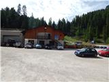 2
2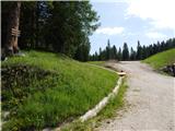 3
3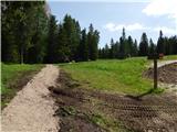 4
4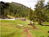 5
5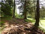 6
6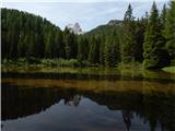 7
7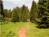 8
8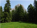 9
9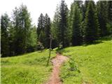 10
10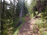 11
11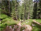 12
12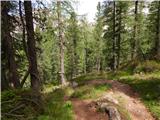 13
13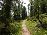 14
14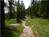 15
15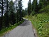 16
16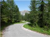 17
17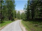 18
18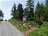 19
19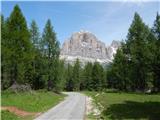 20
20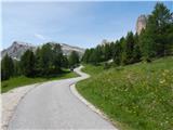 21
21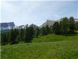 22
22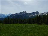 23
23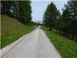 24
24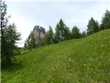 25
25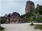 26
26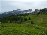 27
27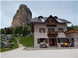 28
28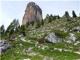 29
29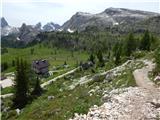 30
30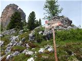 31
31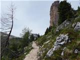 32
32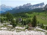 33
33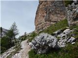 34
34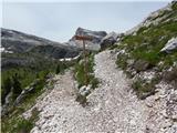 35
35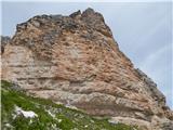 36
36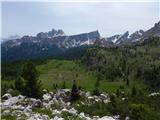 37
37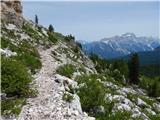 38
38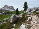 39
39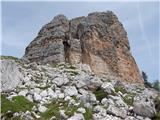 40
40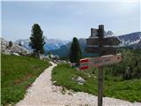 41
41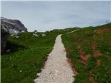 42
42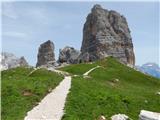 43
43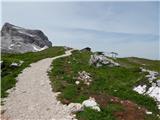 44
44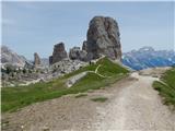 45
45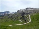 46
46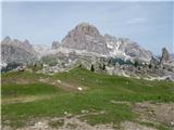 47
47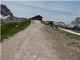 48
48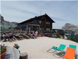 49
49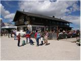 50
50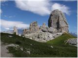 51
51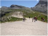 52
52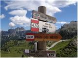 53
53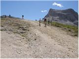 54
54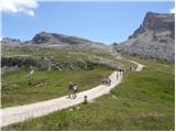 55
55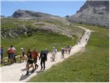 56
56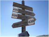 57
57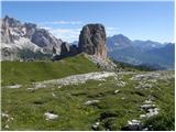 58
58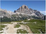 59
59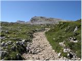 60
60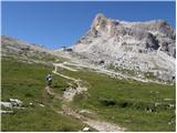 61
61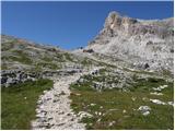 62
62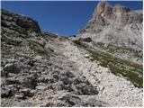 63
63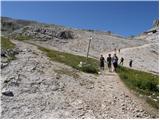 64
64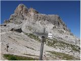 65
65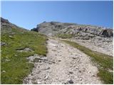 66
66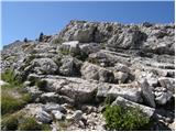 67
67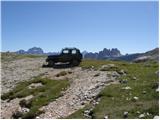 68
68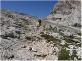 69
69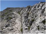 70
70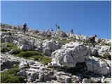 71
71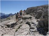 72
72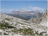 73
73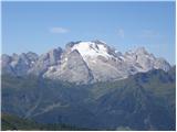 74
74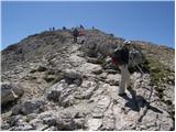 75
75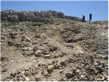 76
76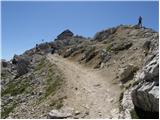 77
77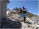 78
78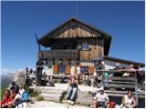 79
79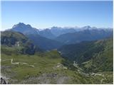 80
80
Discussion about the trail Rifugio Bai de Dones - Rifugio Nuvolau (via Rifugio Cinque Torri)