Rezman - Ruš (on northeast ridge)
Starting point: Rezman (950 m)
| Lat/Lon: | 46,3913°N 14,4688°E |
| |
Name of path: on northeast ridge
Time of walking: 2 h 15 min
Difficulty: very difficult pathless terrain
Altitude difference: 664 m
Altitude difference po putu: 740 m
Map: Karavanke - osrednji del 1:50.000
Recommended equipment (summer):
Recommended equipment (winter): ice axe, crampons
Views: 3.653
 | 1 person likes this post |
Access to the starting point:
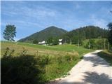
From the motorway Ljubljana - Jesenice take the exit Kranj - east and follow the road in the route "Zgornje Jezersko". Only a few 100 m further from the Kanonir Inn, you will notice direction signs for Stegovnik on the left side of the main road, directing you to a steep dirt road. Follow this ascending road past the Rezman farm to the start of the footpath to Stegovnik. You can park a little lower down in one of the car parks along the road, which may be even more sensible.
Path description:
If we parked a little below the Rezman farm, we take the road ahead to which it won't be far.
Above the Rezman farm, the mountain signs for Stegovnik direct us to the right to the wide ascending cart track, which we then follow past the transmitters to a marked crossroads. Continue right towards Stegovnik on the slightly narrower cart track, which continues to climb transversely on the north-eastern slopes of Bukovec. Higher up, the path is laid and then leads in a gentle descent to a small abandoned mountain pasture, at the edge of which is a hunting lodge.
From the hunting lodge, follow the waymarked trail, which turns slightly to the left after mountain pasture and then begins to climb towards Močnikovo sedlo, which is reached after 15 minutes of further ascent.
A few steps below the saddle, the vegetated cart track descends steeply to the right (northwards) and is followed to a junction where the slightly better cart track turns steeply to the right downhill, while our even worse cart track continues horizontally across the slopes. This ends abruptly and very quickly, and at the very end of the path, towards Lower Ruse, continues a less good but eventually clearly visible path which leads us through the spruce forest gently upwards over the slopes to the NE ridge of Ruse. Here our track heads steeply downwards, and we turn right to the south-west to the NE ridge of Rus. At the start there may still be a hint of an extremely faint trail, which quickly fades away. The terrain is still well-trodden and wooded at the start, but as time goes on it becomes more and more rocky and rocky, and increasingly difficult to traverse. Grebenc narrows and narrows, the precipices on the right begin to glow, but the terrain is still wooded or dominated by larches, with some grass. The terrain is also picturesque in places, partly scenic but also challenging. When sometimes the ridge is really not going, we retreat to the left, into a steep wooded chasm. Eventually the ridge becomes easier to pass and it lays down. When we enter a small meadow and see a partly grassy summit, we are just below the top.

Pictures:
 1
1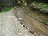 2
2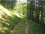 3
3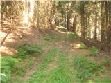 4
4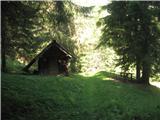 5
5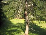 6
6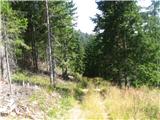 7
7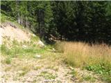 8
8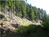 9
9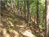 10
10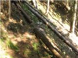 11
11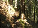 12
12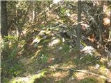 13
13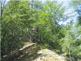 14
14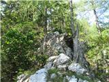 15
15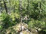 16
16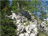 17
17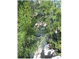 18
18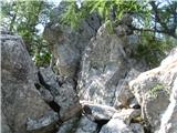 19
19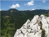 20
20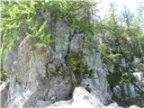 21
21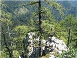 22
22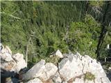 23
23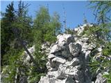 24
24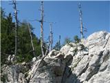 25
25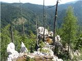 26
26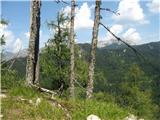 27
27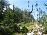 28
28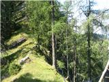 29
29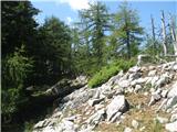 30
30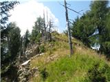 31
31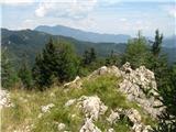 32
32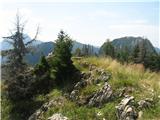 33
33 34
34
Discussion about the trail Rezman - Ruš (on northeast ridge)
|
| ljubitelj gora18. 10. 2015 |
Popoldne po SV grebenu na Ruš. Začel sem pod Robnikom, pred zapornico, na ostrem desnem ovinku zapustim kolovoz in se odpravim po lovski, brezpotju do začetka grebena (Komatevra).
|
|
|