Starting point: Renče (45 m)
| Lat/Lon: | 45,8899°N 13,6695°E |
| |
Time of walking: 2 h
Difficulty: easy marked way
Altitude difference: 598 m
Altitude difference po putu: 600 m
Map: Goriška 1:50.000
Recommended equipment (summer):
Recommended equipment (winter):
Views: 12.312
 | 3 people like this post |
Access to the starting point:
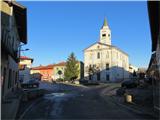
From the expressway Razdrto - Nova Gorica, take the exit Vogrsko and continue towards the village of Volčja Draga. From Volčja Draga, continue towards Bilje, but only as far as Bukovica, where you turn left towards Renče. In Renče, park in the parking lot on the main square.
Path description:
From the parking lot on the main square, turn left towards the primary school building, then turn right after 200 metres at the primary school building. Walk along the side road to the first fork where you turn right. The road climbs slightly, then turn right at the first crossroads. After about 200 m, turn right at the fork. Continue walking on the asphalted road, which soon turns into a forest road. At the next fork turn right and the forest road soon climbs slightly. Higher up, you join the main transverse forest road, which runs in a long gentle steady ascent. When you reach a marked track branching off the forest road to the right, turn right onto it. After walking for a few minutes on a grassy slope, turn right at a fork where the track then ascends more steeply. The track leads back into a coniferous forest. On this part of the trail we are accompanied by signposts leading us in the direction of the mountain hut at Trstelje. At the fork in the forest road, near the mountain hut, turn right and you will quickly reach the summit, which offers a beautiful view.

Pictures:
 1
1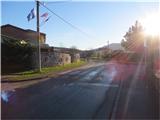 2
2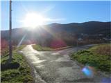 3
3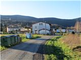 4
4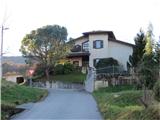 5
5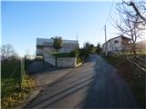 6
6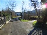 7
7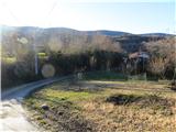 8
8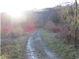 9
9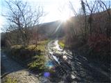 10
10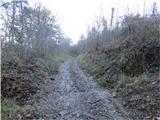 11
11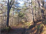 12
12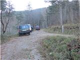 13
13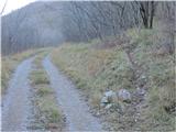 14
14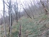 15
15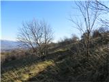 16
16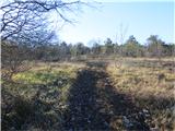 17
17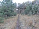 18
18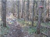 19
19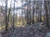 20
20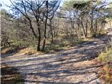 21
21 22
22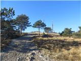 23
23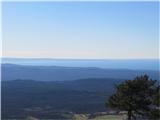 24
24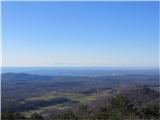 25
25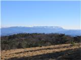 26
26 27
27 28
28
Discussion about the trail Renče - Trstelj
|
| molnik16. 05. 2016 |
V križišču sredi Vovčje Drage je potrebno zaviti desno in potem slediti tablam za Renče.
Zelo luštna pot, vendar mi je opis poti po Renčah do gozda naredil kar nekaj težav, zato predlagam da si od šole v Renčah z Googlom pogledate pot do Renški Podkraj 46. To je zadnja hiša in potem gre pot v gozd - slika devet.
|
|
|
|
| pikica9213. 02. 2022 07:52:07 |
Kot piše predhodnik pot je označena zelooo slabo, PD Nova Gorica res ne morem pohvaliti od šole ni nobene markacije vsaj pol poti nič, potem pa nekaj zbledelega na drevesu 2 tabli z napisom komaj vidnim...
|
|
|
|
| potpodnoge23. 07. 2022 18:59:05 |
Včasih in ponekod, to sicer ni običaj, se pa zgodi. Da markacisti dobro poznajo pot in jo označijo tako, da premalo pomislijo na tiste obiskovalce, ki so prvič v določenih delih na poteh. Drugače sva pa v pogovoru enkrat poleti z mladima oskrbnikoma dobila dobrohoten nasvet ali bolje, v debati omenjeno, da Primorci poleti ne hodijo v gore ker je prevroče, ampak na morje.
|
|
|
|
| pokobalin17. 06. 2023 22:04:26 |
Sploh se ne da pridet na vrh, saj so drevesa zrušena(?) po poti. Verjetno še od požara.
|
|
|
|
| mirank18. 06. 2023 18:40:30 |
Tam kjer je gorelo na naši strani se da it prav povsod brez problema. Bil parkrat gor in vedno šel kar na celo-tam kjer prej brez motorke ne bi šlo, je vse prehodno s Kremanc, z Vinišč ali od Mohorinov
|
|
|