Raspet - Porezen (on ridge of Cimprovka)
Starting point: Raspet (1050 m)
| Lat/Lon: | 46,1705°N 14,0217°E |
| |
Name of path: on ridge of Cimprovka
Time of walking: 2 h 45 min
Difficulty: easy marked way
Altitude difference: 580 m
Altitude difference po putu: 700 m
Map: Škofjeloško in Cerkljansko hribovje 1:50.000
Recommended equipment (summer):
Recommended equipment (winter): ice axe, crampons
Views: 18.789
 | 1 person likes this post |
Access to the starting point:
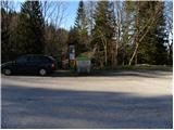
a) First drive to Škofja Loka, then continue driving in the direction of Železniki and Podbrdo. After Železniki, or just before the start of Zali Log, signs for Davča and the ski centre Cerkno direct you to the left onto a road that begins to climb along the Davča River. Follow the road, which has several junctions higher up, in the direction of the Cerkno ski centre. Once you reach the ski centre, continue for another 100 metres to the large gravel parking area Tuškov Grič. Here, take a sharp right onto the road in the direction of Davški Falls, Porezno and the sport fishing. The road climbs moderately, then lays down and leads for a while across the meadows. There is a short descent and then a crossing to the crossroads at Razpotje (1068 m), where you park in a small parking lot by the information boards.
b) From Bohinjska Bistrica or Podbrdo, first drive into the valley of the Selška Sora River, then turn right at the junction after the end of Zali Log in the direction of Davča and continue along the road that begins to climb along the Davča River. Follow the road, which has several junctions higher up, in the direction of the ski centre Cerkno. When you reach the ski centre, continue driving for another 100 metres to the large macadam parking lot at Tuškov Grič. Here, take a sharp right onto the road in the direction of Davški Falls, Porezno and the sport fishing. The road climbs moderately, then lays down and leads for a while across the meadows. There is a short descent and then a crossing to the crossroads at Razpotje (1068 m), where you park in a small parking lot by the information boards.
c) From the Poljane valley, first drive to Hotavlje, and from there continue in the direction of the Cerkno Ski Centre. Continue through the villages of Kopačnica, Leskovica and Robidnica. After passing through all these villages, you will arrive at the large parking lot of Počivalo (the parking lot next to the Cerkno Ski Centre), after which the road starts to descend. After a short descent, we reach the next crossroads, where we continue to the right (left down Cerkno). We continue driving on the road, which ascends crosswise, and we quickly reach the Tuškov Grič parking lot. Here we continue slightly left on the road in the direction of Davški Falls, Porezno and sport fishing. The road continues to climb moderately, then lays down and leads us for some time across the meadows. There is a short descent and then a crossing to the crossroads at Razpotje (1068 m), where you park in a small parking lot by the information boards. d) From the road Idrija - Tolmin, head towards Cerkno, then continue driving towards the ski centre Cerkno. At a junction, the road turns right to the nearby Počivalo parking lot, and we continue left towards Davča. There is only a short cross-country climb and the road leads to the Tuškov Grič parking lot. Here we continue slightly left on the road in the direction of Davški Falls, Porezno and sport fishing. The road continues to climb moderately, then lays down and leads us for some time across the meadows. There is a short descent and then a crossing to the crossroads at Razpotje (1068 m), where you park in a small parking lot by the information boards.
Path description:
From the parking lot, take cart track in the direction of Kopa. Cart track, which continues over a larger grassy slope and from which we have a beautiful view of the ridge of the Cimprovka with Kopa, first descends gently, then passes into the forest, where it first crosses a small well, and then begins to climb more steeply. The path, which is not marked with Knafelč's markings but with small wooden signs on which is drawn the arc of a ski, continues to climb relatively steeply for some time, then leads us to a less well-marked crossroads, where we continue along the upper right cart track, and after a few minutes of further climbing, it leads us to the saddle between Črtovi Rob and Prvić.
Here, where we are completely close to the forest road leading to Porezen, we continue slightly to the left and continue our ascent in the direction of Kopa and also Porezno. The path continues along the wide cart track, which gradually narrows, and higher up turns into a pleasant mountain path, which is quickly followed to the next saddle.
From the viewpoint, continue slightly right into the forest and follow the Cimprovka ridge. The already occasionally sparse forest soon thins out further, but the relatively scenic route quickly leads to a marked crossroads, where we continue right in the direction of Porezno (left Kopa 3 minutes).
The way forward begins to descend steeply over the grassy slope, then gradually lays down and leads us to a larger meadow and the Vrše preval, where it is again completely close to the road. Continue parallel to the road (Porezen markers direct you to the road) and continue on a moderate ascent through a sparse forest. Higher up, the forest ends and the path then continues parallel to the road for some 10 m. When the road makes a right turn, the direction sign for Porezen directs us left onto a gradually steeper slope, over which we descend mainly gently. A little lower down, the path from Franje Hospital joins us on the left, and we continue straight ahead and descend to the Velbnik Pass. Here, a beautiful view opens up to our left, and we continue along the marked path in the direction we already know. The trail continues along the left western side, bypassing the Brdce peak and joining the trail from the village of Poče behind it. Continue straight ahead, following the path that runs parallel to the road for some time, and then focus on the scenic ridge of Porezna (if you continue along the road, you will first reach Dom na Poreznu - a possible circular route). Follow the increasingly scenic ridge path all the way to the top of Porezna, which you will reach after about 20 minutes of further walking.

Pictures:
 1
1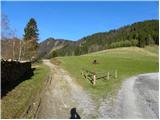 2
2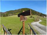 3
3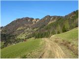 4
4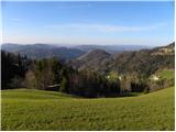 5
5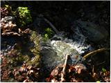 6
6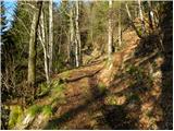 7
7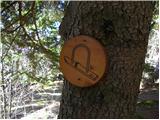 8
8 9
9 10
10 11
11 12
12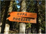 13
13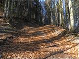 14
14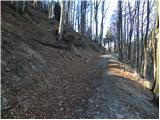 15
15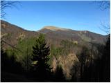 16
16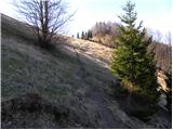 17
17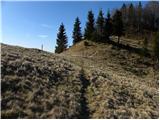 18
18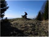 19
19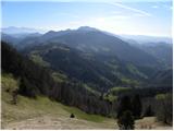 20
20 21
21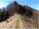 22
22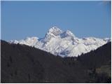 23
23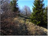 24
24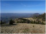 25
25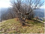 26
26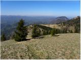 27
27 28
28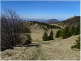 29
29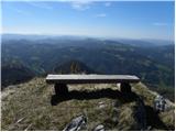 30
30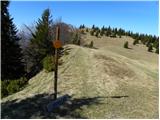 31
31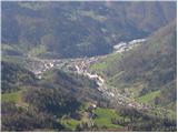 32
32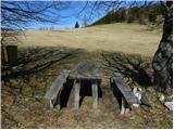 33
33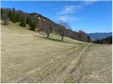 34
34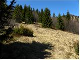 35
35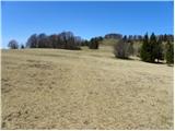 36
36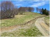 37
37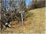 38
38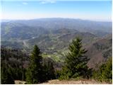 39
39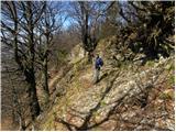 40
40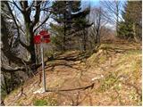 41
41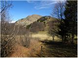 42
42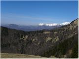 43
43 44
44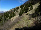 45
45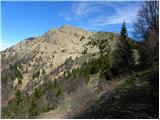 46
46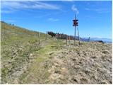 47
47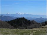 48
48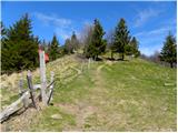 49
49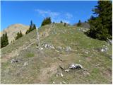 50
50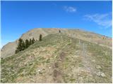 51
51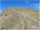 52
52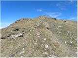 53
53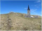 54
54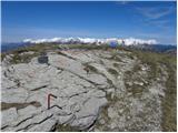 55
55 56
56
Discussion about the trail Raspet - Porezen (on ridge of Cimprovka)