Rašica - Rašica (Vrh Staneta Kosca) (by road)
Starting point: Rašica (400 m)
| Lat/Lon: | 46,1346°N 14,5043°E |
| |
Name of path: by road
Time of walking: 55 min
Difficulty: easy marked way
Altitude difference: 241 m
Altitude difference po putu: 241 m
Map: Ljubljana - okolica 1:50.000
Recommended equipment (summer):
Recommended equipment (winter):
Views: 37.798
 | 4 people like this post |
Access to the starting point:
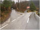
From the Trzin bypass, head in the direction of Črnuče and follow the road towards Ježica and Gameljny. Just before the bridge over the Sava River, turn right towards the village of Gameljne. Continue through Spodnje Gameljne to the village of Srednje Gameljne, where at the crossroads turn right in the direction of Rašica. At the beginning of the village Rašica you will come to a small crossroads, where a macadam road with mountain signs and a small parking area branches off to the left.
Access to the starting point is also possible from Ljubljana and the Gorenjska highway.
Path description:
From the parking lot, return to the asphalted road and follow it up to the upper part of the village, where you will see the mountain signs for the Rašić home by the chapel. Leave the wide road here and continue left along the increasingly narrow road, which soon loses its asphalt coating. The road then climbs over grassy hay fields and then into the forest, where it becomes quite rough for a short time. This relatively poor forest road, closed to traffic, is then followed all the way to the mountain lodge at Rašice.
From home, continue along the wide path which, after a few more steps of walking, leads us to the Staneta Kosca Peak, where the lookout tower stands.
Pictures:
 1
1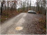 2
2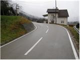 3
3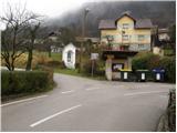 4
4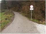 5
5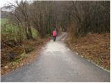 6
6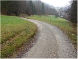 7
7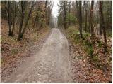 8
8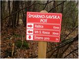 9
9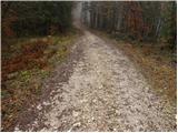 10
10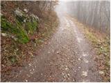 11
11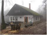 12
12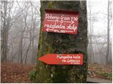 13
13 14
14
Discussion about the trail Rašica - Rašica (Vrh Staneta Kosca) (by road)