Rakitna - Županov vrh (east path)
Starting point: Rakitna (789 m)
| Lat/Lon: | 45,8907°N 14,4397°E |
| |
Name of path: east path
Time of walking: 35 min
Difficulty: easy unmarked way
Altitude difference: 210 m
Altitude difference po putu: 210 m
Map: Ljubljana - okolica 1:50.000
Recommended equipment (summer):
Recommended equipment (winter):
Views: 5.879
 | 1 person likes this post |
Access to the starting point:
a) From the Ljubljana - Koper motorway, take the Brezovica exit and then continue in the direction of Podpeč (Podpeč can also be reached from Črna vas or Ig). In Podpeč, continue in the direction of Borovnica, Krima and Rakitna and continue along the edge of the Ljubljana Moor for a short distance before the signs for Rakitna direct you left onto a steeply ascending road. The road then leads through Preserje, where it also begins to descend. After a short descent, continue left towards Krima and Rakitna, and we then follow the mostly ascending road to Rakitna (after the turnoff for Krim, the road starts to descend), where we park in the parking lot next to the church.
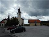
b) First drive to Cerknica, then continue in the direction of Begunje, and when you arrive in Begunje follow the signs for Rakitna. When you arrive at Rakitna, park in the parking lot next to the parish church in Rakitna.
Path description:
From the parking lot, follow the marked trail or, at first, the road in the direction of Krimo, Doma v Iški Vintgar, farms Benko and Ustje, Vrbica and the village of Osredek. The road initially leads us past the chapel, the Mercator shop, and then after a short climb leads us to a place where a road branches off to the left to the nearby Krimček Café, and we continue slightly to the right and continue along the marked road. The road then leads us past a few pastures and houses, and then splits into two parts.
Continue up the road to the left (the road to the spa MKZ Rakitna leads off to the right) and after a short climb it splits again. This time continue straight on in the direction of the Krim (to the right is the Krvavice Partisan Hospital and Iški Vintgar) on a less good macadam road, which becomes slightly steeper. The marked path soon turns right (left western path to Županov vrh) and continues along cart track for a few minutes. After a nearby turning point, cart track becomes a wide mountain trail that climbs cross-country towards the saddle between Županov vrh and Rotovec. Along the path, which is moderately steep throughout, a large number of trail markers can be seen. A few 10 paces before the saddle, where there is also a marked crossroads, at a fork in the tracks continue left onto a relatively new unmarked track. The track continues to climb to the left and then quickly splits into two parts. Continue on the right-hand one, the less easy cart track (the track that continues straight ahead ends a little further on), which climbs a little more. When the track at the shepherd's el. is higher, leave it and continue left through the shepherd's el. , after which you soon emerge from the wood. There is only a short walk with beautiful views to the antennas on Županove vrh.
Description and pictures refer to the situation in 2014 (August).

We can extend the trip to the following destinations: Rotovc
Pictures:
 1
1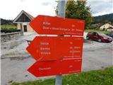 2
2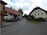 3
3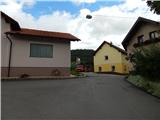 4
4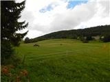 5
5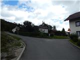 6
6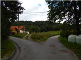 7
7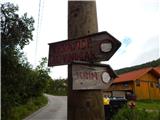 8
8 9
9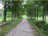 10
10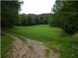 11
11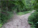 12
12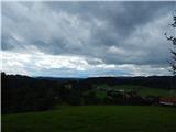 13
13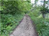 14
14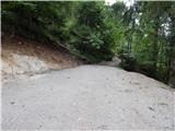 15
15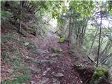 16
16 17
17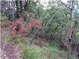 18
18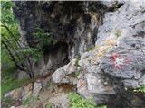 19
19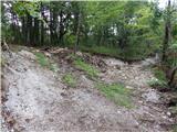 20
20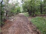 21
21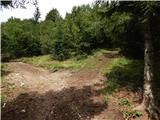 22
22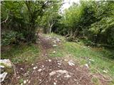 23
23 24
24 25
25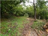 26
26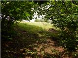 27
27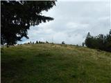 28
28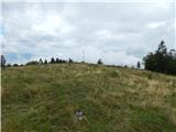 29
29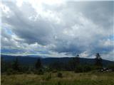 30
30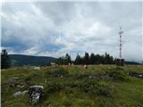 31
31
Discussion about the trail Rakitna - Županov vrh (east path)
|
| grega_p11. 06. 2015 |
Zanimivo, da tale izlet še nima nobenega komentarja.
Lep kratek izlet v bližini prestolnice, kjer ni množice pohodnikov (no vsaj na tistem delu od odcepa proti vrhu) in kjer lahko občudujemo zanimive poglede na notranjska hribovja in na cerkvico Sv.Lenart nad Krvavo Pečjo. Proti severu se tudi kaj vidi, a drevesa že vztrajno rastejo.
Lepo je odkrivati nove poti.
|
|
|
|
| milenula28. 01. 2021 |
Zimska varianta sprehoda po snegu in prekrasnem vremenu, medtem, ko je v dolinah megla. Izlet se lahko podaljša po celem grebenu vse do ceste na Krim in vrne po drugi poti, ki poteka malo nižje pod vrhom. Razgledi fantastični, vsi hribi od KSA, do Karavank in Julijcev kot na dlani. Hrib je fantastičen razglednik!
|
|
|