Starting point: Rakitna (789 m)
| Lat/Lon: | 45,8907°N 14,4397°E |
| |
Time of walking: 30 min
Difficulty: easy marked way
Altitude difference: 175 m
Altitude difference po putu: 175 m
Map: Ljubljana - okolica 1:50.000
Recommended equipment (summer):
Recommended equipment (winter):
Views: 7.361
 | 1 person likes this post |
Access to the starting point:
a) From the Ljubljana - Koper motorway, take the Brezovica exit and then continue in the direction of Podpeč (Podpeč can also be reached from Črna vas or Ig). In Podpeč, continue in the direction of Borovnica, Krima and Rakitna and continue along the edge of the Ljubljana Mor for a short distance before the signs for Rakitna direct you left onto a steeply ascending road. The road then leads through Preserje, where it also begins to descend. After a short descent, continue left towards Krima and Rakitna, and we then follow the mostly ascending road to Rakitna (after the turnoff for Krim, the road starts to descend), where we park in the parking lot next to the church.
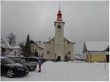
b) First drive to Cerknica, then continue in the direction of Begunje, and when you arrive in Begunje follow the signs for Rakitna. When you arrive at Rakitna, park in the parking lot next to the parish church in Rakitna.
Path description:
At the parking lot we see the mountain direction signs for Krim and Iški Vintgar, which direct us to the ascending road. After a short climb we reach an unmarked crossroads where the road branches off to the left to a nearby bar, and we continue to the right where we see markings a few metres ahead. After a further 10 metres we come to the next crossroads, where we continue along the ascending road to the left (right spa on Rakitna) and follow it for a short distance to a marked crossroads. Leave the road here and continue slightly right along the marked cart track towards Krima (sharp right Iški Vintgar). The path continues to climb between meadows and in the upper part of the meadows leads to a crossroads where you continue along the right marked cart track. Continue along the cart track, which ascends diagonally to the right, and during the ascent you will notice a number of information boards on the forest nature trail. Higher up, the path climbs a little steeper a few times, then flattens out and leads to the saddle between Županov vrh and Rotovec.
From the saddle, continue straight ahead in the route Rotovc (slightly left Krim) along the path, which begins to climb moderately through sparse forest and lane of bushes. This path, which soon leads out of the forest, is then followed all the way to the top of Rotovc, which is reached after a 5-minute walk from the crossroads at the saddle.

Pictures:
 1
1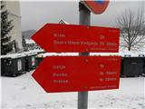 2
2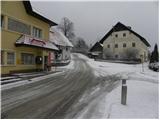 3
3 4
4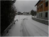 5
5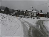 6
6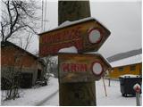 7
7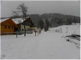 8
8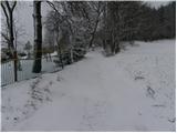 9
9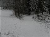 10
10 11
11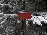 12
12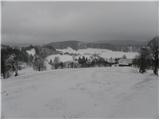 13
13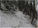 14
14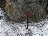 15
15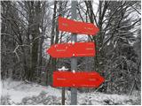 16
16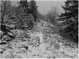 17
17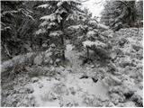 18
18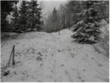 19
19 20
20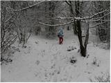 21
21 22
22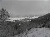 23
23
Discussion about the trail Rakitna - Rotovc