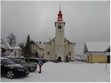
Starting point: Rakitna (789 m)
| Lat/Lon: | 45,8907°N 14,4397°E |
| |
Time of walking: 2 h
Difficulty: easy marked way
Altitude difference: 318 m
Altitude difference po putu: 385 m
Map: Ljubljana - okolica 1:50.000
Recommended equipment (summer):
Recommended equipment (winter):
Views: 65.827
 | 1 person likes this post |
Access to the starting point:
From the Ljubljana - Koper motorway, take the Brezovica exit, then continue in the direction of Podpeč (Podpeč can also be reached from Črna vas or Ig). In Podpeč, continue in the direction of Borovnica, Krimo and Rakitna and continue along the edge of the Ljubljana Marshes for a short distance, before the signs for Rakitna point you left onto a steeply ascending road. The road then leads through Preserje, where it also begins to descend. After a short descent, continue left in the direction of Krimo and Rakitna, and we then follow the ascending road to the parking lot next to the church at Rakitna (the road drops again slightly in the last part).
Path description:
At the parking lot we see the mountain direction signs for Krim and Iški Vintgar, which direct us to the ascending road. After a short climb we reach an unmarked crossroads where the road branches off to the left to a nearby bar, and we continue to the right where we see markings a few metres ahead. After a further 10 metres we come to the next crossroads, where we continue along the ascending road to the left (right spa on Rakitna) and follow it for a short distance to a marked crossroads. Leave the road here and continue slightly right along the marked cart track towards Krima (sharp right Iški Vintgar). The path continues to climb between meadows and leads us in the upper part of the meadows to a crossroads, where we continue along the right marked cart track. Continue along the cart track, which ascends diagonally to the right, and during the ascent you will notice a number of information boards on the forest nature trail. Higher up, the path climbs a little steeper a few times, then flattens out and leads to the saddle between Županov vrh and Rotovc.
Here, continue slightly left in the direction of Krima (straight Rotovc 5 minutes) along the path, which begins to descend first gently and then moderately towards the nearby macadam road. After a short descent, follow the road to the right. Continue along the gently ascending road, which leads us higher to the NOB monument, after which it begins to descend. After a short descent, you will reach a marked crossroads, where you continue left in the direction of Krimo. The path then continues along the road for some time, and then we arrive at a marked crossroads, where we are joined on the left by a marked path from the Plehanov laz hunting lodge.
Leave the road here and continue the ascent in the direction of the footpath to Krim. The path then climbs steeply on a wide cart track, then it lays down a little and gradually turns more and more to the left. The path, which has since changed from cart track to a wide mountain path, quickly leads to the fence of the nearby military area. We climb up along the fence, which leads us to the nearby road. Once on the road, follow it to the left and after a minute's further walking you will reach the top of Krima.

Pictures:
 1
1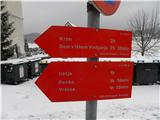 2
2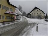 3
3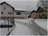 4
4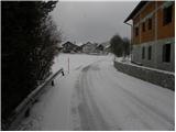 5
5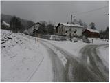 6
6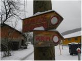 7
7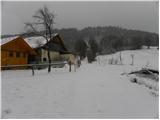 8
8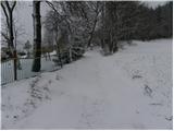 9
9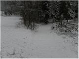 10
10 11
11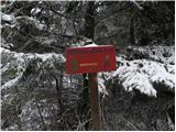 12
12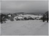 13
13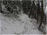 14
14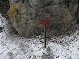 15
15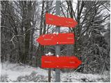 16
16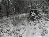 17
17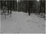 18
18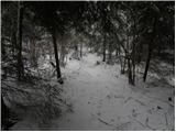 19
19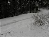 20
20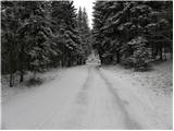 21
21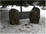 22
22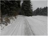 23
23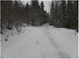 24
24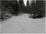 25
25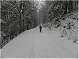 26
26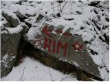 27
27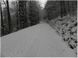 28
28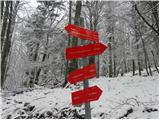 29
29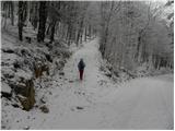 30
30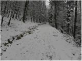 31
31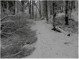 32
32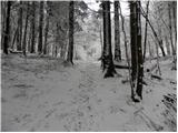 33
33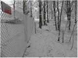 34
34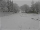 35
35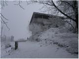 36
36 37
37
Discussion about the trail Rakitna - Krim
|
| darh19. 01. 2011 |
Po tej poti smo se povzpeli na prvi dan letošnjega leta. Snega je bilo morda za vzorec manj kot na teh slikah, zato pa je bil razgled z vrha mnogo lepši. Več o vtisah in nekaj posnetkov s poti pa najdete tule.
|
|
|
|
| VanSims27. 03. 2011 |
Ta pot je eden kondicijsko najlažjih pristopov. Pot se strmo vzpne le na začetku do sedla pod Rotovcem, potem pa je do vrha pravzaprav navaden sprehod(še posebej če na razcepu tik pred vrhom nadaljujemo kar naravnost po cesti).
Poti iz Iške strani so veliko bolj strme in naporne(dol šel čez Kramarco v Strahomer)
Slabost tega pristopa je, da gre večji del po makadamu.
|
|
|
|
| Kokta22. 10. 2011 |
Pot do sedla pod Rotovcem in naprej do ceste je trenutno slaba....poležane in polomlje veje otežijo prehodnost...vzrok je moker sneg...trenutno so markacije slabše vidne...drugače pa fajn 
|
|
|
|
| gmirko28. 01. 2012 |
Po tej poti smo danes obiskali Krim, zelo lepo , le vidljivost z vrha je bila slaba.
Je pa vrh kar lepo bel, malo od snega in nekaj od ivja.
|
|
|
|
| nejcf30. 09. 2018 |
Danes smo se po tej poti vzpeli na vrh. Pod markacijami je bila ves čas tudi ležeča osmica (znak za neskončno)-morda kdo ve kaj pomeni?? Drugače pa kar nekaj ljudi in precej vetrovno vreme.
|
|
|
|
| Mikens23. 06. 2019 |
POMEMBNO!
Vse pohodnike naprošam, naj imajo pse na vrvici! (območje medveda.)
Lep lovski pozdrav.
Klement Mal, LD Tomišelj
|
|
|
|
| nejcf8. 03. 2021 |
taja3 hvala, sem kasneje tudi sam to ugotovil, pred slabima dvema tednoma pa odtisnil v dnevnik zadnji žig. 
|
|
|