Starting point: Radovna (695 m)
| Lat/Lon: | 46,4208°N 13,9772°E |
| |
Time of walking: 3 h
Difficulty: easy unmarked way
Altitude difference: 926 m
Altitude difference po putu: 940 m
Map: Kranjska Gora 1:30.000
Recommended equipment (summer):
Recommended equipment (winter): ice axe, crampons
Views: 5.050
 | 2 people like this post |
Access to the starting point:
a) From the motorway Ljubljana - Jesenice take the exit Lesce and follow the road towards Bled. At the traffic lights in Bled, the signs for Pokljuka direct you to the right. Continue through Spodnje and Zgornje Gorje to the village Cirque, where you leave the main road and continue right towards Radovna and Cirque. Follow the main road through Cirque and then turn left after the bridge over the river Radovna towards Mojstrana and Radovna. After a few kilometres, the asphalt ends and we follow the dirt road over the bridge over the river Radovna. After crossing the bridge, you will reach the left side of the river (right bank) and from the bridge you will drive to the first turn of the dirt road to the left. Park in a suitable place on the roadside near the crossroads.
b) Leave the Gorenjska motorway at the Hrušica exit and follow the road towards Kranjska Gora. Just before the village of Dovje, the road branches off to the left into Mojstrana (Vrata, Kot and Krma). Follow the road towards the village of Radovna and the valleys of Krma and Kot. The relatively steep road then leads us past a TNP signboard, after which the road soon levels off and leads us to a crossroads where a dirt road branches off to the right into the Kot valley. Continue straight ahead on the road as it begins to descend, and a road quickly branches off to the right, leading to Krma. Continue straight ahead on the main road, which quickly leads to Zgornja Radovna, and at the end of the hamlet to a crossroads, where another road branches off to the right and leads to Krma. Turn left here and continue along the dirt road, following it until the first road forks off to the right. Park in a suitable place on the roadside near the junction.
Path description:
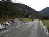
From the starting point, take a side road with a sign that says no further driving (landowners are the exceptions). Just a little further on, the trail takes you past the Slovenian Forest Service hut and a green ramp that prevents further driving (even if the ramp is open, you should not continue driving, as another sign warns you not to).
The road then leads us over a bare slope (the consequences of the October 2009 windstorm), from which we have a beautiful view towards Mežakla. At the crossroads at the top of the windfall, continue to the right, then gradually move into the forest. The relatively steep road splits into two parts again higher up, and this time we continue on the right-hand road (the road leads slightly left towards Konavče gully and Zimova peča). We continue along the Stresena dolina for a short distance, then the road turns sharp right and then climbs cross-country to the next junction, where we continue sharp left along the "main" road (the right-hand road ends in the nearby forests). Just above this junction, we reach a point where the road to Frčkova planina turns sharp right, and we continue straight ahead on a gradually less steep road, which soon turns slightly more to the left. Higher up, the road splits again, and we continue along the road to the right (slightly left Pokljuka), which immediately makes a sharp right turn. We continue to climb cross-climbing to the right, and higher up the road starts to turn more and more to the left, so that we gradually pass onto the northern slopes of the nearby Veliki vrh (1583 m). There is a sharp left turn, and then we slowly return to the eastern to south-eastern slopes of Vošný vrh. Walk along the road for some time, then, when it starts to descend towards the saddle between Vošni vrh and Stresenica, leave it and continue to the right along an easier trackless track, after which, in 2 minutes of further walking, you will arrive at the forested Vošni vrh.
If you continue north along the ridge from the summit, you will quickly reach the northern peak, which offers a beautiful view of the Karawanks and the Kamniško Savinjske Alps.

Pictures:
 1
1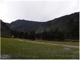 2
2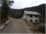 3
3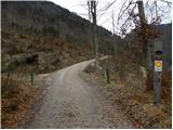 4
4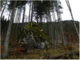 5
5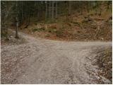 6
6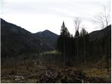 7
7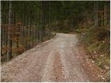 8
8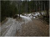 9
9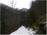 10
10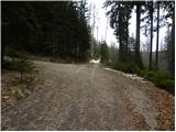 11
11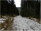 12
12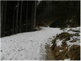 13
13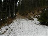 14
14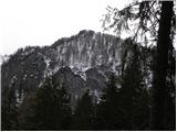 15
15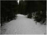 16
16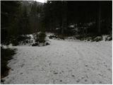 17
17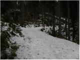 18
18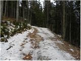 19
19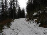 20
20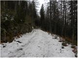 21
21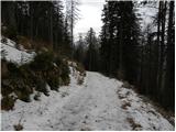 22
22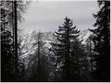 23
23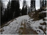 24
24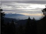 25
25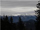 26
26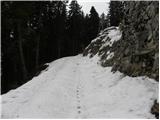 27
27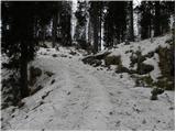 28
28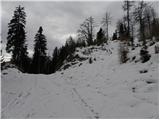 29
29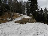 30
30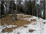 31
31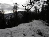 32
32 33
33 34
34
Discussion about the trail Radovna - Vošni vrh
|
| tango19. 11. 2020 |
Prekrasen, topel sončen dan!. Pot pa taka kot je v opisu, v glavnem po lepi gozdni cesti(tisti z MTB bi bili navdušeni), ki vsakega toliko časa ponudi lep razgled na Karavanke. Če ne bereš pazljivo, spotoma skočiš še na koto 1330 m, za kar porabiš slabe 3/4 ure(gor in dol), potem pa naprej proti poraščenemu vrhu. Res, severni predvrh ponudi lepše razglede, tako proti Julijcem, od Cmira do Vrtaškega Slemena, kot tudi proti Karavankam in KS Alpam. Pregledala sva lahko tudi najini pretekli turi od Črne Gore do Rušnate Mlinarice in pa od Biščkove glave do Trte, saj sta oba grebena kot na dlani. Malo snežnega poprha od 1550 m naprej, planinca pa sevda v tem koncu nobenega!Drugič bo potrebno preizkusiti še varianto dovškega župnika, opisano v Stezicah pod RKK3.
|
|
|
|
| Toni-k19. 11. 2020 |
Sva z ženo pred leti bila tam gori z Mtb kolesi
,bilo zelo lepo,sla čisto do konca ceste in naprej po kolovozu ko ni slo nikamor več.
Priznam sicer,da sva želela na Bratovo peč,pa sva zgrešila odcep.Pa nama ni bilo žal,ker tako lepe gozdne ceste zlepa ne najdešu
|
|
|
|
| tango26. 04. 2021 18:34:00 |
Sva ponovila. Gozdna cesta do odcepa na Pokljuko praviloma kopna, naprej pa zasnežena, a ker sva bila zgodnja naju je kar lepo držalo, nazaj pa sva se fino vozila. Na vrhu prekrasno, trop gamsov nama ga je začasno odstopil. Sicer pa nikjer žive duše!
|
|
|