Radeljski prelaz - Sveti Anton na MP Radelj / St. Anton am Radlpaß
Starting point: Radeljski prelaz (674 m)
| Lat/Lon: | 46,6447°N 15,2062°E |
| |
Time of walking: 30 min
Difficulty: easy marked way
Altitude difference: 46 m
Altitude difference po putu: 75 m
Map: Pohorje - izletniška karta 1:50.000
Recommended equipment (summer):
Recommended equipment (winter): crampons
Views: 479
 | 1 person likes this post |
Access to the starting point:
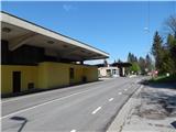
Drive to Radlje ob Dravi, then continue to the Radeljski Pass. After a few kilometres of climbing, we arrive at Border crossing Radelj, where we park.
Path description:
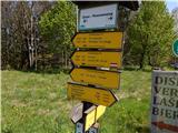
From the starting point, cross the state border, then after the buildings on the pass, continue left in the direction of St. Anton (Kapunerhütte on the right). The way ahead leads along a macadam road, from which you go slightly left on a marked footpath. The footpath continues along the state border for a few minutes, then turns slightly right and returns to the dirt road, which continues above the quarry. Enjoy the views as you continue to a marked crossroads, from which you turn right towards St. Anton (St. Lorenzen on the left). There are two serpentines and some downhill before leaving the area of the large quarry and within a few minutes you climb through the forest to St. Anthony's Church.
Description and pictures refer to the situation in 2019 (May).
Pictures:
 1
1 2
2 3
3 4
4 5
5 6
6 7
7 8
8 9
9 10
10 11
11 12
12 13
13 14
14 15
15 16
16 17
17 18
18 19
19 20
20 21
21 22
22 23
23 24
24 25
25 26
26 27
27
Discussion about the trail Radeljski prelaz - Sveti Anton na MP Radelj / St. Anton am Radlpaß