Pri Žagi (Javorniški Rovt) - Alničje
Starting point: Pri Žagi (Javorniški Rovt) (885 m)
| Lat/Lon: | 46,4539°N 14,0975°E |
| |
Time of walking: 1 h
Difficulty: easy unmarked way
Altitude difference: 260 m
Altitude difference po putu: 260 m
Map: Karavanke - osrednji del 1:50.000
Recommended equipment (summer):
Recommended equipment (winter): ice axe, crampons
Views: 6.396
 | 3 people like this post |
Access to the starting point:
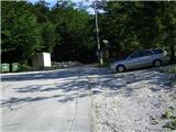
From the motorway Ljubljana - Jesenice take the exit Lipce and turn right towards Jesenice. In the village of Javornik, at the first semaphorised junction, turn right (direction Lj. ) towards Koroška Bílá. At the next traffic-light junction turn left, and soon turn left again towards Javornik Rovto. After a few kilometres of uphill driving (when we have already arrived in the village), the macadam road turns sharp left and heads straight towards the Trilobit house (signposted). Just before this place, we see a small parking lot on the right, which is our starting point.
Path description:
From the starting point, continue along the macadam for a few metres, then you will come across two signposts with the inscriptions Valvazor and Gajškova pot. Turn right here and follow the signs leading over the bridge on the right over the Javornik stream. We are on the marked trail leading towards Valvazor. This first climbs for a few metres, then descends again and soon lays down. After a few minutes of walking, the path descends in places and soon begins to climb gradually, and we again come across direction signs on both sides of the path.
Follow the Valvazor direction and turn left (right Gajškova trail). After a while, the pleasant path through the forest joins the cart track from the right, where you can see a rather worn metal direction sign on a tree. Continue on cart track, which leads uphill and turns slightly left at first and then right towards the top. As the slope eases, you come to a cut part of the path where it turns left. Here, to the SE, we have a view of the western slope of Alničje. When the path splits after a few metres, continue left following the markers. Soon the steepness eases and we walk for a while along a winding, sloping path through the forest. When we see rocks above the path on the left, we are at a stream, which we cross again, and the markings here point left uphill again. Leave the marked path and continue straight ahead on the initially muddy path, which crosses the ravine with a right turn. From here on, walk in a southerly direction. When you soon come across a wooden "half-log" on the right, the path narrows and turns slightly left, then crosses a shorter, steeper part of the slope of Debelega brda (a slip hazard in snow), and finally climbs briefly towards the saddle of Alničje. Here, on the left, under a spruce tree, you can see a bench and a registration book, on the right a small, worn-out hut, and a little further on a wooden shelter - a roof, which offers shelter from the storm. Here we turn right to the ridge Alničje, and in a short time (5 min) we reach a rocky peak, from where we can see Potoška planina, Potoški Stol, Malem vrh, partly Ajdna, and a little before the finish to Kahlkogel and Krvavka. The summit is not equipped with a stamp and a registration book (it is located on the saddle under the spruce tree). (Continuing along the ridge is not the safest, as towards the end (at the steepest part) it is completely lost).

Pictures:
 1
1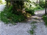 2
2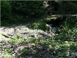 3
3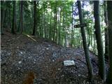 4
4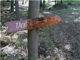 5
5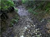 6
6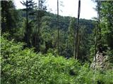 7
7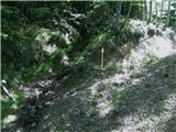 8
8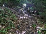 9
9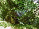 10
10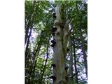 11
11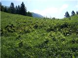 12
12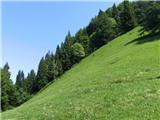 13
13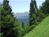 14
14 15
15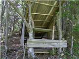 16
16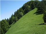 17
17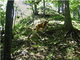 18
18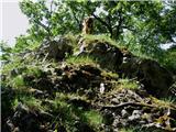 19
19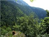 20
20
Discussion about the trail Pri Žagi (Javorniški Rovt) - Alničje