Pri Žagi (Javorniški Rovt) - Planina Stamare (behind Boncla)
Starting point: Pri Žagi (Javorniški Rovt) (885 m)
| Lat/Lon: | 46,4539°N 14,0975°E |
| |
Name of path: behind Boncla
Time of walking: 1 h 45 min
Difficulty: partly demanding unmarked way
Altitude difference: 515 m
Altitude difference po putu: 515 m
Map: Karavanke - osrednji del 1:50.000
Recommended equipment (summer):
Recommended equipment (winter): crampons, lamp
Views: 2.788
 | 3 people like this post |
Access to the starting point:
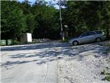
From the motorway Ljubljana - Jesenice take the exit Lipce (Jesenice East), where you turn right towards Jesenice. At the first semaphore crossroads (Slovenski Javornik settlement) turn right (direction Lj. ) towards Koroška Bela, at the next semaphore crossroads turn left, and soon turn left again towards Javorniški Rovt (right Koroška Bela). After a few kilometres of uphill driving, when you reach the village, at the second sharp left turn, you will come across a right fork of the macadam road towards the Trilobit house (signposted). Just before this place, there is a small parking lot on the right - our starting point.
Path description:
From the starting point, continue along the macadam for a few metres, then you will see two direction signs with the inscriptions Valvazor and Gajškova pot. Here, turn right, but do not follow the signs (right over the bridge), but follow cart track straight uphill. Soon you reach the next bridge, where you cross a stream and the path (track) turns left uphill. Follow the main cart track for another 15 minutes, which means that you ignore all the branches. On the left side of the path you will see the sign "Dom Trilobit" twice.
Afterwards, as the path climbs a little steeper, you will come across the fork cart track, where you turn right (left "behind Kraševec" to mountain pasture Stamare). Cart track now turns increasingly to the right and climbs steeply at first, then briefly, and climbs slightly again towards the flatter part (saddle) between the two Bonclams. Here we continue on cart track past the indistinct east ridge Mala Boncla , which is on our right. The path curves a little and then quickly climbs again, first gently and then steeper. Walk along, or right along, the steep logging trail. Higher up, the path leads to the fork logging trail, where you continue straight on, or left (right Velika Boncla). As the path leads through a small valley, the steepness eases. At the end of the gentle slope, however, do not continue straight on as indicated, but turn left onto a relatively steep forest slope, in a north to north-easterly direction. On the slope where the path disappears, keep slightly to the right, and a small moss-covered boulder (somewhere in the middle of the slope) may be used for orientation. Shortly after the slope subsides, we come across a gentle section of forest to a small pass, which is situated along a partly rocky slope on our right. At the foot of this slope, with some attention, you can see a path which you can follow. The path ascends, first crossing to the left, and a little later heading steeply straight up the slope towards the summit. We may need to use our hands here. Then, after a slight and short right turn, the path climbs straight up again, over stony and partly rocky terrain. When the steepness eases, immediately turn left to the edge of the slope, where you will see a red mark on a small spruce tree, and continue in the indicated direction slightly to the left. Shortly afterwards, you will come across logging trail leading through the forest, which you will step on and follow to the left. After turning right, logging trail climbs up the slope and continues to turn left. Here we start to get some nice views, and after a few minutes of further walking we finally reach the mountain pasture of the Stamara from its western side.

Pictures:
 1
1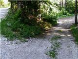 2
2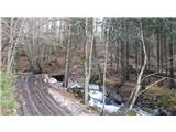 3
3 4
4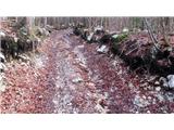 5
5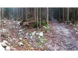 6
6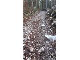 7
7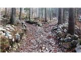 8
8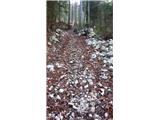 9
9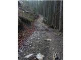 10
10 11
11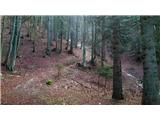 12
12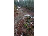 13
13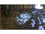 14
14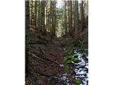 15
15 16
16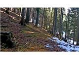 17
17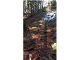 18
18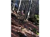 19
19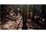 20
20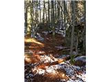 21
21 22
22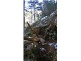 23
23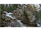 24
24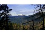 25
25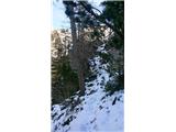 26
26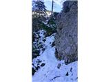 27
27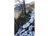 28
28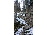 29
29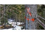 30
30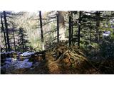 31
31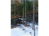 32
32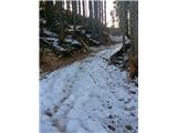 33
33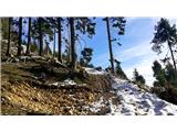 34
34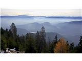 35
35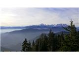 36
36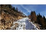 37
37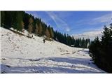 38
38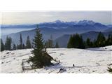 39
39
Discussion about the trail Pri Žagi (Javorniški Rovt) - Planina Stamare (behind Boncla)
|
| Majdag19. 04. 2020 |
Heinz, dobro moraš vedeti kje poteka pot. Včeraj je bila polna listja, steze nikjer in sem raje obrnila. Pa tudi s planine Stamare, ni lahko sledljiva, mi je rekel Pavel, naš vodič. 
|
|
|
|
| heinz25. 04. 2020 |
Majda pot ni označena. Gre za eno od dveh variant lovske poti med V. Bonclo in Stamarami. Za lovske poti je značilno, da potrebujemo kar nekaj orientacije in morda tudi kanček raziskovalne žilice. Druge omenjene variante namenoma nisem opisal, saj je najbrž že ta preveč. Občasno se mi zgodi, da obžalujem oddajo kakšnega opisa poti. Zgornjega sicer štejem med precej natančne.
|
|
|
|
| Majdag25. 04. 2020 |
Heinz, vem, da ni označena pot, saj so lovske vse take, težko sledljive. Mogoče, če ne bi bilo toliko listja bi se izšlo. Ni hudega ena izkušnja več. Ti kar nadaljuj z opisi, vsak zase ve ali zmore ali obrne..
|
|
|
|
| heinz26. 04. 2020 |
Z opisi ni potrebe kaj posebno nadaljevati, saj pravim, da je morda kakšen celo preveč. Predvsem imam v mislih naval raznih pohodnikov, ki v življenski prostor gozdnih prebivalcev vnašajo nemir. Lovske poti bi se po mojem novem spoznanju morale brisati, saj že samo ime pove, da te niso namenjene planincem. O tem, kakšna je kultura modernih "planincev" pa sploh ne bi zgubljal besed.
|
|
|
|
| andi226. 04. 2020 |
Se strinjam z varovanjem in spoštovanjem gozdnih prebivalcev. Je pa škoda, če je prišlo do tega. Vaše poznavanje in opisi malo znanih področij v okviru Karavank so vsaj zame nenadomestljivi v dostopni literaturi. Jih imam shranjene za posebne priložnosti. lp
|
|
|
|
| Janez Seliškar4. 06. 2023 09:55:05 |
Po kolovozih in vlakah sva se na Planino Stamare pozpela preko Male in Velike Boncle. Na vzhodni strani Velike Boncle se svet postavi precej pokonci, a na žalost tudi vlake segajo višje in višje, kar sicer olajša vzpon. Svet postane prestrm tudi za vklako, zato se je potrebno kar potruditi po stezici, ki ponovno pripelje na vlako, ki pride s Planine Stamare navzdol. Ostane le zložna hoja na planino. Pot Za Kraševcem je dobro označena z rumenimi pikami.
|
|
|
|
| Jusk6. 06. 2023 21:05:59 |
Mene pa zanima kaj heinz misli s tem da ne bi smeli hoditi po lovskih poteh,ker se gozdnim prebivalcem vnaša nemir? Saj te gozdne prebivalce srečujemo tudi po markiranih poteh,a vejo da so ob markirani poti in jih ni treba biti strah? Navali pohodnikov po lovskih poteh?? Daj no  Poleg tega pa je iz tvojih objav vidno da si ti tudi rad na nemarkiranih poteh in še s psom,sigurno nista nobene srne vznemirila kajne? Aja pa še o modernih planincih me zanima 
|
|
|