Pri Mlinču - Mangartska koča
Starting point: Pri Mlinču (1094 m)
| Lat/Lon: | 46,4234°N 13,5937°E |
| |
Time of walking: 2 h 20 min
Difficulty: easy marked way
Altitude difference: 812 m
Altitude difference po putu: 812 m
Map: Julijske Alpe - zahodni del 1:50.000
Recommended equipment (summer): lamp
Recommended equipment (winter): ice axe, crampons, lamp
Views: 13.650
 | 1 person likes this post |
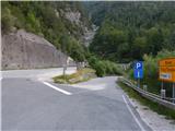
Access to the starting point:
a) Cross Border crossing Rateče into Itali, then turn left at Trbiž / Tarvisio in the direction of Predel / Cave del Predil. After a few 100 m, take another left in the same direction, then at the junction by Lake Rabelais / Lago del Predil, continue straight on the main road towards Slovenia (right Neveje Pass (Na Žlebeh) / Sella Nevea). There are some serpentines and a tunnel, then you reach Border crossing Predel, after which you take the exit to Slovenia again. Just after the crossroads, a side road branches off, where there is a marked parking area.
b) From Primorska, drive to Log pod Mangartom, and from there continue towards Itali. Before reaching Border crossing Predel, turn right after the Predel bridge (bridge over Mangart stream) in the direction of Mangart. Park just after the bridge in the marked parking lot on the side of the road.
Path description:
From the starting point, we continue along the asphalt road leading to Mangartsko sedlo, and we follow it up to the first right turn, or to the place where it crosses the Mangart stream. At this bend, before crossing the bridge, continue straight on the footpath towards Mangart mountain pasture. Continue along the path with a fine view of Mangart, following the path which climbs parallel to the stream, and a little higher up, crossing the Stože landslide, which was triggered in November 2000. As you leave the area of the landslide, you gradually enter the woods, through which you climb moderately to the western edge of Mangart mountain pasture.
Once on mountain pasture, walk to the nearby shepherd's hut, after which follow the slightly overgrown path leading through mountain pasture. After crossing mountain pasture, you reach a strip of woodland, and then quickly reach a narrower strip of meadow along which the old abandoned road continues (you can also get here by continuing along the road at mountain pasture, and then turning left at the first crossroads in the direction of the Mangartth saddle). The fainter road or cart track climbs gently and then, after crossing the torrent, it finally turns into a mountain path. There is a moderate climb for a few minutes, then cross an asphalt road. On the other side of the road, climb up a flight of steps and then reach a clearing where the path turns left and starts to climb quite steeply. After a few minutes of climbing, cross the road again, and then, a few steps higher up, reach it once more.
Here, the marked path continues to the right (unmarked path over Gladki rob on the left) and leads us to a small tunnel with beautiful views of the Loška Steno. After the tunnel, we have a nice view towards Mangart, and then, when we reach the larch forest belt, we leave the road and continue left along the marked path, which cuts around a bend. After a few steps, when you rejoin the asphalt road, just cross it and continue your ascent along the marked path, which first climbs moderately, then flattens out and continues crosswise to the right. During the crossing, you first reach a small ravine and then the Nakel ravine (the Nakel ravine starts at the border ridge itself and then descends steeply all the way down to the Koritnice river (a stream called Ilovec flows in the lower part)). Exit the ravine crosswise to the right, then the path turns left and starts to climb steeply. Climb steeply for a few minutes, then approach the torrent again, where the path turns right and climbs steeply over a short jump. After the jump, the path lays down a little, then over a mostly grassy slope, with beautiful views of the surrounding mountains, it leads us back to the Mangart road, which we follow to the right. Soon after we get on the road, the path leads us to the last tunnel, which is quite long. As the road is quite busy, it is a good idea to use a torch in the tunnel to make it easier for other people to see us. After the tunnel, cross another ravine and then reach a small crossroads where you continue left towards the Mangartska koča on Mangart saddle. From the crossroads it is only a few minutes' walk before you reach the hut.
Description and figures refer to the situation in 2016 (July).

We can extend the trip to the following destinations: Mangart
Pictures:
 1
1 2
2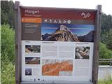 3
3 4
4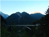 5
5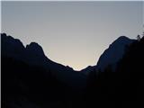 6
6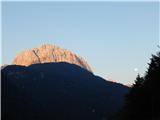 7
7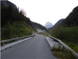 8
8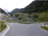 9
9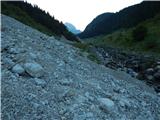 10
10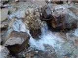 11
11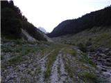 12
12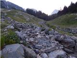 13
13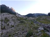 14
14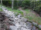 15
15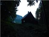 16
16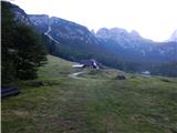 17
17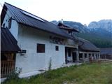 18
18 19
19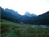 20
20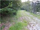 21
21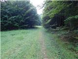 22
22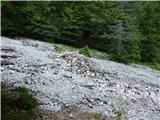 23
23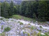 24
24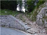 25
25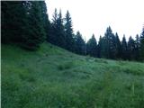 26
26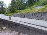 27
27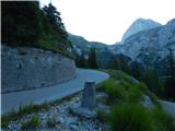 28
28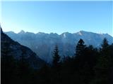 29
29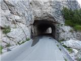 30
30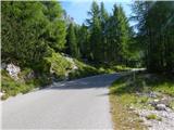 31
31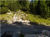 32
32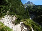 33
33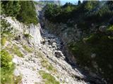 34
34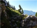 35
35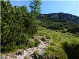 36
36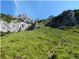 37
37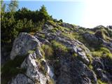 38
38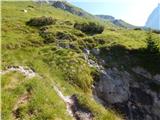 39
39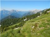 40
40 41
41 42
42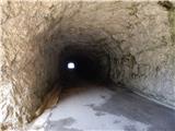 43
43 44
44 45
45 46
46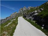 47
47 48
48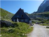 49
49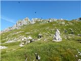 50
50
Discussion about the trail Pri Mlinču - Mangartska koča
|
| GregorD28. 07. 2016 |
Na sliki 33, kjer piše, da je neroden prehod. kaj točno j s tem mišljeno? je izpostavljeno ali samo štorato za čez priti?
Sprašujem zaradi otrok. Hvala.
|
|
|
|
| Tadej28. 07. 2016 |
Bolj štorasto, kot izpostavljeno. Je pa tisti borovec v pomoč, tako da se da varno priti čez.
|
|
|
|
| SuzanaM29. 07. 2016 |
Po tej poti sem šla pred par leti. Če odmislim prehod čez grapo (slika 33), je pot prav prijetna. Prehod čez grapo pa .... takrat je bil vse prej kot varen. Gre le za nekaj korakov, ki bi jih lahko uredili, glede na to, da gre za označeno planinsko pot. Tudi borovc ne bo vzdržal dolgo.
|
|
|
|
| GregorD31. 07. 2016 |
Včeraj smo šli po tej poti. Malo pred grapo(slika 33), pa ob skoku(slika 38) sem imel 4 letnika privezanega (bolj zaradi mojega občutka), sicer je plezal kot gams.
Na sliki 33 je imela največ težav žena, ki ne more v celoti obremeniti kolena. Torej se strinjam s Tadejem, da je narodno oziroma štorasto.
Vrnili smo se po cesti, ki je sicer dolgočasna, vendar pa nudi razglede, otrokoma pa je bila posebna dogodivščina iti s čelno lučko skozi tunele.
|
|
|
|
| mpogac25. 06. 2017 |
Baje je zadnje tri kilometre cesta zaprta. Je bil kdo gor v zadnjem času. Pa še to, je ta "štorasti" prehod iz slike 33 že kaj boljši.  
|
|
|