Starting point: Preska (332 m)
| Lat/Lon: | 46,1322°N 14,4026°E |
| |
Time of walking: 1 h 45 min
Difficulty: easy marked way
Altitude difference: 474 m
Altitude difference po putu: 500 m
Map: Škofjeloško in Cerkljansko hribovje 1:50.000
Recommended equipment (summer):
Recommended equipment (winter):
Views: 14.726
 | 1 person likes this post |
Access to the starting point:
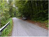
From Ljubljana, take the old road towards Kranj, and follow the road only as far as the first crossroads in Medvode, where you turn left (towards Preska and Golo Brdo) over the railway line (if you are coming from Kranj, turn right at the last traffic light in Medvode). After the railway line, turn right towards Preska, and we will pass through the town to the fire station. At the small crossroads behind the fire station, turn left and we continue along Bergantova cesta, which we follow past a few houses to the start of the footpath leading to St. Jakob (there is a small parking lot at the starting point and a signpost marking the start of the trail). You can also park further down at a suitable parking place in Preska.
Path description:
From the starting point, turn right onto the marked footpath, which begins to climb moderately through the forest. Soon we cross the wide cart track, and we continue past the sign (cross) and continue in the direction of Jakob and Katarina. The way ahead is mostly along the gently sloping cart track, and then signs direct us slightly right onto a wide footpath, which we quickly follow out of the wods. Once out of the wods, the path gradually disappears on the grassy hay meadows, and we continue in the same direction, where we soon come to the waymarked cart track, which takes us up to the nearby road in a few minutes.
Follow the road to the right, and it will soon lead us through the village Studenčice to a marked crossroads, where the path from the village of Sora joins us from the right.
Continue on the asphalted road, which leads past the NOB monument to the upper part of Studenčice village. Here the road starts to climb steeply and then it is laid and leads us past an abandoned quarry to the village of Tehovec. We continue our ascent, again on a more scenic slope, and we follow the asphalted road all the way to the church of St Florijan in the aforementioned village.
From the church we continue along the asphalted road for some time, and then we reach a small pass from where we continue along a wide macadam road. Follow the road for a short distance, then the signs point slightly left onto a path that goes into the forest and around the top of Sveti Jakob on the left. After a few minutes of crossing, we re-emerge from the forest and join the path coming from the village of Topol. Here we take a sharp right and follow the wide cart track for some 10 steps, and then the signs direct us to the right onto a steep footpath which, along the edge of the forest, will take us in a few minutes to a viewpoint with the Church of St James.

Pictures:
 1
1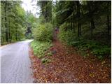 2
2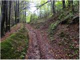 3
3 4
4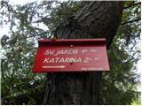 5
5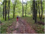 6
6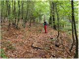 7
7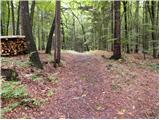 8
8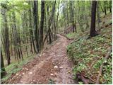 9
9 10
10 11
11 12
12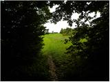 13
13 14
14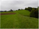 15
15 16
16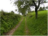 17
17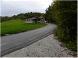 18
18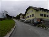 19
19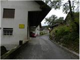 20
20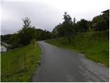 21
21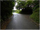 22
22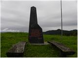 23
23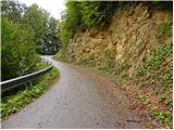 24
24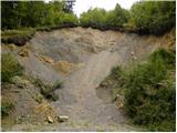 25
25 26
26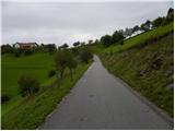 27
27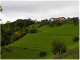 28
28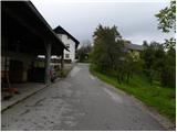 29
29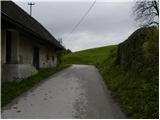 30
30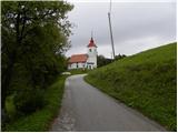 31
31 32
32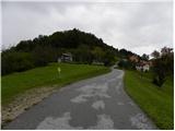 33
33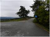 34
34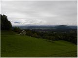 35
35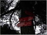 36
36 37
37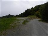 38
38 39
39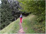 40
40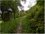 41
41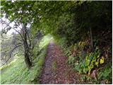 42
42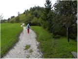 43
43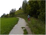 44
44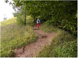 45
45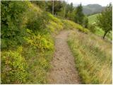 46
46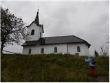 47
47 48
48 49
49
Discussion about the trail Preska - Sveti Jakob
|
| viharnik28. 09. 2010 |
Lepo tadej in Esther!
Izbrala sta najdaljšo pot na Jakoba,če izvzamemo še daljšo od Podutika.preko Toškega Čela in Katarine na vrh Jakoba.
Še en bližji in direktnejši dostop je malo naprej po cesti od parkiranega vozila,na koncu oline,kjer se cesta deli desno na Studenčece,mi zavijemo(pri kantah) levo ter po 200m strogo desno(asfalt)in naprej mimo vikendov še malo naprej na gozdni makadam,kjer kmalu po prvi strmni desno parkiramo na večlem parkirišču(do 6 vozil).Naprej krenemo vseskozi po gozdni cesti in po 40min pridemo do kmetije Mamovec.Tu imamo še 5min do zah.rame jakoba(tabla kolo in križ).
Vajina prva varianta bolj sede gorskim kolesarjem.Sam jo večkrat krožno prevozim ob povratku na Soro.
|
|
|
|
| darh7. 03. 2011 |
Po tu opisani poti smo se iz Medvod na Sv. Jakob povzpeli v soboto. Le v dolino se nismo vračali po isti poti, ampak smo se prek Roga in Jeterbenka spustili v Golo Brdo ter se od tam vrnili v Medvode. Posledično smo tudi parkirali niže, da se nam na koncu ne bi bilo potrebno ponovno vzpenjati. Podrobnejši opis ture pa si lahko preberete tule.
|
|
|