Potoki - Gradišče nad Sotesko (Soteska)
Starting point: Potoki (570 m)
| Lat/Lon: | 46,4156°N 14,1174°E |
| |
Time of walking: 30 min
Difficulty: easy unmarked way
Altitude difference: 154 m
Altitude difference po putu: 154 m
Map: Karavanke - osrednji del 1 : 50.000
Recommended equipment (summer):
Recommended equipment (winter): ice axe, crampons
Views: 2.104
 | 3 people like this post |
Access to the starting point:
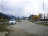
From the motorway Ljubljana - Jesenice take the exit Lipce (Jesenice East) and turn right towards Jesenice. At the first traffic lights (Slovenski Javornik) turn right, and at the next one (end of the settlement, by Acroni) go straight ahead, passing the settlement Koroška Bela on the left and a little later the petrol station on the right. After less than 2 km of further driving, you will arrive near the next settlement, Potoki, where you will be directed by a sign on the roadside. Turn left and park in a suitable place near the signpost.
Path description:
Carefully cross the railway line and follow the road towards the first houses on Potoki, between which you will soon find yourself at a crossroads. After a few metres, turn left and you will reach the end of the road at the last house on the western edge of the village, "pri Blažunu". On the right hand side of the house we see logging trail, similar to a stream bed, and next to it a municipal signboard with the inscription. Step on this logging trail, which, along the slope on the right, leads shortly to the bed of the brook Sevnik, which we cross. A crossroads follows, where we continue to the left along a path that is firstly gentle and then gently ascending at the edge of the forest, which leads us here along the slope of hill Gradišče nad Sotesko on the right. When the path emerges from the forest, it climbs slightly steeper up the grassy slope and turns right at this point. A little higher up, where the steepness eases and the dirt track turns left, leave the latter and continue straight ahead on a less obvious track, steeply into the forest. Once on the forest ridge, a visibly steeper and slightly steeper path leads to the top of the hill. Shortly before the finish, when the steepness briefly eases, continue straight up the steep slope (slightly to the right is a hunting track). Just below the summit, you will come across the first remains of the walls of an ancient fortification along the path. The latter can also be seen on the summit itself, and a few metres lower down on the southern slope. From the top, which does not offer much of a view of the valley due to the forest, we can see the neighbouring hill Ajdna, and part of the landscape to the east and west.

Pictures:
 1
1 2
2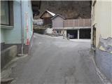 3
3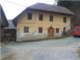 4
4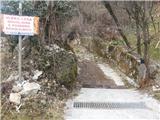 5
5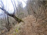 6
6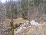 7
7 8
8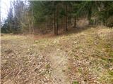 9
9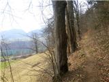 10
10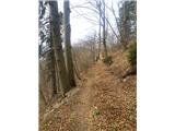 11
11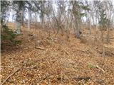 12
12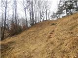 13
13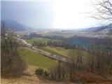 14
14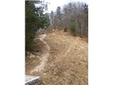 15
15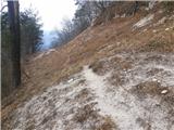 16
16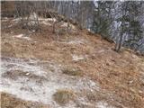 17
17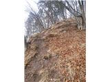 18
18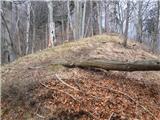 19
19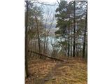 20
20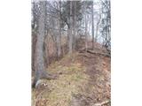 21
21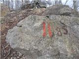 22
22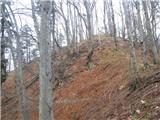 23
23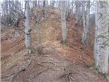 24
24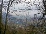 25
25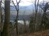 26
26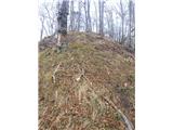 27
27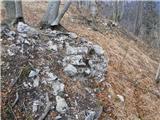 28
28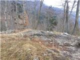 29
29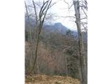 30
30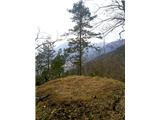 31
31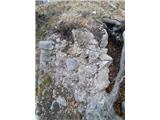 32
32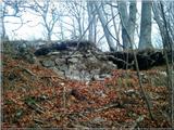 33
33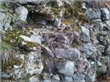 34
34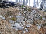 35
35
Discussion about the trail Potoki - Gradišče nad Sotesko (Soteska)
|
| Anamarija13627. 10. 2019 |
Pot je od hiše pri Blažunu malo spolzka zaradi vode, ki teče po poti, drevesa so čez pot in potrebno se je skloniti. Na levo stran se odpira pogled na avtocesto v daljavi. Pot je mirna in lepa.
Po 10-12 minutah hoje prečkamo hudournik in nato nadaljujemo pot na levo, pridemo do ovinka in sledimo poti, ki se sedaj giblje med drevesi. Ko se pot začne vzpenjati pa naletimo na oviro - podrta drevesa, potrebno se je vrniti nazaj in med drevesi je nova pot, ki pelje čez travnik od koder se počasi nato vrnemo na pot.
Zmerno se vzpenja do sedla.
Na sedlu je električni stolp in prelep razgled na Koroško Belo na eni strani in celotno Zgornje savsko dolino, na drugi strani na vas Potoki, Ajdno nad Potoki, najvišji vrh Karavank, vasi pod Stolom, Radovljico in v daljavi se vidi Šmarna Gora.
S sedla nadaljujemo pot proti ruševinam. Pot je strma, poteka po robu in potrebna je previdnost. Do vrha, kjer so vidne ruševine pod koreninami dreves je še dobrih 10 minut hoje. Razgleda ni zaradi dreves.
|
|
|