Poljana (Završnica) - Waterfall below Gozdašnica
Starting point: Poljana (Završnica) (640 m)
| Lat/Lon: | 46,4072°N 14,1461°E |
| |
Time of walking: 25 min
Difficulty: partly demanding unmarked way
Altitude difference: 120 m
Altitude difference po putu: 120 m
Map: Karavanke - osrednji del 1 : 50.000
Recommended equipment (summer):
Recommended equipment (winter): ice axe, crampons
Views: 8.491
 | 3 people like this post |
Access to the starting point:
From the Ljubljana - Jesenice motorway, first take the Lesce exit, and then take the old road towards Žirovnice and Jesenice at the roundabout. After a few km of driving, pass the crossroads where the road branches off to the right towards the centre of Žirovnica. After crossing the Završnica viaduct, you will come to a right turn-off, which is where you should head (take a sharp right). Immediately afterwards, turn left at a small crossroads and right at the next one (after 50 m), in the direction of Završnica. After a short descent, the road briefly climbs a little and then flattens out, leading to a point where a macadam road branches off to the left towards Valvasor's home. Park in the new parking lot nearby, next to the reservoir on the right-hand side of the road.
Path description:
From the parking lot, continue in the same direction along the road for about 200 m to the first wide forest path on the left side of the road (the first cottage is on the right). Take this forest path and follow it for a short distance. When you see two markers attached to the tree trunks on the left side of the path (before the little bridge over the stream), take the second one and head perpendicularly to the left, steeply up the bank, along the initially less visible path, up the slope of Gozdašnica hill. The path ascends northwards, climbing quite steeply for a while, turning slightly to the right, and then crosses the increasingly steep eastern slope of Gozdašnica. When the steepness of the ascent eases, the path crosses the steepest and most dangerous wet slip slope of the hill. Shortly afterwards, you see the cliff over which the waterfall falls. After a further 10 metres, the path leads us to the waterfall, where we cross a stream bed and pass through a rocky narrow (gate) to get under the waterfall. Before the above-mentioned narrows, in the route slightly to the right, you can also climb up to a small ridge from which you can see the waterfall and the preserve (amphitheatre) at its foot.

Pictures:
 1
1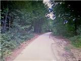 2
2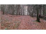 3
3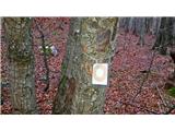 4
4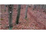 5
5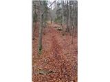 6
6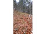 7
7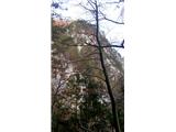 8
8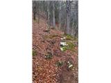 9
9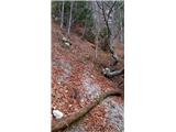 10
10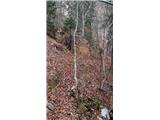 11
11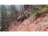 12
12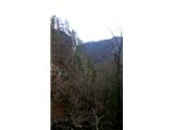 13
13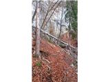 14
14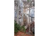 15
15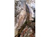 16
16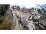 17
17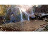 18
18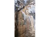 19
19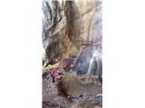 20
20 21
21
Discussion about the trail Poljana (Završnica) - Waterfall below Gozdašnica
|
| ločanka10. 03. 2023 16:30:24 |
ja, pot dobro sledljiva, ko jo najdeš. Ampak midva sva jo zgrešila pri lesenem mostičku, ki gre čez potok. Tam je oznaka na visokem drogu, ki pa kaže v smeri potoka. Pa saj nekaj časa slediš nekakšni stezici, ki je sicer postajala vse manj vidna in pelje potem na nasprotni breg. No, pa sva kar nekaj časa vztrajala, ko pa je postalo res vse podrto in sesuto, je Jože k sreči opazil pohodnico s psom precej višje na levi strani in takrat nama je postalo jasno, da sva pravo pot pravzaprav zgrešila. Tako sva se prebila v levo iz grape in stopila na pot. Potem nobenega problema več in tako tudi pri povratku  . Slap se pa splača vidit! Res pa je, da tega opisa prej nisem dobro prebrala, ker pot ni bila v planu.
|
|
|
|
| jerque15. 10. 2024 18:16:18 |
Četudi zveni seksistično, se sodeč po maPZS, drugih zemljevidih in nenazadnje po smerni tabli pri odcepu s ceste zdi, da je "Hudič babo pere" uradno ime slapa. Zato bi že zaradi iskalnikov predlagal, da se ime "gore" preimenuje (in po možnosti dopiše še kakšen stavek o drugih imenih).
Sicer je edina pot od označenega odcepa s ceste ob desnem bregu potoka (oz. je potok na naši desni, ko gremo navzgor), ki se mi ne zdi prav nič zahtevna, verjetno pred kratkim celo kaj urejena, tik pred slapom je tudi razgledna klopca.
Nikakor pa ne priporočam, da iščete pot "do razgledišča" ob drugem (levem) bregu potoka, ki jo sicer nakazuje maPZS. Dejansko ni nobene poti, samo zelo strm in težko prehoden teren. Tudi če do slapu pridete po uradni poti in tam prečkate potok, dobro premislite, ali bi se na drugi strani zagnali strmo navzgor (oz. ali se boste lahko po isti poti vrnili). Z "razgledišča" se namreč vidi samo drevje, naprej pa že omenjeno strmo brezpotje.
|
|
|
|
| grega_p22. 09. 2025 19:37:27 |
Lep in dokaj lahko dostopen slap, ki s svojim 20m padcem v izdolbeno kotanjo v vznožju ponuja prijetno kuliso.
Na drugi strani pa res ni nobene vidne poti naprej od razgledišča pod pečinami, samo strm in siten teren. Mogoče kdo ve ali obstaja "sprejemljiv" prehod do zgornje ceste in Turške jame na Gozdašnici?
|
|
|