Poldov rovt (Vrata) - Šplevta (via bivouac)
Starting point: Poldov rovt (Vrata) (941 m)
| Lat/Lon: | 46,4216°N 13,86289°E |
| |
Name of path: via bivouac
Time of walking: 4 h 30 min
Difficulty: difficult unmarked way
Altitude difference: 1331 m
Altitude difference po putu: 1331 m
Map: Triglav 1 : 25.000
Recommended equipment (summer):
Recommended equipment (winter): ice axe, crampons
Views: 12.157
 | 2 people like this post |
Access to the starting point:
Take the Mojstrana, then follow the signs for the Vrata valley. Continue through the Vrata valley, and about 100 metres before the 10 km road marker, you will see cart track branching off to the right perpendicular to the main road. This is the start of the route described. The marked parking area where parking is allowed is about 500 metres further along the main road.
Path description:
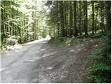
Take the cart track sign, which leads into the wods and then past a small house, where you continue slightly to the left on a footpath. Go through the forest and climb slightly to the left towards the Red Brok. Just before the brok, a path branches off to the right across the Juniper (marked cairn, with a face and the letter L carved on a tree). The path then leads to a stream bed. Here the path goes up the right-hand side (left bank) and then soon crosses the stream to the left-hand side. The path climbs up the valley until it is blocked by a small wall, where you usually also come across a small well. The path goes right from here and climbs steeply after a natural crossing. Slightly exposed and not protected. We are above a small waterfall (if there is water). Here we come out of the forest and climb over some scree. The path over the scree is not comfortable as storms and landslides destroy the path every year. The path soon turns slightly to the right and briefly climbs up a grassy slope. Then it climbs again along the scree and soon reaches the bivouac at Jezeri, which you will see on your left. We can spend the night here or just take a bucket in case of a storm. This is where the world flattens out. The view of Triglav from here is very nice.
The path from the bivouac onwards is slowly disappearing but we can still follow it. Continue slightly to the right towards the saddle between Dovškim Križ and Šplevto. At the saddle, turn right and continue the ascent along the pathless world, initially relatively steeply upwards. After a few minutes, the steepness subsides and the increasingly scenic "path" leads us after a few more 10 steps to the top of Šplevta.

Pictures:
 1
1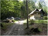 2
2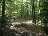 3
3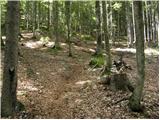 4
4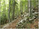 5
5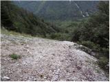 6
6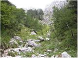 7
7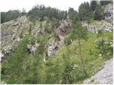 8
8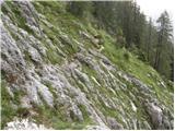 9
9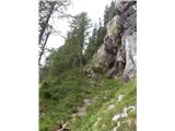 10
10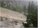 11
11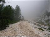 12
12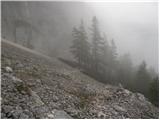 13
13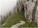 14
14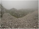 15
15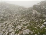 16
16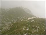 17
17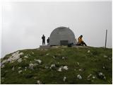 18
18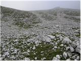 19
19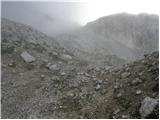 20
20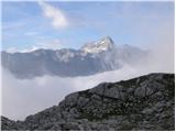 21
21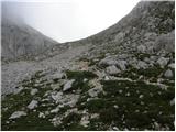 22
22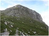 23
23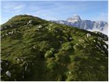 24
24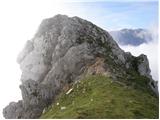 25
25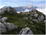 26
26
Discussion about the trail Poldov rovt (Vrata) - Šplevta (via bivouac)
|
| bbugari14. 11. 2017 |
Danes sem tudi opisal vzpon na Šplevto čez Brinje. Sledil je spust do Bivaka II. ter nadaljevanje spusta do Vrat. Ta steza je, razen odseka v prekrasnem macesnovem gozdu na dnu velikega melišča, orjentacijski dosti zahtevna. V prvem delu sem od bivaka šel malce na desno, ne po melišču. Ta pot mi je dosti lepša, če pa ni krajša, samo treba paziti da se na vreme odmaknemo od Malega Matterhorna ter vrnemo levo na melišče, preden se dolinica zoži v usko neprehodno kratko grapo. Previdno treba sestopiti po travah in steni posuti z drobirjem na veliko melišče ter po njem mimo jame pod MM na levo. Tu je dosti lepša pot skozi macesnov gozd kot nadaljevanje po melišču (pa ni brže!). Ko se končno melišče preči na levo pod stene (uvodna slika 11), sledi zelo nevaren spust po grapi, nakon macesna v dnu uvodne slike br. 9. Na dnu grape se najde lepa stezica pa ne vem kjer sem je prej grape ali pa v grapi zapustil, ali pa je to steza ki gre na Kališče? Spust po koritu Rdečeg potoka se dosti vleče. Steza je težje sledljiva in ni posebno zanimljiva. Se opravičujem za hudo slovenščino... 
|
|
|