Podrošt - Altemaver (Ratitovec)
Starting point: Podrošt (563 m)
| Lat/Lon: | 46,2114°N 14,0595°E |
| |
Time of walking: 3 h 20 min
Difficulty: easy marked way
Altitude difference: 1115 m
Altitude difference po putu: 1140 m
Map: Škofjeloško in Cerkljansko hribovje 1:50.000
Recommended equipment (summer):
Recommended equipment (winter): ice axe, crampons
Views: 4.830
 | 1 person likes this post |
Access to the starting point:
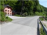
a) Drive to Železniki, then continue to Soriška planina and Petrov Brdo. When you reach a crossroads where the road to Petrovy Brdo and Tolmin branches off to the left and the road to Sorica and Soriška planina continues straight ahead, you are in Podrošt, where you will see the mountain signs for Ratitovec. There are no suitable places to park next to the mountain signs, so park in a suitable place somewhere nearby.
b) Drive to Baško grapa, then continue driving towards Železniki. After Petrovi Brdo, the road starts to descend and we drive to the crossroads where we join the road with Soriška planina. Here we turn right and see signs for Ratitovec. There are no suitable places to park next to the mountain signs, so park in a suitable place somewhere nearby.
c) From Bohinjska Bistrica ascend to Soriška planina, then start descending towards Sorica and Železniki. When we reach the valley, we are in Podrošt, where just a little further on from the crossroads where the road from Petrovy Brdo joins us, we see signs for Ratitovec. There are no suitable places to park next to the mountain signs, so we park in a suitable place somewhere nearby.
Path description:
Signs for Ratitovec direct us from the main road to a side road, which leads us past the Podrošt cafeteria, and then on past a barrier that prevents further traffic. Behind the lock on the left, you will see a small dam, above which is a small reservoir. Leave the road just a little further on and continue right on the marked path, which begins to climb crosswise to the left. The way forward leads us along what was once a well-maintained and wide path, which is now damaged in several places, and especially badly trodden and consequently quite overgrown. During the crossing of the slopes of the Lajtnik peak, where we walk above the stream Štajnpoh, the path forks a few times, and we follow the markings for Ratitovec on all of them. When we are a little higher up, in a few parts, looking back, we have a nice view towards Porezno, but otherwise the path mostly passes through the forest. Higher up, we reach the bed of the torrential Ravenska grapa stream, which we cross, but the high water level makes the crossing quite awkward due to the slippery rocks around the stream. Walk along the stream for a short distance and then reach a macadam road, which you follow to the right (the left road ends below the summit of Štoment). Cross another stream here, then go a little further left on a marked path, which quickly ascends to a pasture, where you climb along its lower left edge for a while, and higher up you pass into lane of bushes through which you climb to another road, where you reach the village of Ravne.
The path continues past a few individual houses, occasionally crossing a road or continuing along it for a short distance. After crossing an asphalt road, which can be followed to the village Torka, Ravne ends and we continue to follow the signs for Ratitovec. A relatively well-marked but poorly trodden path then leads us along the route of a high-voltage power line, and we continue along the line to a marked crossroads at the saddle Povden.
We continue in the direction of the Cottage on Ratitovec, and the path takes us into the forest on the right side of the information board marking the Natura 2000 area. The ascent through the fairly dense forest follows, and when the path becomes slightly more steep, we are joined on the left by the path from the village of Torka. From the crossroads, walk for a short distance along cart track, and then the signs for Ratitovec direct you to the right on the mountain path. The path ahead starts to climb steeply, and at a height of about 1500 metres it leads us out of the forest. Continue along the steeper slope, with increasingly beautiful views, where there is a high risk of avalanches in winter. Higher up, the trail leads us through a short protected section (easy), and then the trail turns left and lays down. There are a few minutes of easy ascent through the pastures of Ratitovec and you reach the Krek hut on Ratitovec. From the hut, continue along the marked path in the direction of Soriška mountain pasture. The trail first descends gently to the winter bivouac, where the trail joins from the right side with mountain pasture Pečana, and we continue straight to the watering point for animals, where the trail stops descending. The way ahead starts to climb steeply along the pasture fence and after a few minutes of climbing leads us to the eastern foothill of the Altemaver peak. There is a short descent and then the marked path turns slightly to the right. At the point where the marked trail leading to Soriška planina turns slightly to the right, we leave it and continue our ascent along the clearly visible trail towards the summit of Altemaver, which continues along the ridge of Ratitovec. Follow this scenic route to the highest peak of Ratitovec, which is reached after a further 10 steps.
Podrošt - Ravne 1:20, Ravne - Povden 40 minutes, Povden - Krekova koča 1:00, Krekova koča - Altemaver 20 minutes.

Pictures:
 1
1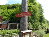 2
2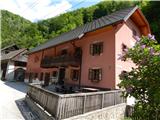 3
3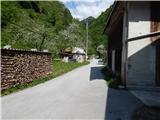 4
4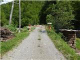 5
5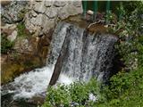 6
6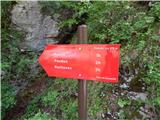 7
7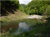 8
8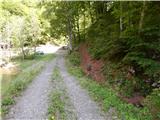 9
9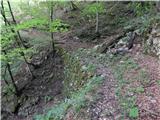 10
10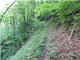 11
11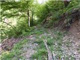 12
12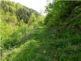 13
13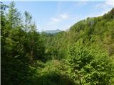 14
14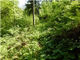 15
15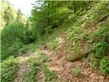 16
16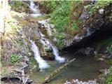 17
17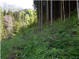 18
18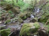 19
19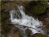 20
20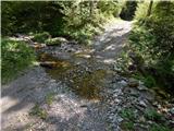 21
21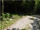 22
22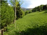 23
23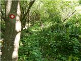 24
24 25
25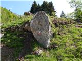 26
26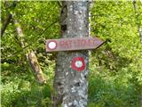 27
27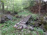 28
28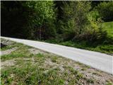 29
29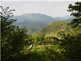 30
30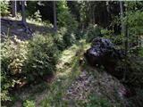 31
31 32
32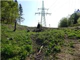 33
33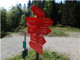 34
34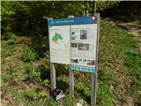 35
35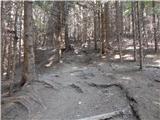 36
36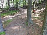 37
37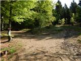 38
38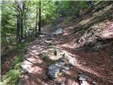 39
39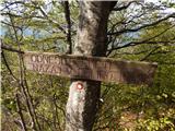 40
40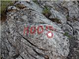 41
41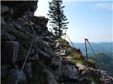 42
42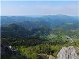 43
43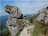 44
44 45
45 46
46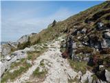 47
47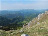 48
48 49
49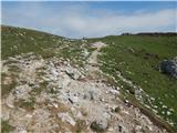 50
50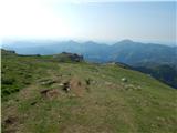 51
51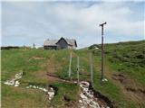 52
52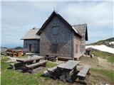 53
53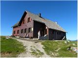 54
54 55
55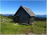 56
56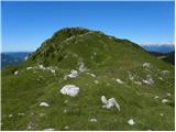 57
57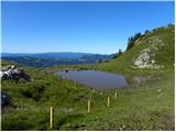 58
58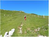 59
59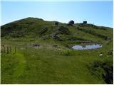 60
60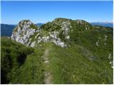 61
61 62
62 63
63 64
64
Discussion about the trail Podrošt - Altemaver (Ratitovec)