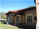
Podmelec (railway station) - Koča na planini Razor (on slope of Jalovnik and Kobilja glava)
Starting point: Podmelec (railway station) (230 m)
| Lat/Lon: | 46,15951°N 13,81406°E |
| |
Name of path: on slope of Jalovnik and Kobilja glava
Time of walking: 5 h 20 min
Difficulty: easy unmarked way, easy marked way
Altitude difference: 1085 m
Altitude difference po putu: 1250 m
Map: Julijske Alpe
Recommended equipment (summer):
Recommended equipment (winter): ice axe, crampons
Views: 1.210
 | 4 people like this post |
Access to the starting point:
We arrive by train - Podmelec is a stop on the "Bohinj line" Jesenice-Most na Soči.
If you arrive by car (Baška grapa), in Kneža turn off the main road towards "Sela nad Podmelcem", park after about 1 km in front of the village Podmelec, in a small parking lot.
Path description:
From the Podmelec railway station, head towards the centre of the village Klavže, crossing the river Bača, first turn right - a direction sign directs you to Jalovnik (3 hours) - immediately afterwards cross the road and continue along the asphalt road (turn left). At the end of the village, follow the sign Sela nad Podmelcem, which directs you to a paved road, which later changes to cart track. In the hamlet of Borovnice, where you pass a couple of cottages, you then cross a tarmac road and follow cart track up to the village of Sela nad Podmelcem. Follow the road to a dirt track leading to a meadow. Follow the grassy ridge up to the macadam road. Soon we see a nice signpost for Jalovnik, if we go to mountain pasture Razor follow the signpost to the right (Planina Razor 3 hours), the dirt road leads us in a few steps to the lookout point, and also later we occasionally still open a view of Porezen and Tolmin - the Bohinj Mountains. The road gets worse and worse and later turns into a track leading down a steep slope. Later we come to a fence, and the track becomes more distinct again and leads us to the abandoned mountain pasture Temna brda. Here follow the path below, which soon leads to a clearly visible path towards mountain pasture Lom, which is reached in about an hour and a half from the signpost for Mountain pasture Razor. At mountain pasture Lom we reach a marked trail, actually a road, by which we first reach mountain pasture Podkuk, and then on to mountain pasture Razor.

Pictures:
 1
1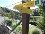 2
2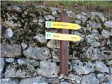 3
3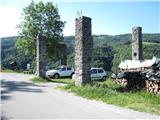 4
4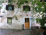 5
5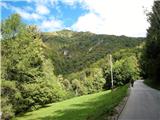 6
6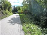 7
7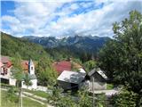 8
8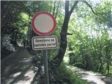 9
9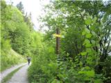 10
10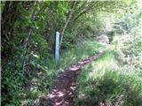 11
11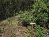 12
12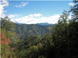 13
13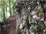 14
14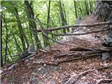 15
15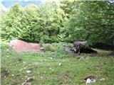 16
16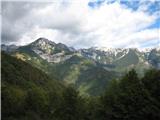 17
17 18
18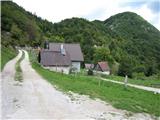 19
19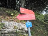 20
20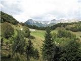 21
21
Discussion about the trail Podmelec (railway station) - Koča na planini Razor (on slope of Jalovnik and Kobilja glava)
|
| winni3. 05. 2023 13:14:26 |
Pot med Seli nad Podmelcem in Planino Lom je res v zelo slabem stanju, varovalna vrv pa je v izpostavljenem delu še vedno prisotna.
|
|
|