Podljubelj (Lajb) - Begunjščica
Starting point: Podljubelj (Lajb) (770 m)
| Lat/Lon: | 46,4151°N 14,2701°E |
| |
Time of walking: 3 h 30 min
Difficulty: partly demanding marked way
Altitude difference: 1290 m
Altitude difference po putu: 1290 m
Map: Karavanke - osrednji del 1:50.000
Recommended equipment (summer):
Recommended equipment (winter): ice axe, crampons
Views: 20.268
 | 3 people like this post |
Access to the starting point:
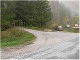
Leave the Gorenjska motorway at the Podtabor junction and continue to Border crossing Ljubelj. Continue past the Bistrica pri Tržiču turnoff, and higher up, past the turnoff for Podljubelj. Just after the 4. 5 km marker, turn right after the underpass and then right again into Podljubelj. Park in a suitable place by the sign marking the start of Podljubelj.
Path description:
From the parking lot, continue along the road that crosses the narrow bridge (overbridge) and turns left at the other end. After a few dozen steps, you will see signs for Preval, Begunjščica and Dobrčo along the road. Continue along the road as it climbs above the village and at the end of the village you will see a sign forbidding further traffic. The road, which climbs moderately, soon crosses a stream over a bridge and continues along a mostly vegetated slope. Somewhere halfway up to Preval, the road crosses some scenic slopes and then goes into the forest again, where we have two options for continuing. On the right side of the road we see a steep cart track, which soon leads us to Preval, or we can continue on a slightly more winding road, which leads us to Preval only about a minute later. At Preval, the two routes merge and there is only a short climb up to the hut, which is visible on the left-hand side.
From the cross at Preval, continue northwards on the marked footpath in the route Begunjščica over Kalvarija (Roblekov dom over Rožo on the left, Ljubelj and Podljubelj on the right). The way forward initially climbs over a grassy slope with a view, then passes into the forest through which it begins to climb steeply. Higher up, the forest begins to thin out and the path becomes slightly steeper. A fairly steep climb follows, initially through a few dwarf pines lanes, but higher up over steep grassy slopes which are particularly dangerous for slipping in wet conditions. The path then climbs up a steep grassy slope for a few minutes. When the slope is a little higher, the marked path turns left and crosses the slopes to the left. Just a few minutes further on, we arrive in a small valley where the slope is further flattened. Cross the valley (slightly to the right of the valley, you can climb to Begunjska Vrtača in 15 minutes on an easier trackless path), and then climb to the main ridge of Begunjščica in a few minutes. Once on the ridge, there is a fine view to the north, and we continue on the gently sloping path, which continues along a slightly narrower ridge. There is a short descent to a small saddle, where the "path" over the Šentanski plaza joins from the right. Here the ridge Begunjščica widens and we follow the increasingly scenic path to the summit of Veliki vrh. There is another very short descent, and then without any major problems we climb to the highest peak of Begunjščice in a few minutes. Starting point - Preval 1:30, Preval - Begunjščica 2:00.

Pictures:
 1
1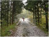 2
2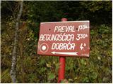 3
3 4
4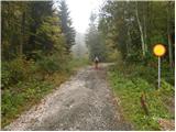 5
5 6
6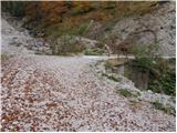 7
7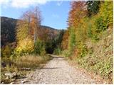 8
8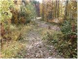 9
9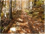 10
10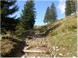 11
11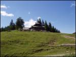 12
12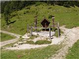 13
13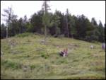 14
14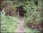 15
15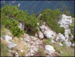 16
16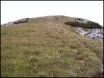 17
17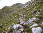 18
18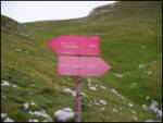 19
19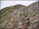 20
20 21
21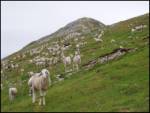 22
22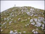 23
23
Discussion about the trail Podljubelj (Lajb) - Begunjščica
|
| mabone23. 01. 2010 |
Danes šel po tej poti.
Do Prevala nobene markacije. Najbolje po cesti in ne po opisani poti, katero je na parih mestih odnesel zemeljski plaz (vsaj zdi se mi tako).
Od planine naprej so sicer markacije, samo pot ni shojena oz je veliko stopinj a vsaka po svoje. V zgornjem delu niti slučajno ni lahka. Brez cepina nebi šlo.
Lep razgled in toplo sonce vseeno več kot poplačata celoten napor.
LP
Martin
|
|
|