Podljubelj - Dom na Kofcah (via Kal)
Starting point: Podljubelj (658 m)
| Lat/Lon: | 46,3979°N 14,2876°E |
| |
Name of path: via Kal
Time of walking: 2 h 5 min
Difficulty: easy marked way
Altitude difference: 830 m
Altitude difference po putu: 830 m
Map: Karavanke - osrednji del 1:50.000
Recommended equipment (summer):
Recommended equipment (winter): ice axe, crampons
Views: 42.458
 | 3 people like this post |
Access to the starting point:
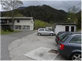
From the motorway Ljubljana - Jesenice, take the exit Podtabor (Tržič, Ljubelj), then continue to Ljubelj. After about 6 km from the petrol station at Bistrica pri Tržiču, we leave the main road, as the signs for Podljubelj direct us to the right onto the local road. Just a little further on, we arrive at the next crossroads, where we continue right and then after a few 10 m we park in a suitable place in the middle of the village.
Path description:
From the starting point, walk to the primary school in Podljubelj, and then turn left at the crossroads in the direction of Kala and Kofc. The path initially follows a dirt road which climbs moderately along the Jezernica stream. A few minutes higher up, the road makes a long right turn, but leave it and continue slightly left along the wide and marked cart track. Cart track or the worse road ends a little higher up at a dilapidated house, and we continue on the worse cart track, which turns into a forest. We continue to climb up the right side of the stream for a short distance, then cross it and take the left side. A little further on, you come to another small stream, along which you climb up to a nearby farmhouse. Go around the house on the right and then immediately after it to the left. A few metres higher, signs direct you to the right on a grassy slope, along the edge of which you climb up to a nearby wooden hut. Here the path turns slightly left and crosses a pasture fence a little further on. The path, which is less visible for some time, continues straight up across the pasture, then as you leave the pasture it passes into the woods and crosses cart track a little higher up. Continue straight on past a large rock and continue climbing towards Kala. The path continues along a small valley and occasionally climbs steeper. At a higher altitude, you will reach cart track, which leads quickly out of the forest and up to the nearby Shelter on the Kalo.
From the shelter, continue along the macadam road, where you will quickly reach a marked crossroads. From the crossroads, continue left up the marked footpath (straight Dom na Kofcah past the chapel), which starts to climb steeply. After a few steps, the path flattens out and leads into lane of bushes, where you cross the view slopes to the right. On the other side, the path returns to the forest and starts to climb steeply along the edge of the cliffs. The path continues past a few small natural caves, before it lays down and leads us into a more plateau-like world. The way ahead crosses a worse forest road while overlooking the western part of Košuta, and then leads to a parking area at the end of the forest road leading to Kofce. From the parking lot, follow the wide cart track, which will take you up to mountain pasture Kofce in 15 minutes. From the point where we have reached the lower edge of the mountain pasture, we are only 5 minutes away from the mountain hut, which is an increasingly scenic walk across the pastures of the aforementioned mountain pasture.

We can extend the trip to the following destinations: Planina Spodnja Dolga njiva,
Tegoška planina,
Planina Pungrat,
Planina Ilovica,
Zavetišče na planini Šija,
Planina Zgornja Dolga njiva,
Mala Košuta,
Kofce gora,
Toplar,
Malo Kladivo,
Veliki vrh (Košuta) (2 h 10 min),
Veliko Kladivo
Pictures:
 1
1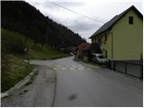 2
2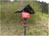 3
3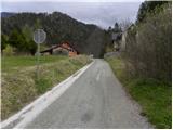 4
4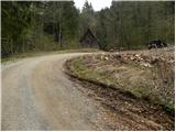 5
5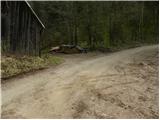 6
6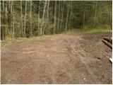 7
7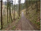 8
8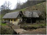 9
9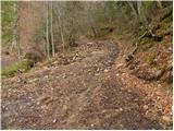 10
10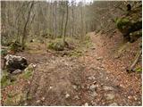 11
11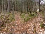 12
12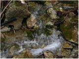 13
13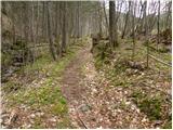 14
14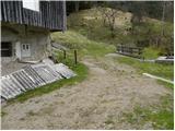 15
15 16
16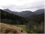 17
17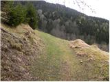 18
18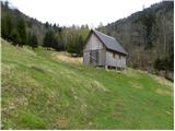 19
19 20
20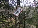 21
21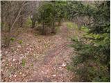 22
22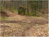 23
23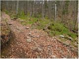 24
24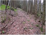 25
25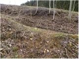 26
26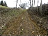 27
27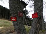 28
28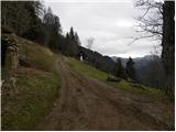 29
29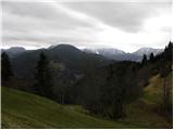 30
30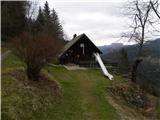 31
31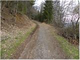 32
32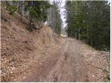 33
33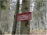 34
34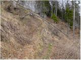 35
35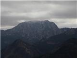 36
36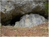 37
37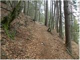 38
38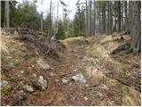 39
39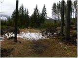 40
40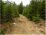 41
41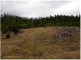 42
42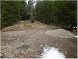 43
43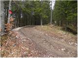 44
44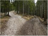 45
45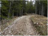 46
46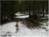 47
47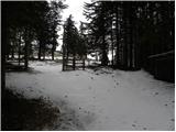 48
48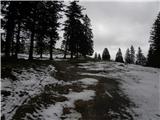 49
49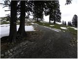 50
50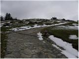 51
51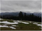 52
52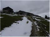 53
53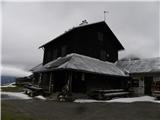 54
54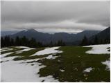 55
55
Discussion about the trail Podljubelj - Dom na Kofcah (via Kal)
|
| georgia26. 07. 2021 17:59:41 |
Na Kofcah sem bila že velikokrat po različnih poteh, a včeraj sem bila prvič po tej poti iz Podljubelja, čez Kal sem ponavadi šla iz Doline. Čeprav mi je bil ta del poti iz Podljubelja do Kala neznan, je lepo označen in ni bilo problema s sledljivostjo, vsaj pri vzponu ne. Je pa treba biti bolj pozoren pri sestopu, je kar nekaj mest (pod Kalom), kjer lahko hitro zaidemo s prave poti, morda manjka kakšna markacija... Vsekakor oči na peclje, pa ne bo nepotrebnega tavanja.  Sicer pa prijetna, samotna in senčna pot ob potoku, zanimiva in jo priporočam za spremembo! Parkirala pa sem kar pred šolo.
|
|
|
|
| Kafetarca9. 04. 2025 12:13:20 |
Morda kdo ve, kako je s parkiranjem v Podljubelju v letu 2025?
|
|
|
|
| georgia9. 04. 2025 15:39:24 |
S tega izhodišča greva vsaj enkrat na leto in do zdaj še ni bilo nobenih težav s parkiranjem, vedno sva pustila avto pred šolo v Podljubelju (čez vikend, kako je med tednom, ne vem). Letos pa še nisva bila, dvomim, da bi tu kaj spremenili ...
|
|
|