Pod Zjabci - Lanževica (on Rapallo border)
Starting point: Pod Zjabci (745 m)
| Lat/Lon: | 46,3261°N 13,6982°E |
| |
Name of path: on Rapallo border
Time of walking: 4 h
Difficulty: difficult pathless terrain
Altitude difference: 1258 m
Altitude difference po putu: 1300 m
Map: Julijske Alpe - zahodni del 1:50.000
Recommended equipment (summer):
Recommended equipment (winter): ice axe, crampons
Views: 9.726
 | 2 people like this post |
Access to the starting point:
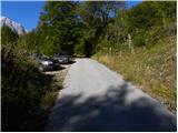
a) First drive to Kranjska Gora, then continue over the Vršič Pass towards Bovec. Shortly after the Berebica Gallery, you will arrive in the village Soča, where you will turn left over the bridge over the Soča River (towards the Jelinčič Tourist Farm and the Korita bivouac). After the bridge, do not turn left towards the bivouac, but continue driving straight ahead on the ascending asphalt road. Continue climbing through vast meadows, in the middle of which stand a few individual huts, and then the road turns into a forest. Higher up, the road turns quite left and leads us to Pod Zjabcev, where we see mountain direction signs for mountain pasture Za skala, Dom na Komni and Triglav lakes. Park at a suitable place along the road.
b) From the coastal side, first drive to Bovec, then continue driving towards Trenta. Towards the end of the village Soča, turn right in the direction of the Jelinčič tourist farm and the Korita bivouac. After the bridge, do not turn left towards the bivouac, but continue straight on the ascending asphalt road. Continue climbing through vast meadows, in the middle of which stand a few individual huts, and then the road turns into a forest. Higher up, the road turns quite left and leads us to Pod Zjabcev, where we see mountain direction signs for mountain pasture Za skala, Dom na Komni and Triglav lakes. Park at a suitable place along the road.
Path description:
From Pod Zjabcev, follow the marked trail, which passes the nearby cottage on the right. After the cottages, the path goes into the woods and quickly leads to a small crossroads, where we continue right across the stream. On the other side of the stream, the path turns left and starts to climb moderately through the dense forest. The ascent continues along the old mule track, which is already fairly loaded in several places, but it leads us higher up to a short steep rocky section. A well-maintained and wide mulatier leads us through this part, and the path above this part leads us to a viewpoint from which we have a beautiful view of the Bavški Grintavec.
From the viewpoint, the path returns to the forest and climbs quickly up to an old water trough (there is a small spring along the path, which dries up in dry periods). Above the trough, the path turns slightly left and then climbs through the forest in numerous switchbacks. Higher up, the path bends slightly and leads to a less visible crossroads, where an abandoned path branches off to the left towards mountain pasture Za skalo.
From here we continue straight on, but again a slightly steeper path, after 10 minutes of further walking, leads us to the next, this time completely unmarked crossroads. Here, an unmarked path branches off to the right, leading to a nearby hunting lodge and on towards mountain pasture behind Črni vrh, a hunting trail branches off to the left towards mountain pasture behind the rock, and we continue straight on to the next crossroads nearby, which is slightly better marked.
Here we continue straight ahead, or slightly right, along the marked trail in the direction of Triglav Lakes and Komna. Continue along the gently sloping path through the coniferous forest to the fork in the trail.
From the fork, continue along the right-hand path in the direction of Komna (Triglav lakes on the left), which bypasses Dol za Bajarjem on the right. On the other side of the valley, the path begins to climb, first gently and then steeply. The steepness quickly subsides, but the increasingly scenic route leads us into a series of small valleys, which we climb steeply up to Oslova škrbina.
From Oslova škrbina, the marked trail starts to descend towards the Lepa Komna plateau, but we leave it at this point and continue our ascent to the right along the trackless path. From Oslova škrbina we continue in the direction west to south-west, and higher up almost south, our orientation for the future should be the ridge that continues all the way to the top of Lanževice.
From the stump we first climb over a beautifully traversed pathless world, and then an easy passage is blocked by a steep slope. Here we have two options for continuing. We can climb straight up a rather steep and partly crumbly slope, or we can continue slightly to the left and climb along and partly through the dwarf pines to the ridge, where a slightly more difficult option joins us. Both routes continue along and occasionally along the ridge, which is no longer particularly difficult. Higher up, a short steep section can be avoided by passing a small scree slope on the right and then continuing along the ridge, where you can see old boundary stones, the former Rapallo borders. Follow this increasingly scenic and, in the upper part, also well-traversed "path" all the way to the 2003 m high Lanževice.

We can extend the trip to the following destinations: Velika Baba
Pictures:
 1
1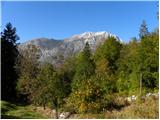 2
2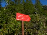 3
3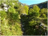 4
4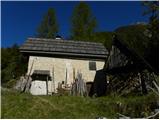 5
5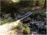 6
6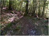 7
7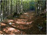 8
8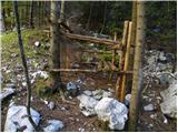 9
9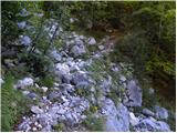 10
10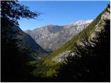 11
11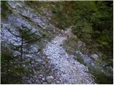 12
12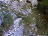 13
13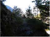 14
14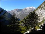 15
15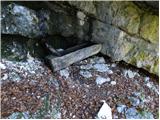 16
16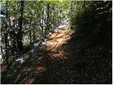 17
17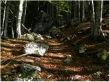 18
18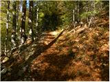 19
19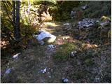 20
20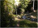 21
21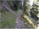 22
22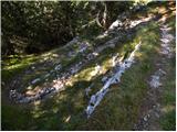 23
23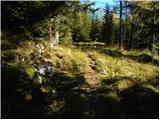 24
24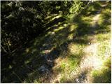 25
25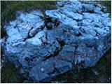 26
26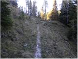 27
27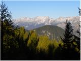 28
28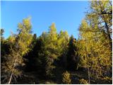 29
29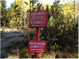 30
30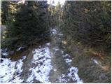 31
31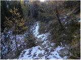 32
32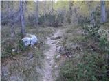 33
33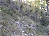 34
34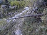 35
35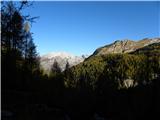 36
36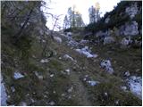 37
37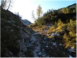 38
38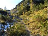 39
39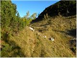 40
40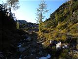 41
41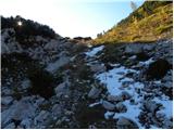 42
42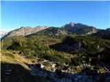 43
43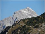 44
44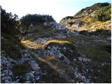 45
45 46
46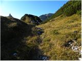 47
47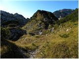 48
48 49
49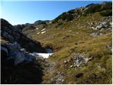 50
50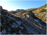 51
51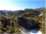 52
52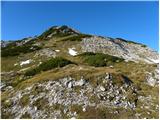 53
53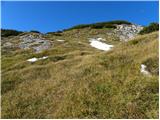 54
54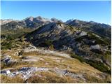 55
55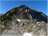 56
56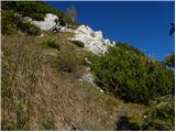 57
57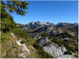 58
58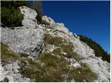 59
59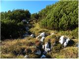 60
60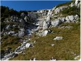 61
61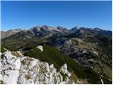 62
62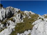 63
63 64
64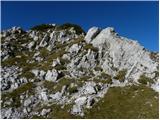 65
65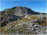 66
66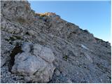 67
67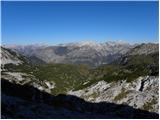 68
68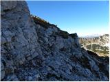 69
69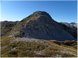 70
70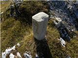 71
71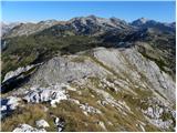 72
72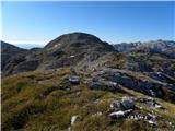 73
73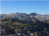 74
74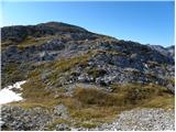 75
75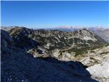 76
76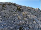 77
77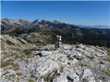 78
78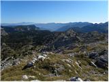 79
79
Discussion about the trail Pod Zjabci - Lanževica (on Rapallo border)
|
| Zgembo30. 04. 2017 |
A mogoče kdo ve kje se da dobiti žig?
|
|
|
|
| darinka426. 11. 2021 13:39:06 |
Opisano spodnje korito, kjer naj bi tekla voda je bilo sušno. Morda je več vode spomladi. Kar malo razočarana sva bila, ker se že drugič bolj zaradi snega nisva odločila po grebenu od Oslove škrbine vse do vrha. Predvsem ker ne veš kako je s snegom na poti. V tretje morda spomladi bo šlo lažje. Tudi potka , ki se odcepi za Kaluder mimo lovske koče in opuščene planine za Črnim vrhom se potem izgubi. Če bo tam kdo hodil naj ima navigacijo. Na teh poteh redkokoga srečaš.
|
|
|
|
| mirank26. 11. 2021 14:09:11 |
Iz tega izhodišča še nikoli nisem šel in me tudi ne mika, pa se vsako leto vsaj enkrat podamo v tiste robe. Vedno štartamo pri rampi! Kar se tiče steze pa marsikje uporabljam taktiko, da hodim kot drugi in kričim "tukaj je hojeno" 
|
|
|
|
| darinka44. 10. 2023 09:47:24 |
Kdor čaka dočaka. Včeraj nam je v lepi jesenski idili uspelo prehodit pot po Rapalski meji. Od Pod Zjabci smo se namenili na Mala Vrata. Tam smo že hodili, ko smo šli na Kal. Potem pa po brezpotju , mimo mejnih kamnov , nekoč rapalske meje. Vse do vrha Lanževice. Sestopali smo po nam že poznani poti pod Babo in Kaludrom. Poti niti ne bi rekla, ker jo ni več. Čeprav nekoč vrisane v garminu, ne obstajajo več, ker so se zarasle. In ruševja je tam tudi vsako leto več. Kljub temu, da smo tam že hodili, smo iskali prehode . Kakšne pol ure izgubili kot če bi šli po levi strani ob sestopu z Lanževice. . Tura niti ni bila kratka. Enih 17 km je naneslo hoje in skoro 1600 višincev.
|
|
|