Starting point: Pod Luknjo (950 m)
| Lat/Lon: | 46,2488°N 13,9145°E |
| |
Time of walking: 2 h 30 min
Difficulty: easy marked way
Altitude difference: 894 m
Altitude difference po putu: 894 m
Map: TNP 1:50.000
Recommended equipment (summer):
Recommended equipment (winter): ice axe, crampons
Views: 50.272
 | 3 people like this post |
Access to the starting point:
From the Ljubljana - Jesenice motorway, take the Lesce exit and follow the road towards Bled and on to Bohinjska Bistrica. From Bohinjska Bistrica turn left towards Tolmin and Soriška mountain pasture. Soon we will see signs for Črna prst on the right, but we continue straight ahead. Just a little later we come to a crossroads where a signpost points us right towards the village of Ravne. Take this road, which will take you to the end of the village, where the asphalt ends. Continue along the macadam road, which leads past the former home of Dr Janez Mencinger (now a private house). Follow this road for about 4km to where a worse forest road joins from the right (there is a hunting observatory, numerous cart tracks and a mountain marker for Črna prst). Continue along this road for about 4km to where a worse forest road joins from the right (there is a hunting observatory, numerous cart tracks and a mountain marker for Črna prst nearby).
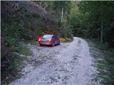
Park in one of several small parking lots along the road, but in such a way as not to interfere with the forestry work (harvesting of timber).
Path description:
Due to the forestry work and the consequent number of tractor trains, the trailhead is relatively difficult to find. Between the hunting observation post and the mountain sign for Črna prst there are three larger cart tracks, which head up from the road to the left (the direction of our arrival). We choose the "first" one, i. e. the one closest to the hunting observation post (the mountain sign for Črna prst directs us to the "last" cart tracks, but if we head in the direction of this sign, we will quickly go astray).
So if we decide to climb the "first" cart track we will see the markings after a few minutes of climbing (the path comes across from the "last" cart track and is completely overgrown). Follow the wide tractor track logging trail slightly to the left, but only to the point where the markings direct you to the right to the slightly narrower cart track. The orientation is much easier further on, as the labyrinth of tracks ends. From the sometimes slightly steeper path, a marked path soon branches off to the left towards Orožno's hut.
Continue straight ahead along the cart track, which leads us higher up into a small valley along which we climb up to a forest road (it takes about 30 minutes to get here). Once on the road, continue a few steps to the left, and then the mountain sign for Črna prst directs you right into the forest, where it starts to climb steeply. The path crosses an overgrown clearing (ferns and raspberries) a little higher up and then returns to the forest, where it continues until mountain pasture Osredki.
From mountain pasture, where there are two small wooden huts (one of them converted into a bivouac), continue along the left side of the watering-hole, following a less visible path which starts to climb moderately between bushes and individual trees. The path continues to be poorly visible, but is well marked and leads us higher to a slightly larger meadow at the edge of which we see the next puddle. The path then climbs steeper and steeper and slowly turns to the left. At the top of the ascent, we come to a small pass, after which the path turns right and ascends crosswise. A few minutes of climbing on a slope covered with dwarf pines follows and the path leads to the main ridge of the Lower Bohinj Mountains.
Continue left (right Rodica) and follow the relatively winding path along the ridge to Črna prst, which is reached after 10 minutes of further walking.
Starting point - mountain pasture Osredki 1:15, mountain pasture Osredki - Črna prst 1:15.

Pictures:
 1
1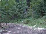 2
2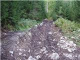 3
3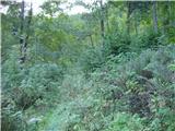 4
4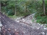 5
5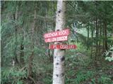 6
6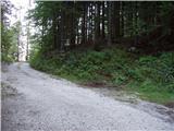 7
7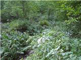 8
8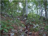 9
9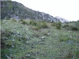 10
10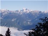 11
11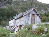 12
12 13
13 14
14 15
15 16
16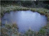 17
17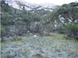 18
18 19
19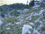 20
20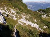 21
21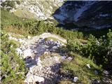 22
22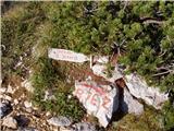 23
23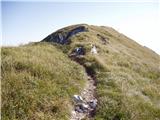 24
24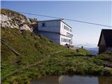 25
25 26
26
Discussion about the trail Pod Luknjo - Črna prst
|
| Tadej18. 09. 2008 |
Če želite nekoliko drugačen pristop na Črno prst se povzpnite po malo obiskani poti, ki vodi čez planino Osredki. V poletnem času zaradi visokih trav in zaraščenosti odsvetujem vzpon po zgoraj opisani poti.
|
|
|
|
| Bajtur22. 08. 2010 |
Včeraj šel po omenjeni poti. Malo popravkov: lovske opazovalnice na začetku poti ni več. Je pa tabla za Črno prst ob cesti zelo opazna in tudi trije kolovozi so nezgrešljivi. Kot vodič svetuje, pojdite po prvem in ne morete zgrešiti. Se strinjam s Tadejom, da so nekateri deli zaraščeni, se pa ne strinjam z njim, da ne bi priporočil izleta. Ko pridete na planino Osredki, je pot zelo lepa in predvsem tiha, ker nisem srečal niti ene duše. 
|
|
|
|
| velkavrh20. 04. 2014 |
Pred dvema letoma sem skušal po tej poti iti na Črno prst. Pustil sem torej vozilo nekako tam pri smerokazu za Črno prst. Kmalu pa sem v tistem labirintu kolovozov zašel.Imel pa sem sreči, da je zgleda nekdo šel pred mano, tako, da sem ga nekako lahko sledil.Kje sem se nazadnje znašel-na planini Poljana, natopa šel po stari opuščeni mulatjerina planino Suho in od tam na Rodico in naprej na Črno prst.
Sprašujem ali kdo ve ali je ta gozdna cesta do tistega znaka do Črne prsti prevozna?Po prognozi naj bi danes šel na Črni prsti sneg -je res šel?
|
|
|
|
| Atelium16. 08. 2017 |
Odsvetujem to pot v poletnem času, ker je v nekaterih delih zelo zaraščena, po drugi strani pa vas bodo pričakali super zdrsljive vlažne skale in kamenje.
|
|
|
|
| glorija17. 09. 2019 |
Zanimam me kako je sedaj z cestam in označbami za Črno prst te dni?
|
|
|
|
| Anja Karina18. 08. 2020 |
Lovska opazovalnica ponovno stoji, izgleda, da je na novo postavljena. Oznake so lepo vidne in Bajturov nasvet, da je najboljše iti po prvem kolovozu drži.
Sama sem šla po tej poti v poletnem času in nisem imela težav z orientacijo, markacije so bile lepo vidne. Vsekakor pa je tako kot drugje potrebna pazljivost in dobra obutev.
|
|
|
|
| JasnaMS18. 08. 2020 |
Anja Karina, hvala za nedavni nasvet, ravno sem hotela preveriti, kako je s potjo, ali jo je lahko najti in ji slediti.. saj planiramo v kratkem vzpon po tej poti.
Zanima me še, kako je z dostopnostjo do izhodišča Pod Luknja, je cesta v razmeroma ok stanju?
Hvala in lp
|
|
|
|
| danicaM29. 08. 2020 |
Cesta je v dobrem stanju, na nekaterih mestih je zaradi odvodnjavanja večji kanal, vendar ni problema. Malo nad lovsko prežo je velik odstavni pas kjer se lahko parkira. Tam te tudi table usmerijo proti Črni prsti. Lahko greš preko Orožnove koče in po botanični poti na vrh ali pa preko planine Osredki.Mi2 sva šla po botanični na vrh in preko planine Osredki nazaj.
|
|
|
|
| michael6610. 08. 2025 06:20:57 |
V kakem stanju je makedam -cesta do izhodišča.hvala.
|
|
|