Pod Hlipovcem - Koča na Travniku
Starting point: Pod Hlipovcem (1356 m)
| Lat/Lon: | 46,4186°N 14,8271°E |
| |
Time of walking: 55 min
Difficulty: easy marked way
Altitude difference: 192 m
Altitude difference po putu: 235 m
Map: Kamniške in Savinjske Alpe 1:50.000
Recommended equipment (summer):
Recommended equipment (winter): ice axe, crampons
Views: 18.681
 | 1 person likes this post |
Access to the starting point:
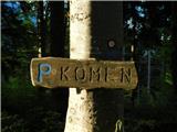
From the Ljubljana - Maribor motorway, take the Šentrupert exit and follow the road towards Logarska dolina. In the village Ljubno ob Savinji, the sign for Smrekovec points to the right. The road then takes you through the centre of the village, where you turn left again after the Smrekovec sign. The road then leads to Ljubenske Rastke, where you turn left at the crossroads near the church. The ascending road leads us higher to the hamlet of individual farms, and we follow it in the direction of the partisan hospital and Komno (on the Kamen signs). The road, which has since become macadam, leads us higher to a crossroads where a road closed to traffic branches off to the sharp right, leading to the Hlipovec saddle. Park in a suitable place near the crossroads.
Path description:
Just slightly above the crossroads, you will see mountain direction signs pointing to the left in the direction of the Travnik huts. The path goes immediately into the forest, where it starts to climb relatively steeply. Higher up, the steepness eases and the path from the Hlipovec saddle joins us from the right.
Continue to the left along a pleasant forest path, which continues to climb only slightly. A little further on, the path leads us to the next crossroads, where we continue to the left (right Veliki Travnik or Turnovka) along the path which crosses the slopes of Veliki Travnik. A further wide cross path, however, soon leads us out of the forest onto the vast mountain pasture Broad Lawn, where the next crossroads is.
Continue left down (right top Veliki Travnik) along a pleasant path, which leads us in 2 minutes of further walking to a hut on the Meadow.
Pictures:
 1
1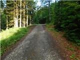 2
2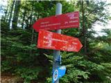 3
3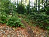 4
4 5
5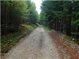 6
6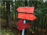 7
7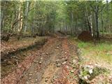 8
8 9
9 10
10 11
11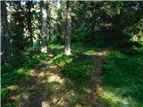 12
12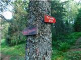 13
13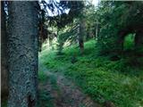 14
14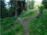 15
15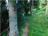 16
16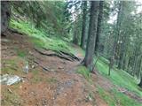 17
17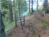 18
18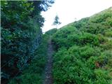 19
19 20
20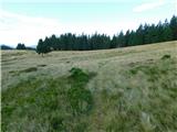 21
21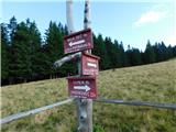 22
22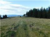 23
23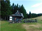 24
24
Discussion about the trail Pod Hlipovcem - Koča na Travniku
|
| Tajka6729. 07. 2023 16:21:17 |
Štartala sem direkt iz parkirišča Travnik- nobene markacije. Po dolgem času me je vodil google maps  . Prečila sem hrib in kakšnih 500m pred kočo stopila na ozko travniško stezo, ne vem s katere smeri je vodila. Oskrbnik me je za dol napotil na pravo pot, ki se nekje na polovici spremeni v vlako. Res kratka pot, pa so mi vseeno manjkale markacije.
|
|
|