Pocol de ra Crosc - Ra Bujela (Via ferrata Maria e Andrea Ferrari)
Starting point: Pocol de ra Crosc (1928 m)
| Lat/Lon: | 46,52914°N 12,08067°E |
| |
Name of path: Via ferrata Maria e Andrea Ferrari
Time of walking: 2 h
Difficulty: extremely difficult marked way
Ferata: C
Altitude difference: 329 m
Altitude difference po putu: 340 m
Map: Tabacco 03 1:25.000
Recommended equipment (summer): helmet, self belay set
Recommended equipment (winter): helmet, self belay set, ice axe, crampons
Views: 869
 | 2 people like this post |
Access to the starting point:
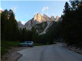
a) Access from Gorenjska: Via Border crossing Rateče or Predel to Trbiž / Tarvisio and then along the motorway towards Udine to the Tolmezzo exit. From Tolmezzo, follow the road towards Ampezzo and the Passo della Mauria mountain pass. The road then descends and leads to a crossroads where you turn left (possibly right) towards Cortina d'Ampezzo. At all subsequent junctions, follow the signs for Cortina d'Ampezzo. In Cortina d'Ampezzo, follow the signs for the Passo di Falzarego Alpine pass. Follow this ascending road to where a road forks off to the right towards the rifugio Dibona hut (the fork is at about 1700 m). Follow the narrow asphalted road to a crossroads where a road forks off to the right towards the Duca d'Aosta hut. Park near the junction where there are a few small car parks along the road.
b) From the coastal side: Take the motorway towards Venice/Venezia. At Portogruaro, leave the motorway towards Venice and turn right on the motorway towards Pordenone. At the next motorway junction near Conegliano, turn right towards Belluno. The motorway ends near Belluno and we continue towards Cortina d'Ampezzo at the next junctions. Continue as described above.
Path description:
Turn right onto the macadam road towards the Duca d'Aosta hut. From the crossroads, the road climbs through the forest and quickly leads to the ski slopes. Continue following the road as it continues along the ski slope. From the road, we can see beautiful views of the Sorapiss and Antelao mountain groups, and even better, the southern wall of the nearby Tofana di Rozes. Later, the road leads to a slightly wider ski slope, where the view opens up towards Cortina d'Ampezzo. Here the road turns left and the forest soon ends. There is one last climb up the increasingly scenic road to the Duca d'Aosta hut.
From the hut, continue left towards the Rifugio Pomedes hut and the Ferrata de Ra Bujela protected path. The dirt road leading to the Pomedes hut leads quickly to the bottom of the slopes of the Ra Bujela peak, where there is a crossroads.
Here a signpost directs you to a narrow path leading to the base of Ra Bujela. Before entering the climbing part of the route, equip yourself with a helmet and a self-protection kit; climbing gloves are also recommended.
At the beginning of the protected route, you climb steeply along a rope, with some scrambling aids (difficulty B/C). The route then turns right and leads to a vertical wall. The path is very exposed here, and there are a number of scrambles to help us climb (difficulty C). The difficulty then drops and we are at a bridge crossing a steep ravine. After crossing the bridge, the path leads from the eastern slopes to the south side of the mountain, where the climb is a shade less difficult (difficulty B). Further on, we continue to climb along the steel cable, and from the path we have a very nice view of the ski slope, where the Alpine Skiing World Cup races are also held. Soon you reach another bridge crossing a deep ravine. Then cross to the right, which leads to a ridge. Here, continue left and climb up a steep ridge. The ascent becomes more difficult again (difficulty up to C). Higher up, the route becomes less difficult and in the shorter part even the fixed safety gear are not necessary. The route follows and follows a slightly narrower ridge, descending a few times into small stubs. Just below the summit you reach a crossroads where you continue to the right and quickly reach the summit along a narrow exposed ridge.
From the summit, return to the above-mentioned crossroads and descend to the south-west side. From the crossroads, first cross the slope below the summit, followed by a slightly steeper descent with a few scrambles to help (difficulty B). Continue descending for a short distance along the steel cable to the west, then the protected route ends.
The path then soon leads to an unmarked crossroads. If you want to descend back to hut Rifugio Duca d'Aosta, continue right down at the crossroads. If you want to continue towards hut Rifugio Pomedes, turn left.

Pictures:
 1
1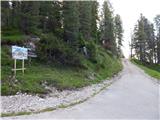 2
2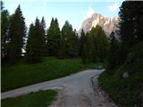 3
3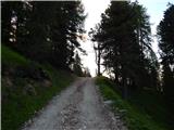 4
4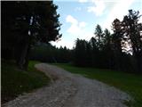 5
5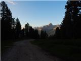 6
6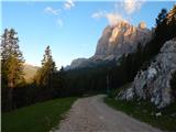 7
7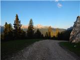 8
8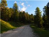 9
9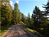 10
10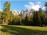 11
11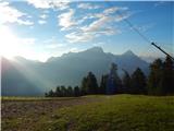 12
12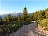 13
13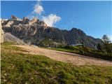 14
14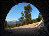 15
15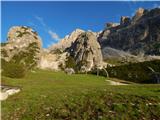 16
16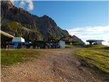 17
17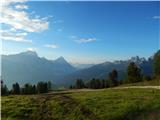 18
18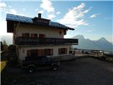 19
19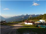 20
20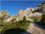 21
21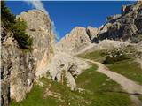 22
22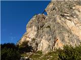 23
23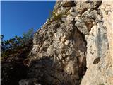 24
24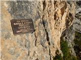 25
25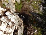 26
26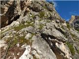 27
27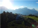 28
28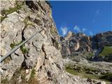 29
29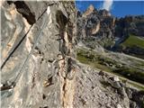 30
30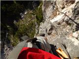 31
31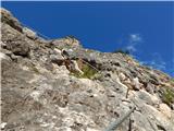 32
32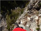 33
33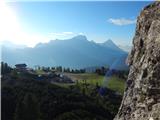 34
34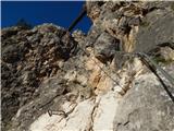 35
35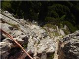 36
36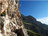 37
37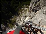 38
38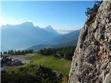 39
39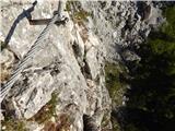 40
40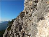 41
41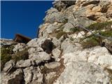 42
42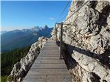 43
43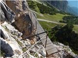 44
44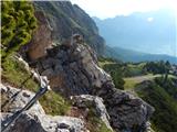 45
45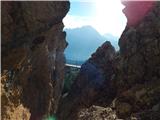 46
46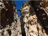 47
47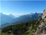 48
48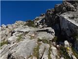 49
49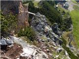 50
50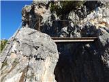 51
51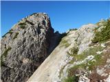 52
52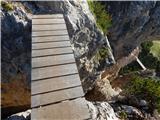 53
53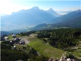 54
54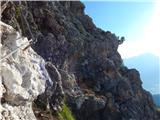 55
55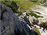 56
56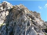 57
57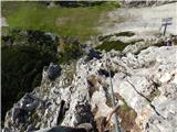 58
58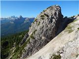 59
59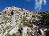 60
60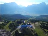 61
61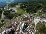 62
62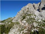 63
63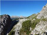 64
64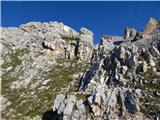 65
65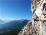 66
66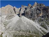 67
67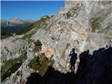 68
68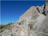 69
69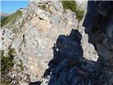 70
70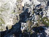 71
71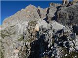 72
72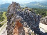 73
73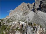 74
74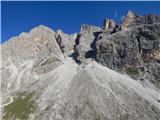 75
75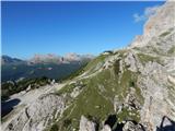 76
76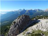 77
77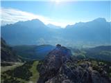 78
78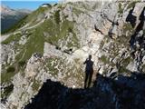 79
79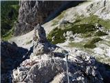 80
80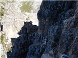 81
81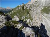 82
82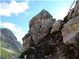 83
83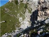 84
84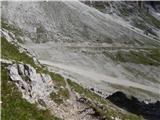 85
85
Discussion about the trail Pocol de ra Crosc - Ra Bujela (Via ferrata Maria e Andrea Ferrari)