Starting point: Počivalnik (575 m)
| Lat/Lon: | 46,3186°N 13,5747°E |
| |
Time of walking: 3 h
Difficulty: difficult unmarked way
Altitude difference: 982 m
Altitude difference po putu: 1025 m
Map: Julijske Alpe - zahodni del 1:50.000
Recommended equipment (summer): helmet
Recommended equipment (winter): helmet, ice axe, crampons
Views: 8.187
 | 1 person likes this post |
Access to the starting point:
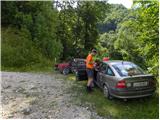
First drive to Bovec, then continue to Čezsoča. In Čezsoča, at the Vančar guesthouse, we continue left in the direction of Jablenca and the valley of the dwarfs and follow the narrow and asphalted road past the Slatenik swimming pool to a slightly larger crossroads, where we continue slightly to the right (straight towards Jablenca). The road, which loses its asphalted coating further on, begins to climb steeply, and we follow it at the crossroads towards the Javoršček peak. We follow this initially beautiful, then deteriorating forest road to a sharp left turn at which we park (we can also park earlier at one of the roadside car parks).
Path description:
Continue along the forest road eastwards and soon reach a crossroads where a marked track (Brda - B7a) branches off to the right. We continue walking along the road, which crosses a larger rock peak. The road then soon ends and we continue along the track, which quickly becomes very overgrown and almost impossible to follow. If you cannot follow the track, continue along the trackless path, crossing the slope to the east as you climb. When you reach the steeper slopes, the path becomes more visible again. The path then starts to cross quite steep slopes using the fixed safety gear. Later on, the path climbs along a steel ladder a few more times and crosses an exposed slope with the help of an iron ladder. Considerable caution is needed here as the slope to be crossed is steep and the path is poorly trodden. The fixed safety gear are not always in the best condition either.
Further on, the path becomes less difficult and is marked with slightly faded red dots and some cairns. Despite the markings, there are a few places where you have to be quite careful not to stray from the path. The trail, which runs through the forest the whole time, then leads us to an abandoned forestry hut, where we join the usual marked trail.
From the hut, we then mostly climb through the forest on the military mulatier. The trail also leads us past some clearings where we get a nice view of the surrounding peaks, and a little out of the way is a military cemetery. The path through the forest then leads us past mountain pasture Golobar and leads to the Čez Utro saddle. Here we have beautiful views of the surrounding peaks, and there is also a memorial to the fallen partisans on the saddle.
From the saddle, continue straight ahead and after a few dozen metres the path leads to a crossroads. Continue up the path to the right, and to the left the path leads to Čezsoča and Drežnica.
From the crossroads onwards, the path is no longer marked, but it is sufficiently well trodden that it can be followed without difficulty. Further on, the trail follows mostly the north side of the mountain and crosses some relatively steep slopes. In the last part, the path leads us out of the forest and there is only a short climb up to the summit.

Pictures:
 1
1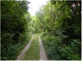 2
2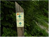 3
3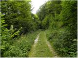 4
4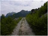 5
5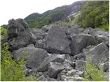 6
6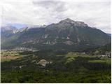 7
7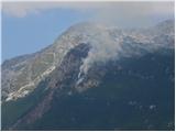 8
8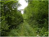 9
9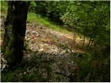 10
10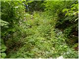 11
11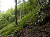 12
12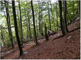 13
13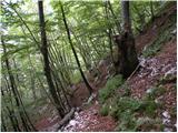 14
14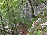 15
15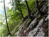 16
16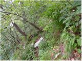 17
17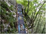 18
18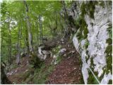 19
19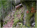 20
20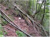 21
21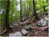 22
22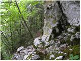 23
23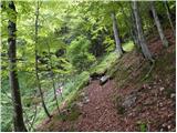 24
24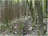 25
25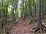 26
26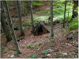 27
27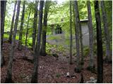 28
28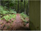 29
29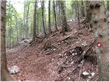 30
30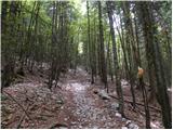 31
31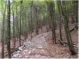 32
32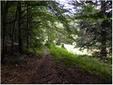 33
33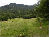 34
34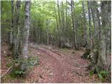 35
35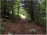 36
36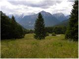 37
37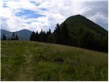 38
38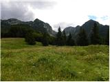 39
39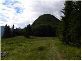 40
40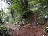 41
41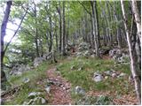 42
42 43
43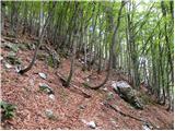 44
44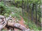 45
45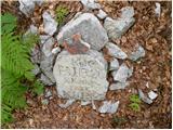 46
46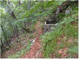 47
47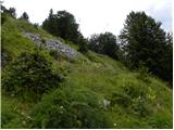 48
48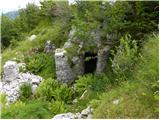 49
49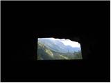 50
50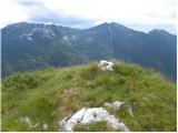 51
51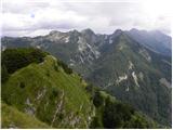 52
52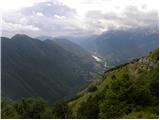 53
53
Discussion about the trail Počivalnik - Javoršček
|
| darinka43. 11. 2022 06:45:13 |
2.11. je končno prišel na vrsto vzpon na Javoršček. Kljub navigaciji smo iskali prehode po dolini Slatenik. Kajti pot je in jo ni več. Občudovali smo Slatenikva korita. So veličastna . Vode je bilo ravno prav, da smo vsaj nekje lahko šli ob potoku po skalah. Zadnji del poti od table naprej se je kar vlekel. To pa zato, ker je vojaška pot speljana vse okoli. Naleteli smo na ročno granato. Neeksplodirano. Sestopili pa mimo planine Golobar po mulatjeri, ki je lepo speljana v Čezsočo že v temi, kjer nas je ravno pri avtu ujel dež. Tura niti ni bila kratka. Za višino Javorščka , ki ni ravno visok.
|
|
|
|
| smatjaz3. 11. 2022 18:03:04 |
darinka4, sva tudi z Marjanom pred časom diskutirala o tej poti, midva sva delala ravno v obratni smeri tako da sva od Počivalnika krenila po lovski v tej smeri kot je opisana v postu zgoraj. Sestop pa do grabna Slatenika, vendar sva nadaljevala po stari označeni poti do podora. ki ga nisva mogla prečiti in se vrnila nazaj do sirarne, tu bi morala kreniti po strugi navzdol pa sva falila in nadaljevala po poti miru pod Vršičem do pl. Predolina kjer sva skrenila desno po gozdni vlaki. Ko je bilo te konec pa prečno nazaj v proti grabnu. Tisti je bila pa čista jeba, pa še noč naju je ujela. Bolj po sreči sva ujela pri grabnu staro mulatjero in lovsko pot, ter prečila podor spodaj in srečno sestopila pri bazenih, potem pa še po avto gor na počivalnik. Vsaka šola nekaj stane...... 
|
|
|
|
| darinka44. 11. 2022 15:07:25 |
smatjaz ja vem, smo te imeli v mislih , ko smo iskali prehode. Pot je res ponekod slabo prehodna. Nekje smo se čez podrta drevesa spravljali. Nekajkrat zgrešili, a z navigacijo zopet šli na pravo pot. Sem dobila navodila dan prej, naj oblečem kaj bolj starega , ker ne bo ravno lepa pot. In res je bilo tako.
|
|
|