Starting point: Počivalnik (575 m)
| Lat/Lon: | 46,3186°N 13,5747°E |
| |
Time of walking: 1 h 45 min
Difficulty: difficult unmarked way
Altitude difference: 235 m
Altitude difference po putu: 400 m
Map: Julijske Alpe - zahodni del 1:50.000
Recommended equipment (summer): helmet, lamp
Recommended equipment (winter): helmet, ice axe, crampons, lamp
Views: 5.506
 | 1 person likes this post |
Access to the starting point:
First drive to Bovec, then continue to Čezsoča. In Čezsoča, at the Vančar guesthouse, we continue left in the direction of Jablenca and the valley of the dwarfs and follow the narrow and asphalted road past the Slatenik swimming pool to a slightly larger crossroads, where we continue slightly to the right (straight towards Jablenca). The road, which loses its asphalted coating further on, begins to climb steeply, and we follow it at the crossroads towards the Javoršček peak. We follow this initially beautiful, then deteriorating forest road to a sharp left turn at which we park (we can also park earlier at one of the roadside car parks).
Path description:
In the middle of the bend, at the route sign for Javoršček, you will see the old and quite overgrown cart track, which branches off the road to the right. Take the cart track mentioned above, which ends after about 50 m. Just a few metres before it ends, you will see a path on the left, which is at first less visible, and after a climb of 10 steps leads to a small crossroads.
Continue to the right on a well-traced path which crosses relatively steep slopes. The path continues gently downhill and leads to the bed of the Hunški potok (Humski potok on maps). Next, cross the aforementioned stream, and the path leads from the slopes of Javorščko to the very steep slopes of Humčič. After a few metres of crossing, the path climbs steeply on an exposed ledge and then passes to the protected part of the path. With the help of a rope, cross the narrow and exposed ledge, which ends at the entrance to the cavern. The protected path continues into the cavern, where it continues to climb gently. After some 10 m, you leave the cavern onto the sometimes still quite steep slopes of Humčič. After a few minutes of traversing the relatively steep slopes, you reach a small hut, after which the path begins to climb steeply. A little higher, you reach a marked crossroads, where you continue to the right along the ascending path. Continue up the path, which leads past a number of caverns. The path climbs higher and turns slightly to the left. Continue the ascent along the path, which continues along and along the main ridge of Humčič. Higher up, the path climbs steeply for a short time and then leads us to the summit within a few minutes of further walking.
Due to the overgrowth and the numerous unmarked crossroads, orientation along the entire route is relatively difficult.

Pictures:
 1
1 2
2 3
3 4
4 5
5 6
6 7
7 8
8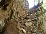 9
9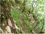 10
10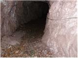 11
11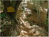 12
12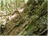 13
13 14
14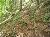 15
15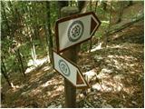 16
16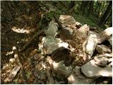 17
17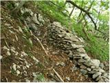 18
18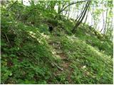 19
19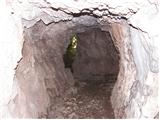 20
20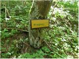 21
21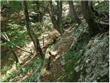 22
22 23
23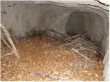 24
24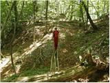 25
25 26
26 27
27 28
28 29
29
Discussion about the trail Počivalnik - Humčič