Starting point: Platak (1111 m)
| Lat/Lon: | 45,4251°N 14,5653°E |
| |
Time of walking: 2 h 45 min
Difficulty: easy marked way
Altitude difference: 297 m
Altitude difference po putu: 420 m
Map:
Recommended equipment (summer):
Recommended equipment (winter):
Views: 5.337
 | 2 people like this post |
Access to the starting point:
From the Zagreb - Rijeka motorway, take the Kikovica exit, which leads to the old Zagreb - Rijeka road. Follow the old road in the direction of Zagreb, but only as far as where the ascending road to the ski resort of Platak turns off to the left. Follow this road to a large parking lot, where you park.
Path description:
At the beginning of the parking lot, the road branches off to the right (in the route of the climb), which leads us after a 100m walk to the mountain home Sušak on Platku. At the home we see the mountain signs for Risnjak, which direct us to the left on the worse road. Soon the road leads to the place where it ends. Continue to the right along the marked cart track, which climbs gently through the forest and after 15 minutes of further walking leads us to the next road, where we continue to the left. This road also soon ends and the climb continues in the route of Risnjak. The wide path continues and leads us higher to the next road, where we continue to the right and then immediately to the left on the wide path towards Risnjak. It is an hour's walk along cart track, which ascends and descends several times. After an hour and a half walk from Platko, you reach the first major fork in the trail, where you continue straight up again in the route of Risnjak. The path ahead starts to climb steeply up the forested slopes of the Risnjak Nature Park. After a half-hour climb, the path descends gently and soon leads to a crossroads, where you continue to the right in the route of Vidikovec. The path continues to climb moderately through the forest to the top slope of the mountain. After a few further steps, you reach a lookout point where there is also a stamp. The true summit is still two minutes away but is not visible due to the vegetation.

Pictures:
 1
1 2
2 3
3 4
4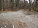 5
5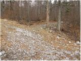 6
6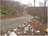 7
7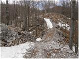 8
8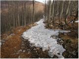 9
9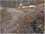 10
10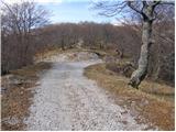 11
11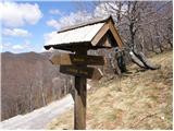 12
12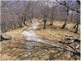 13
13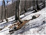 14
14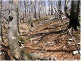 15
15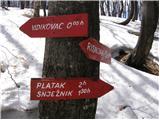 16
16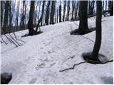 17
17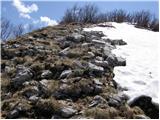 18
18 19
19
Discussion about the trail Platak - Vidikovac
|
| rokeg9. 07. 2023 21:54:48 |
Včeraj sem bil v teh koncih. Tabel na sliki 16 ni, sama pot do vrha je skoraj nesledljiva, o žigu ni ne duha ne sluha, tudi napisa ni bilo nikjer. Bil sem tudi na samem vrhu, res je precej poraščen.
Koča na Risnjaku je zaprta in propada, zelo žalostno za videt. Res, ne vem zakaj? Večina tabel je na tleh in polomljenih. Sicer je pot relativno dobro markirana. Sestopil sem preko Lazaca in čez Mirnjak na Snježnik. Tudi tam koča žalostno propada. Na Platku živahno.
|
|
|