Planina Zapleč - Krasji vrh (via snežna jama)
Starting point: Planina Zapleč (1201 m)
| Lat/Lon: | 46,2833°N 13,6308°E |
| |
Name of path: via snežna jama
Time of walking: 2 h
Difficulty: easy marked way
Altitude difference: 572 m
Altitude difference po putu: 572 m
Map: Julijske Alpe - zahodni del 1:50.000
Recommended equipment (summer):
Recommended equipment (winter): ice axe, crampons
Views: 21.320
 | 2 people like this post |
Access to the starting point:
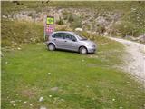
From Tolmin or Bovec, take the road to Kobarid, and from there follow the road towards Drežnica (the road branches off from the Kobarid bypass). Continue over the bridge over the Soča River and immediately after the bridge turn left in the direction of Drežnice. In Drežnica we reach a crossroads where the road to the village Magozd turns left, and we continue a little further to the next crossroads, where we turn left in the direction of Drežniške Raven. The road then leads to a crossroads in Drežniške Ravne, where you turn right up towards Krasje vrh. At the next junction turn right again and follow the road to the water trough where the asphalt ends. Follow the dirt road for a few kilometres to a roadside parking area in front of a TNP sign and a grazing fence.
Path description:
From the parking lot in front of the TNP sign, continue on the macadam road, which soon leads us under the slopes of ridge Krnčica to the crossroads at mountain pasture Zaprikraj. Here, continue left along the lower road, which leads us in a few steps to the hamlet at mountain pasture.
From the buildings at mountain pasture, follow the path which ascends gently towards Krasje Peak. The path then crosses a grazing fence at the end of mountain pasture and leads through the forest to a clearing where a hunting lodge stands. The way forward continues along cart track, which goes into the forest again and soon leads us to a crossroads. Leave cart track and head slightly downhill to the left. Walk almost horizontally for a few minutes and then join the footpath from Drežniška Ravenna. The path then climbs moderately up the woded slopes. The path then crosses a clearing where tall grass grows and then climbs again to a crossroads at 1450m.
Continue right towards the snow cave. The way forward initially climbs steeply through the forest and takes us slightly higher over less vegetated slopes, where it leads us to a crossroads. Continue straight ahead, five minutes down the snow cave on the left. The path then climbs slightly steeper and leads to the World War II ruins. To the left, in a hollow below us, we see a large metal cage containing unexploded bombs. The path then passes to a ridge where we get a beautiful view of the Bovec basin and the surrounding peaks. There is a short ten-minute walk along an undemanding summit ridge.

Pictures:
 1
1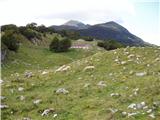 2
2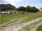 3
3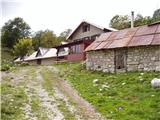 4
4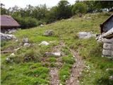 5
5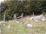 6
6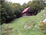 7
7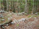 8
8 9
9 10
10 11
11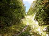 12
12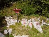 13
13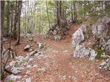 14
14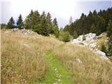 15
15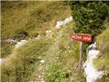 16
16 17
17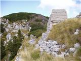 18
18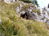 19
19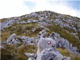 20
20 21
21
Discussion about the trail Planina Zapleč - Krasji vrh (via snežna jama)
|
| akvarij21. 09. 2009 |
Cesta do planine Zapleč je na začetku precej slaba (razrita), nato se popravi.
|
|
|
|
| Matjaz_6514. 08. 2010 |
na planino zapleč je možno tudi po poti od korita z vodo kjer nas tabla usmeri desno v gozd ... številka 5 mojih fotkah  s tem vzpon podaljšamo za uro ... a se izognemo slabi cesti  mimogrede si lahko ogledamo še slap curk ... ki je 15 minut s poti
|
|
|