Planina Polog - Mahavšček (via Prehodci)
Starting point: Planina Polog (457 m)
| Lat/Lon: | 46,238°N 13,7232°E |
| |
Name of path: via Prehodci
Time of walking: 6 h 15 min
Difficulty: partly demanding marked way
Altitude difference: 1551 m
Altitude difference po putu: 1635 m
Map: Julijske Alpe - zahodni del 1:50.000
Recommended equipment (summer): helmet
Recommended equipment (winter): helmet, ice axe, crampons
Views: 5.573
 | 1 person likes this post |
Access to the starting point:
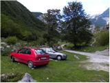
First, go to Tolmin, and from there follow the road in the direction of Zatolmin (leave the main road at the traffic lights). In Zatolmin, you will see the mountain signs for Javorca, which will direct you to the ascending road towards Javorca. After about 8 km of driving, the sometimes quite narrow and sometimes precipitous road leads us to a small crossroads where the road to Javorca branches off to the left upwards. We continue straight ahead, following the road for only about 100 m, where we then park at a suitable place next to the ramp.
Path description:
From the starting point, continue along the dirt road (the road is closed to public traffic), which after a few minutes of easy walking leads to the central part of mountain pasture, where there are a few huts. After mountain pasture, the road gets a little worse, but after a few minutes of further walking, it leads to a crossroads where the path to mountain pasture to Prodih branches off to the right (the access to mountain pasture is very interesting, as you have to cross the river Tolmin, which is facilitated by a hand-carried cable car). Continue straight ahead, and the road eventually turns into cart track and higher up into a well-preserved mulatier. The path then becomes a little steeper and leads past two benches and a fresh rock peak higher up (earthquake in Posočje 1998) to a pasture fence, over which you enter the southern edge of mountain pasture below Osojnica. Just a few metres further on, the path splits into two parts. Continue along the lower right path, which descends gently to the hunting hut at the spring Tolmin.
From the source of the Tolminka River, we continue our ascent through the mountain pasture below Osojnica, and the upper path, which is exposed to an active rocky peak, soon joins us from the left.
Continue in the direction of "Planina Prode in Prehodci" along the path which leads to a mighty torrent. Cross the torrent and on the other side continue to the left in the direction of Prehodci (slightly to the right, the Dobrenjščica mountain). Continue climbing along the well-preserved military causeway, which you can leave a few times, as the marked path runs along "shortcuts". The taller bushes and grass are slowly replaced by rubble, and the path turns more and more to the left. A little higher, we reach the mighty torrential ravine again, but here it already meets the nearby scree, which falls from the nearby Maly and Veliki Kuntar.
Here, an unmarked path branches off to the left across a mighty torrent, leading to mountain pasture Lašča and on to Rdeči rob and Male peske, while we continue to the right along a marked path that gradually turns into a dense forest. The mulatiera then climbs in numerous serpentines and continues through the forest for some time. As the forest thins out, the path turns increasingly to the right, where it leads to steep slopes and views. Over the artificial and wide shelf, we are helped by a rope, which comes in handy at a time when there is still snow on the shelf (in the land, the crossing is quite easy). The path continues to climb moderately once more and leads us in a few minutes to a marked crossroads at Prehodci. At the crossroads, continue to the right after the markings "Dom na Komni" and "Hut at mountain pasture Razor". The trail then turns slightly to the right and mostly follows dwarf pines. The relatively gentle path, from which we have beautiful views towards Bogatin and Mahavščko, then leads us to a well-marked crossroads. Here we continue to the left, following the signs Dom na Komni, and to the right the path leads to the Cottage on mountain pasture Razor. The path then descends gently and leads to the Za Lepočami valley, where you will see a number of buildings built by the Italians between the two wars to serve the needs of the belaying Rapallo border.
From the crossroads, the path climbs a little steeper at first, then becomes flatter and leads along the increasingly rare dwarf pines. Soon we have a view towards Lanževica followed by a climb along a wide military causeway to Bogatinsko sedlo (Vratca).
At the saddle, continue right (straight down Komna, left Lanževica) along the path, which leads us in a few minutes to the initially indistinct ridge Bogatin. The way forward begins to climb steeply on the very steep and crumbly north-west ridge Bogatin (danger of slipping and falling rocks). Higher up, the ridge narrows a little more, and the path is laid and leads us in a few 10 steps to the top of (Little) Bogatin.
From Bogatin continue along the ridge path, which begins to descend steeply towards the saddle between Bogatin and Mahavščko (due to the considerable steepness, there is a risk of slipping). From the saddle (which can also be reached by a marked path that bypasses the summit of Bogatin on the south-west side, the latter is much easier) continue along the ridge path, which begins to climb again. Higher up, the ridge path retreats to the Bohinj side, where it climbs crosswise over small scree fields. Next, the path returns to the main ridge and, after a few minutes of further walking, leads us to the top of Mahavščka.

Pictures:
 1
1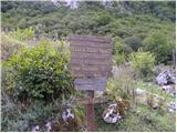 2
2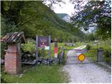 3
3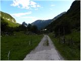 4
4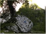 5
5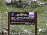 6
6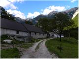 7
7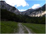 8
8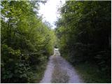 9
9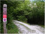 10
10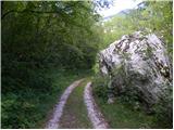 11
11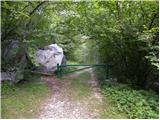 12
12 13
13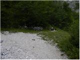 14
14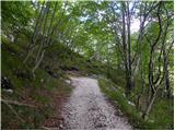 15
15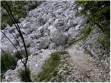 16
16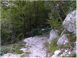 17
17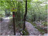 18
18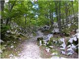 19
19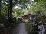 20
20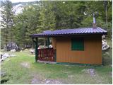 21
21 22
22 23
23 24
24 25
25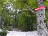 26
26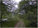 27
27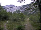 28
28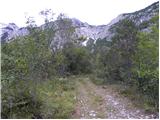 29
29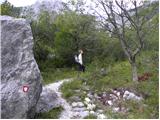 30
30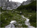 31
31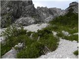 32
32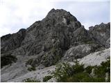 33
33 34
34 35
35 36
36 37
37 38
38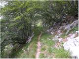 39
39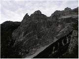 40
40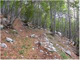 41
41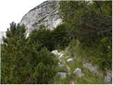 42
42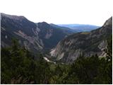 43
43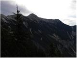 44
44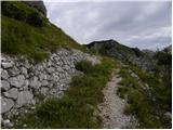 45
45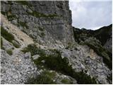 46
46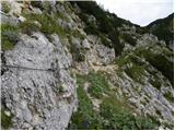 47
47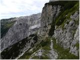 48
48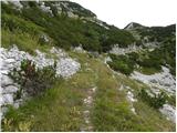 49
49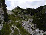 50
50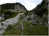 51
51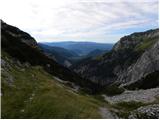 52
52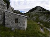 53
53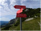 54
54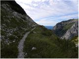 55
55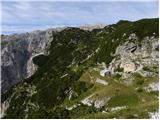 56
56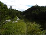 57
57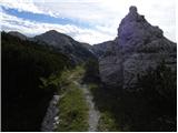 58
58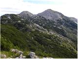 59
59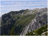 60
60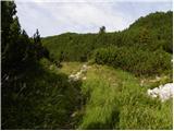 61
61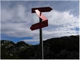 62
62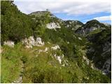 63
63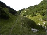 64
64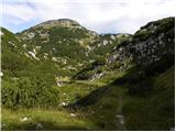 65
65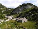 66
66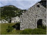 67
67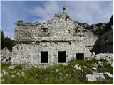 68
68 69
69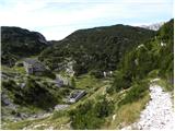 70
70 71
71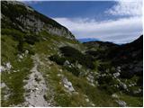 72
72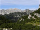 73
73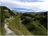 74
74 75
75 76
76 77
77 78
78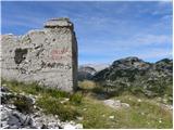 79
79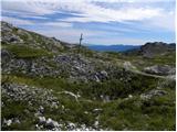 80
80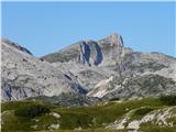 81
81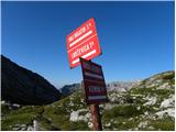 82
82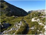 83
83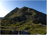 84
84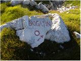 85
85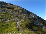 86
86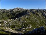 87
87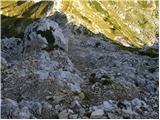 88
88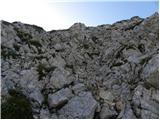 89
89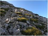 90
90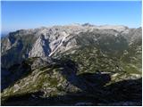 91
91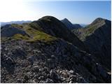 92
92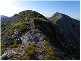 93
93 94
94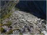 95
95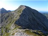 96
96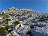 97
97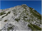 98
98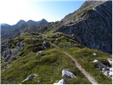 99
99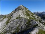 100
100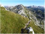 101
101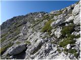 102
102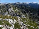 103
103 104
104
Discussion about the trail Planina Polog - Mahavšček (via Prehodci)