Planina Podvežak - Kocbekov dom na Korošici (via Vodotočno jezero)
Starting point: Planina Podvežak (1500 m)
| Lat/Lon: | 46,3319°N 14,6726°E |
| |
Name of path: via Vodotočno jezero
Time of walking: 2 h 55 min
Difficulty: easy marked way
Altitude difference: 308 m
Altitude difference po putu: 525 m
Map: Kamniške in Savinjske Alpe 1:50.000
Recommended equipment (summer):
Recommended equipment (winter): ice axe, crampons
Views: 16.855
 | 3 people like this post |
Access to the starting point:
First drive to Luče, then continue into the Podvolovjek valley (direction Kamnik and Kranjski Rak). At the road marker between 11 and 11. 5 km, you will come to a small crossroads where the road to the right branches off towards Farmer Planinšek and the mountains Podveža, Ravne and Vodole (the branch is marked). Take this initially still asphalted road and follow it at the crossroads in the route mountain pasture Podveža. After a relatively long and in the upper part also worse macadam road you will reach the parking lot under mountain pasture Podveža (at the starting point there is a ramp and a number of mountain signs).
From Kamnik, drive towards the Črnivec Pass, but only as far as the crossroads, where the road to Kranjski Rak turns sharp left (the turn-off is marked and is located only 500 m before the pass). At the crossroads at Kranjski Rak, continue straight ahead on the main road, which starts descending into the Podvolovjek valley. In the valley, just 100 m after the Gams bar, you will reach a crossroads where the road to the left branches off towards the farmer Planinšek and the Podveža, Ravne and Vodole mountains (the branch is marked). Follow the description above.
Path description:
From the parking lot, take the footpath (or road) in the route mountain pasture Podveža. Both the road and the footpath, which crosses a forest road during the ascent, lead us in 15 minutes of moderate ascent to the shepherd's hut at mountain pasture Podveža, from which we have a beautiful view towards Rogatec and Lepenatka.
From mountain pasture continue along the marked, but at first less visible path, which soon goes into the forest. The path through the forest climbs a little steeper and then enters a small uncultivated valley, above which it completely flattens out. It is followed by a few minutes of crossing the slopes below the side ridge of the Deska, and then the path leads to a less visible crossroads, where a slightly narrower and newly marked path branches off to the left, leading towards the Deska and the Watercourse Lake.
Continue along the above-mentioned path, which begins to climb crosswise towards the saddle between Deska and Tolstim vrh. From the point where we left the broad path, we first climb through the dwarf pines zone and then across increasingly scenic grassy slopes. There is a slightly steeper traverse over a small scree slope and the path leads to the aforementioned saddle.
Here we continue straight on (left Deska 5 minutes, right Tolsti vrh 10 minutes) along the path which leads us lower down into a small valley, along and along which we then descend to Vodotočna jezero.
From the lake, walk to the nearby shepherd's hut, then climb the steep slope above the hut, where you will quickly reach the marked path leading out of the Lučka Bela valley. Follow the path down to a marked crossroads, then continue to the right in the direction of Korošice. The path continues on a moderate slope over the slopes, which are overloked and partly covered with dwarf pines. Next, the path from the Presedljaj saddle joins us from the left, and we continue straight along the undulating path, along which we soon see the signs for Lučki Dedec (the turnoff is just a few minutes before the Prag Pass).
From Prag we continue straight ahead and follow the wide path which begins to descend crosswise towards the green Korošice plain. After 10 minutes of descending, the path flattens out and you are only a few steps of easy walking away from Kocbek's home.

Pictures:
 1
1 2
2 3
3 4
4 5
5 6
6 7
7 8
8 9
9 10
10 11
11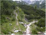 12
12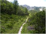 13
13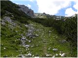 14
14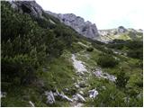 15
15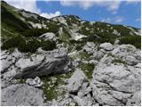 16
16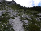 17
17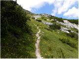 18
18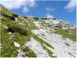 19
19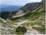 20
20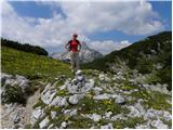 21
21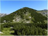 22
22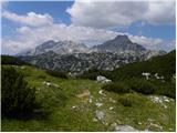 23
23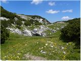 24
24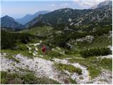 25
25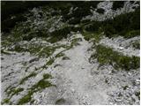 26
26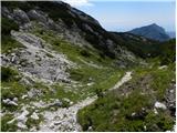 27
27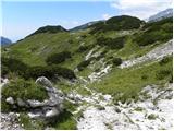 28
28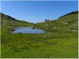 29
29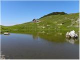 30
30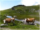 31
31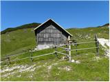 32
32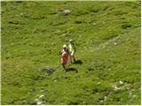 33
33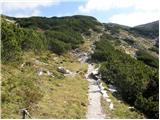 34
34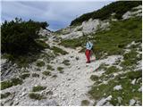 35
35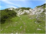 36
36 37
37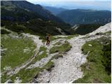 38
38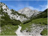 39
39 40
40 41
41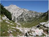 42
42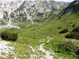 43
43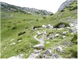 44
44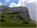 45
45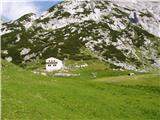 46
46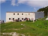 47
47
Discussion about the trail Planina Podvežak - Kocbekov dom na Korošici (via Vodotočno jezero)
|
| Paintball9. 02. 2011 |
z eno samo besedo: krasno
|
|
|
|
| Bajtur15. 09. 2011 |
Včeraj sem šel iz Podvežaka na Ojstrico in sem hotel naredtiti krožno, tako da bi šel po tej poti nazaj. Žal od jezera nisem našel poti, oziroma nisem vedel kje gre pot na sedlo med Tostim in Deskami. Fajn bi bilo postaviti vsaj eno tablo pri jezeru in drugo nad njim, da te pravilno usmeri proti sedlu. Drugače je pa res lepa tura. 
|
|
|
|
| jprim15. 09. 2011 |
Ja, prvič je res malo težje, ko pa greš drugič, tretjič ... pa ni težav. Pa saj je pot shojena, samo merkat treba. LP!
|
|
|
|
| otiv15. 09. 2011 |
@Bajtur Upam,da se nisi vrnil nazaj na Korošico Ko boš naslednjič hodil, se ne spusti do jezera temveč greš po levi strani brežine in nimaš kaj zgrešiti,pot je resnično uhojena,kakor je že napisala @jprim Lep pozdrav!
|
|
|
|
| bostjan8515. 09. 2011 |
tudi jaz sem imel iste probleme,sicer sem šel kot praviš po levi strani brežine,zatem pa se pot res skoraj porazgubi,vsaj jaz je nisem našel,do planine Podvežak sem potem prišel na poti,ki je večinoma potekala skozi gozd,Na drevesih so bili križi,prvič sem videl kaj takega.
|
|
|
|
| tisa16. 09. 2011 |
@bostjan85 Morda si se vračal preko Lastovca,tam je več gozda,za križe pa tudi jaz nisem vedel,pa se velikokrat tam potepam.Le še vrni se v ta prelepi del Kamniških planin,tu je vse lepše kakor v dolin.
|
|
|
|
| tomo_kugy4. 08. 2012 |
Prehodil danes z ženo in 8,5-letno hčerko. Pot je lepa in dokaj enostavna, le malo sitna od sedla - dol-gor-dol-gor-dol. Na križišču, ki pelje proti jezeru, je sedaj nova tabla, tako da odcepa ne moreš zgrešiti. Je pa res, da potem naprej ni več nobenih markacij in nam je uspelo malo zaiti s poti, tako da smo en kos prehodili kar po brezpotju direktno proti sedlu med Desko in Tolstim vrhom. Pri jezeru bi bilo res dobro, da bi stal en kažipot, ki te usmeri proti Korošici. Jezero je v tem trenutku bolj luža kot jezero  Je pa absoluten plus, da smo na tej poti srečali točno tri planince - na Korošici je bila običajna gneča za tako vreme. Kakor koli, dobro smo se nahodili in se imeli nasploh fino.
|
|
|
|
| zvezdica_zaspanka27. 10. 2019 |
Se pridružujem mnenju, da je pot kar slabo označena - ne v smislu, da je ne bi videl, temveč da je več poti in kar nekaj neoznačenih odcepov, ko ne veš, kam zaviti in ali greš proti pravemu cilju (pomanjkanje tabel). Jaz sem bila namenjena danes po drugi, krajši poti, pa sem pravkar iz opisa ugotovila, da sem šla po tej - pa še na tej poti sem uspela zgrešiti en odcep (dve poti od katerih nobena označena kam vodi).
|
|
|