Starting point: Planina Lom (1090 m)
| Lat/Lon: | 46,1988°N 13,7828°E |
| |
Time of walking: 1 h 30 min
Difficulty: easy unmarked way
Altitude difference: 362 m
Altitude difference po putu: 420 m
Map: Julijske Alpe - zahodni del 1:50.000
Recommended equipment (summer):
Recommended equipment (winter): ice axe, crampons
Views: 4.813
 | 1 person likes this post |
Access to the starting point:
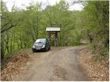
Between Most na Soči and Tolmin we see the signs for the village Poljubinj, which direct us to a side road that will soon take us to the village. Continue driving on the ascending road, which takes us slightly higher to the village Ljubinj, where we continue to the left in the direction of the huts at mountain pasture Razor and mountain pasture Stador. Continue up the narrow, steep and asphalted road, which after a while leads to a place where the road branches off sharply to the right towards the hut at mountain pasture Stador and the Kobala airstrip. Continue straight ahead and follow the road for a good km until you see a TNP sign on the side of the road, in front of which you park in a small parking lot.
Path description:
From the TNP signpost, continue along the road, which quickly leads to mountain pasture Lom, on which a large number of huts stand. At the beginning of mountain pasture, just after the NOB monument, the road turns right, and we follow it for a few steps, then on the right we see a wide unmarked path climbing past the huts up to the vast and relatively steep grassy slope of mountain pasture Lom.
Several smaller paths lead across this grassy slope, which merge higher up and then lead higher up to the upper edge of mountain pasture. Further on, only one path crosses a short lane of wodland, and after this leads to a broad ridge along and over which you then climb. The path, which is becoming more and more scenic and in some parts a little less visible, soon leads us to the unmarked Vrh Klonic (1343 m), from which a magnificent view opens up.
Continue along the pleasant path, which continues along a very scenic ridge. The way ahead is slightly sloping and leads us past a small watering place for animals to a crossroads where we are joined on the right by a marked path with the mountain pasture Stador. Continue straight ahead and in less than 5 minutes of further walking you will reach the top of Kobilje glave.
From the summit, continue on the unmarked path which starts descending towards the saddle between Kobilja glava and Jalovnik (direction southeast). From the saddle, continue the ascent on the path which starts climbing moderately on the ridge Jalovnik. Follow this pleasant and easy trail to the top of Jalovnik, which is reached after a few minutes of further walking.

Pictures:
 1
1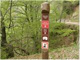 2
2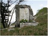 3
3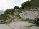 4
4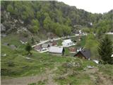 5
5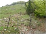 6
6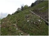 7
7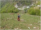 8
8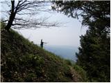 9
9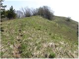 10
10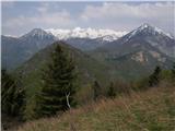 11
11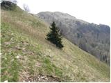 12
12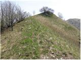 13
13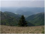 14
14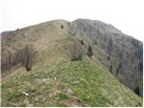 15
15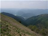 16
16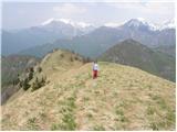 17
17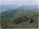 18
18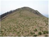 19
19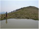 20
20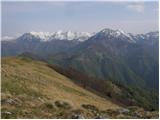 21
21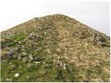 22
22 23
23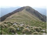 24
24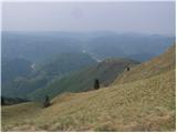 25
25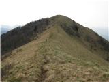 26
26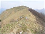 27
27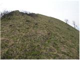 28
28 29
29
Discussion about the trail Planina Lom - Jalovnik