Planina Loka - Kup (on Raduha)
Starting point: Planina Loka (1435 m)
| Lat/Lon: | 46,4034°N 14,7573°E |
| |
Time of walking: 1 h 20 min
Difficulty: easy unmarked way
Altitude difference: 373 m
Altitude difference po putu: 390 m
Map: Kamniške in Savinjske Alpe 1:50.000
Recommended equipment (summer):
Recommended equipment (winter): ice axe, crampons
Views: 10.512
 | 2 people like this post |
Access to the starting point:
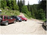
From Mozirje drive towards the Logar valley, but only as far as the village of Strmec (the village between Ljubno and Luce), where the signs for Snežna jama to Raduha direct you right onto a narrower ascending road. Follow the road, which has a few crossroads, in the direction of Snežna jama and the hut at Loka (the crossroads are well marked). After 16 km (9 km of which are macadam) of driving from the town, when we have left the main road, we reach the starting point, where we park near a small crossroads (at the crossroads there are mountain signs for the hut at Loka).
Path description:
At the parking lot we see the mountain direction signs for the hut at Loka and Raduha, which direct us to the worse forest road, which climbs through the lane of the forest. After only a few 10 steps, we emerge from the forest at the lower part of mountain pasture Loka. The ascent continues along a relatively steep road, which takes a few minutes to reach the hut on Loka.
From the hut continue slightly right along the marked path towards the saddle Durce (slightly left Raduha, right Smrekovec and Travnik). Continue on the right side of the ravine (on the left side of the ravine there is a path to Raduha) on a path that gradually starts to climb steeper. After about 10 minutes' walk from the hut, the path leads to a less visible crossroads, where we continue sharp right along a less visible path (straight Durce). After a few steps of further walking, we will notice on the tree the mountain direction signs marked Lanež and Durce via Lanež, which direct us left up the steep but marked trackless path (in the fog, orientation is extremely difficult). After a few minutes of climbing over the steep grassy slope, the "path" leads us to the pasture fence, where we continue to the left. Only a few steps further on, the marked path crosses the fence and then turns slightly to the left (here the path is already more visible).
The ascent continues along the scenic route, which leads past the animal watering point to a small valley between Lanež and Jelovec. The moderately steep path, which continues along a pleasant valley, soon leads us to an undistinguished saddle between the two peaks mentioned above.
Here, turn right and continue along the grassy slope to a small saddle on the south side of Jelovec. From here continue left and cross the slopes on the right (east) side of the ridge. The narrow path continues through dwarf pines and in a few places also slightly descends. Soon you will see the top of a cross in front of you. The path continues through dwarf pines and soon leads us to a scenic peak.
Starting point - Koča na Loki 0:15, Koča na Loki - Jelovec 1:05.

Pictures:
 1
1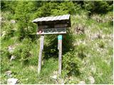 2
2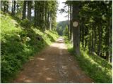 3
3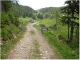 4
4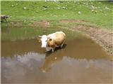 5
5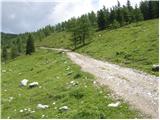 6
6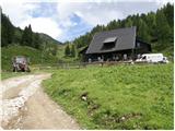 7
7 8
8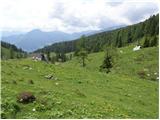 9
9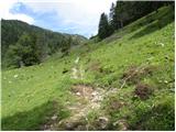 10
10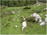 11
11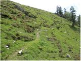 12
12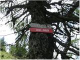 13
13 14
14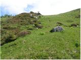 15
15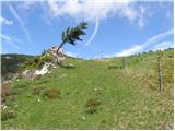 16
16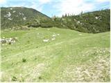 17
17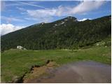 18
18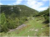 19
19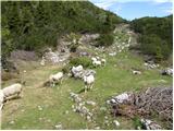 20
20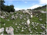 21
21 22
22 23
23 24
24 25
25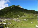 26
26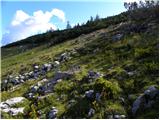 27
27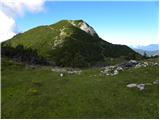 28
28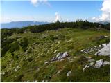 29
29 30
30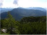 31
31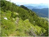 32
32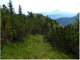 33
33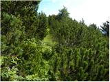 34
34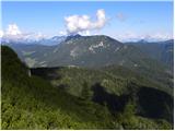 35
35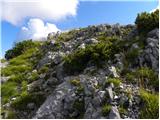 36
36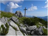 37
37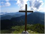 38
38 39
39
Discussion about the trail Planina Loka - Kup (on Raduha)
|
| seinfeld28. 06. 2019 |
Danes z ženo, s planine Vodol na Jelovec. Parkirala sva na ovinku tik ob cesti in kot je predlagal geppo, hodila do konca cesta mimo planine in nato po strmih travah in gozdu do grebena. Po grebenu ni kaj več za zgrešiti, kmalu se tudi razloči steza, ki pripelje do vrha. Pot lepa, enostavna, sicer strma, čudoviti razgledi. Nazaj sva šla proti Lanežu, navzdol proti koči na Loki, od tam čez planino Javorje proti izhodišču. Vse skupaj slabih 8km, v 3h in 20min.
|
|
|
|
| kkac29. 10. 2019 |
Krajevna tabla ni več Struge, ampak Strmec.
|
|
|