Planina Kosmačeve Rastke - Lanež (east path)
Starting point: Planina Kosmačeve Rastke (1042 m)
| Lat/Lon: | 46,4121°N 14,7821°E |
| |
Name of path: east path
Time of walking: 2 h 25 min
Difficulty: easy marked way
Altitude difference: 883 m
Altitude difference po putu: 883 m
Map: Kamniške in Savinjske Alpe 1:50.000
Recommended equipment (summer):
Recommended equipment (winter): ice axe, crampons
Views: 5.885
 | 1 person likes this post |
Access to the starting point:
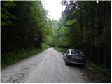
a) From the Ljubljana - Maribor motorway, take the Šentrupert exit and then continue to Mozirje, Ljubno ob Savinji and the Logar valley. From Ljubno, follow the main road for about 6 km, then in Strmec, signs for Raduha and Snežna jama direct you to the right onto a narrower and initially still asphalted road. At the crossroads follow the signs for Snežna jama, and we follow the road, which loses its asphalt coating higher up, to mountain pasture Kosmačeva Rastka (the mountain is not visible from the road), where we see the signs for Koča na Loki (from the main road to the starting point is about 13 km). We park at a suitable place along the road.
b) From the motorway Ljubljana - Jesenice, take the exit Vodice, then continue driving towards Kamnik. In Kamnik, follow the signs for Gornji Grad and the Črnivec Pass, and just 1 km before the pass, turn left in the direction of Kranjski Rak and Podvolovljek. From Kranjski Rak (Volovljek Pass) we start descending towards Luce, where we turn right towards Mozirje. From Luce, drive towards Mozirje for about 3 km, then in Strmec, signs for Raduha and Snežna jama direct you left onto a narrower and initially still asphalted road. At the crossroads follow the signs for Snežna jama, and we follow the road, which loses its asphalt coating higher up, to mountain pasture Kosmačeva Rastka (the mountain is not visible from the road), where we see the signs for Koča na Loki (from the main road to the starting point is about 13 km). We park at a suitable place along the road.
Path description:
From the starting point, follow the footpath behind the signs for Koča na Loki. The trail then passes through the forest and most of the time crosses the slopes in a gentle ascent towards the south-west. Later the path becomes slightly wider and turns into cart track, which leads to a hunting lodge.
From the hunting lodge, where the view to the south opens up, continue slightly right along the forest road. The road quickly leads to a crossroads, where you turn right at cart track after the signs for Koča na Loki. Here, the path from Radušnik Farm joins us from the left.
The track continues to climb through the forest and leads us to the road leading to Snežna jama, which we reach just at the point where the forest road closed to public traffic branches off to the right, up which we arrive at the Cottage na Loki under Raduha within 15 minutes of further walking.
From the hut, continue slightly right along the marked path towards the saddle Durce (slightly left Raduha, right Smrekovec and Travnik). Continue on the right side of the ravine (the left side of the ravine is the path to Raduha) along the path, which gradually starts to climb steeper. After about 10 minutes' walk from the hut, the path leads to a less visible crossroads, where we continue sharp right along a less visible path (straight Durce). After a few steps of further walking, we will notice on a tree the mountain direction signs marked Lanež and Durce through Laneža, which direct us left up a steep but marked trackless path (in the fog, orientation is extremely difficult). After a few minutes of climbing over a steep grassy slope, the "path" leads us to the pasture fence, where we continue to the left. Only a few steps further on, the marked path crosses the fence and then turns slightly to the left (here the path is already more visible).
The ascent continues along the scenic route, which leads past the animal watering point to a small valley between Lanež and Jelovec. The moderately steep path, which continues along a pleasant valley, soon leads us to an undistinguished saddle between the two peaks mentioned above.
The marked trail here turns left and begins to climb steeply up the eastern slopes of Lanež. Only a little higher up, we reach a scenic ridge where the path climbs even steeper. After a few minutes of climbing, the steepness eases and the increasingly scenic route quickly leads to the vast summit of Lanež. Kosmačeva Rastke mountain - Hut na Loki 1:15, Hut na Loki - Lanež 1:10.

Pictures:
 1
1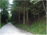 2
2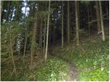 3
3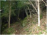 4
4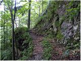 5
5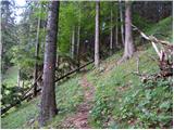 6
6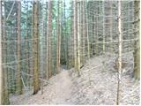 7
7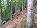 8
8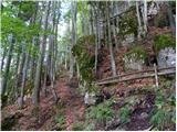 9
9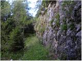 10
10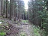 11
11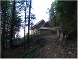 12
12 13
13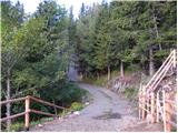 14
14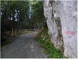 15
15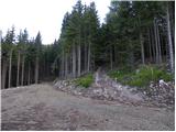 16
16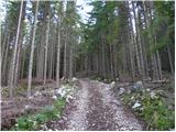 17
17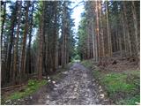 18
18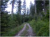 19
19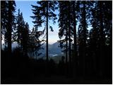 20
20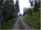 21
21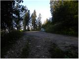 22
22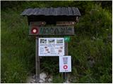 23
23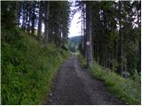 24
24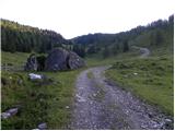 25
25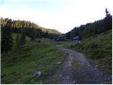 26
26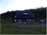 27
27 28
28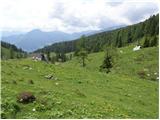 29
29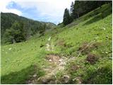 30
30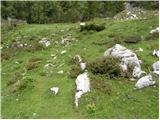 31
31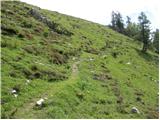 32
32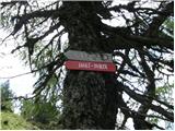 33
33 34
34 35
35 36
36 37
37 38
38 39
39 40
40 41
41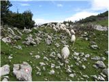 42
42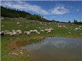 43
43 44
44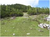 45
45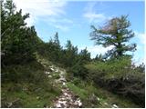 46
46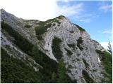 47
47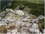 48
48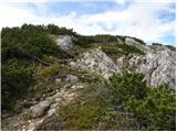 49
49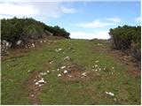 50
50 51
51
Discussion about the trail Planina Kosmačeve Rastke - Lanež (east path)