Planina Jezerca - Kompotela
Starting point: Planina Jezerca (1410 m)
| Lat/Lon: | 46,2855°N 14,5314°E |
| |
Time of walking: 2 h 30 min
Difficulty: easy marked way
Altitude difference: 579 m
Altitude difference po putu: 660 m
Map: Kamniške in Savinjske Alpe 1:50.000
Recommended equipment (summer):
Recommended equipment (winter): ice axe, crampons
Views: 62.183
 | 2 people like this post |
Access to the starting point:
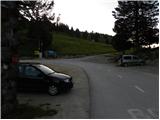
a) From the motorway Ljubljana - Jesenice take the exit Vodice, then continue to the first semaphore crossing in Vodice, where you turn left towards Cerkelj na Gorenjskem and Brnik. When you reach the main roundabout at Spodnji Brnik, continue driving in the direction of Cerkeliai and the ski resort Krvavec. At the end of Cerklje na Gorenjskem, leave the main road, which continues towards Velesovo and Visoke, and turn slightly right onto the road towards the ski resort Krvavec. Continue to the village of Grad, where signs for Ambrož pod Krvavcem direct you to the right on a steep asphalt road (straight ahead to the lower station of the round-cabin cable car to Krvavec and Štefanja Gora). When the steepness of the steep road eases slightly, you will come to a junction, where you will continue to the left in the direction of Ambrož pod Krvavcem (straight ahead to the settlements of Ravne, Apno and Šenturška Gora). A little further on, the road descends a little and then climbs over slopes that are sometimes quite scenic. Higher up, you reach Ambrož pod Krvavcem, where you pass the church of St Ambrose and the tourist farm Pr Ambružarju on the left. From the tourist farm the road passes into the forest and climbs through it to mountain pasture Jezerec, where there is a large parking lot.
b) From the motorway Jesenice - Ljubljana take the exit Kranj - East, then continue to Brnik, Komenda and Mengeš. When you reach the main roundabout at Spodnji Brnik, continue driving towards Cerkeliai and the ski resort Krvavec. At the end of Cerklje na Gorenjskem, leave the main road, which continues towards Velesovo and Visoke, and turn slightly right onto the road towards the ski resort Krvavec. Continue to the village of Grad, where signs for Ambrož pod Krvavcem direct you to the right on a steep asphalt road (straight ahead to the lower station of the circular cable car to Krvavec and Štefanja Gora). When the steepness of the steep road eases slightly, you will come to a crossroads, where you will continue to the left in the direction of Ambrož pod Krvavcem (straight ahead to the settlements of Ravne, Apno and Šenturška Gora). A little further on, the road descends a little and then climbs over slopes that are sometimes quite scenic. Higher up, you reach Ambrož pod Krvavcem, where you pass the church of St Ambrose and the tourist farm Pr Ambružarju on the left. From the tourist farm the road passes into the forest and climbs through it to mountain pasture Jezerec, where there is a large parking lot.
Path description:
At the end of the parking lot, where the road turns left and the road branches off to the right towards the nearby mountain pasture Jezerca, you will notice red mountain direction signs directing you straight onto the marked footpath in the direction of Kriška planina, Vrh Korena, Košutna, Kompotela and Mokrica, which ascends through the pastures of the aforementioned mountain pasture. After a short climb, cart track is reached, and we follow it to the left, crossing the slopes of Kržišče (1658 m). Cart track, which we are following, quickly splits into two parts, and we continue straight on the lower one. Transitionally, we get a nice view towards Kranj, the Škofjeloško hribovje and Storžič, and then the path starts to descend gently. A few more minutes of walking follow, and then we arrive at the parking lot at the lower part of Kriška planina.
From the parking lot, continue in the direction mountain pasture Koren and follow the worse dirt road, which passes through the underpass under the ski slope. After the underpass, the marked path veers slightly left off the road, continuing parallel to the road along a spruce tree avenue. After a few minutes of gentle ascent, when you reach the eastern edge of Kriška planina, where there is a small watering place for animals, continue slightly left over a pasture fence (right mountain pasture Osredek and Kamniški vrh), but continue the gentle ascent in roughly the same direction. The path continues with mountain pasture to the slightly steeper slopes of Krvavec, over which we climb crosswise to a viewpoint from which we have a fine view towards Kržišče), the ridge of Kamniški vrh, the Korošice valley, Velika planina and towards the nearby Košutna and Velika Zvoh.
From the viewpoint, which is located a few steps to the right of the path, we begin a steeper descent towards the hunting lodge above the Korošica valley. When the descent stops and the trail continues without any major changes in altitude, you will come to a prominent but poorly marked crossroads where the trail branches off to the right towards the aforementioned hunting lodge and further towards the Korošice valley and the Kamniška Bistrica valley. At this crossroads, continue slightly left and start climbing slightly through the forest. The path quickly leaves the forest and passes through bushes and dwarf pines, and then gradually leads us through a pasture fence to the next unmarked crossroads, which is located right in the middle of a sharp right-hand bend. From the serpentine, an unmarked path continues straight ahead towards the Razor saddle (the saddle between Krvavec and Velika Zvoh), and we continue to the right along the further marked path. There is a short cross-climb and the path leads us to the southern part of mountain pasture Koren, from where we have a nice view over the central part of mountain pasture and the surrounding peaks. From the southern part of mountain pasture there is a short descent to the nearby shepherd's hut, which is located in the central part of mountain pasture Koren.
Here our route continues slightly left (slightly right mountain pasture Košutna) through the meadows on the valley floor (the path is initially not very visible). The path then becomes steeper and steeper and after less than 30 minutes of walking leads us to a small puddle where there is a less well marked crossroads. Continue straight ahead (right Košutna) and follow the gently sloping path to the next crossroads, where you continue along the right path in the direction of Kompotela (left Vrh Korena). From here on, the orientation is a little more difficult in the fog, but very difficult. The way forward slowly begins to climb gently on a grassy slope covered with dwarf pines. The path then leads us to the top of Kompotele in beautiful views.

Pictures:
 1
1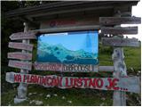 2
2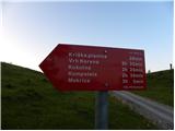 3
3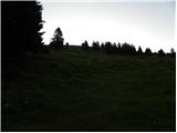 4
4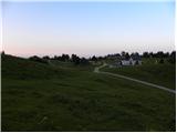 5
5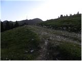 6
6 7
7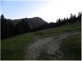 8
8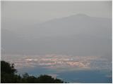 9
9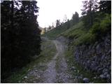 10
10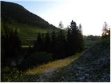 11
11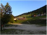 12
12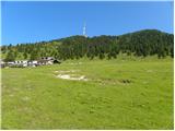 13
13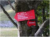 14
14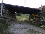 15
15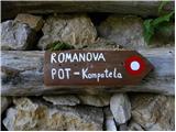 16
16 17
17 18
18 19
19 20
20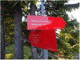 21
21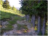 22
22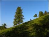 23
23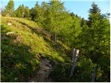 24
24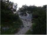 25
25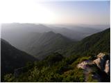 26
26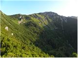 27
27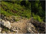 28
28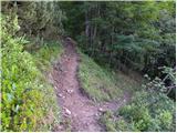 29
29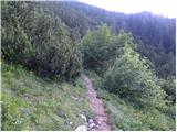 30
30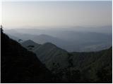 31
31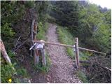 32
32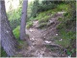 33
33 34
34 35
35 36
36 37
37 38
38 39
39 40
40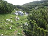 41
41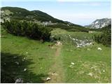 42
42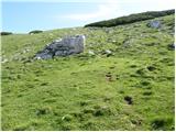 43
43 44
44
Discussion about the trail Planina Jezerca - Kompotela
|
| velkavrh16. 08. 2013 |
Na vrhu Kompotele je nova skrinjica za vpise in mislim , da tudi žig.Tudi usmerjevalne table pod Vrhom Korena, ki nas usmerijo na Kompotelo in naprej na Mokrico so nove.Letos me ta tura prek planine Koren, planine Košutna, vrha Košutna, Kompotela in Mokrica še čaka. Od Mokrice pa se lahko spustimo še do Medvedove jame, kjer bomo še vedno našli kako koščico jamskih medvedov.Priporočam-prijetna, nenaporna tura.
|
|
|
|
| pohodnik0117. 08. 2013 |
V začetku meseca sva bila z ženo v tistih koncih. Vse je tako kot je opisal "velkavrh". Tudi žig je, kar včasih ni bilo. Edino je škoda, da skrinjici za vpise manjka pokrov. Mogoče ga je kdo (sicer maloverjetno?) sunil. Veliko užitkov na poti 
|
|
|
|
| valerija11211. 10. 2014 |
Take megle pa še ne! Danes smo poleg Kompotele
obiskali še Vrh korena in Košutno.Celo dopoldne nas je obkrožala gosta megla,šele po 13h nam je na Košutni sonce pričaralo malo razgledov. Vseeno je bil dan poln lepih doživetji,srečali smo veliko prijetnih pohodnikov.Mogoče boste jutri imeli z razgledi več sreče. Poti so lepo označene in markirane. Hvala markacistom.
|
|
|
|
| gofra2. 01. 2016 |
Morda samo opozorilo - Slika 8 prikazuje odcep, pri katerem naj bi nadaljevali naravnost. V zimskih razmerah tega odcepa ni videt, kar sicer ne moti prevec (nadaljujes naravnost proti Kriski planini) je pa vseeno vredno omeniti.
V nadaljevanju svetujem, da se pašno ograjo (začetek pri sliki 17) prečka čimprej (v primeru dvomov) in se pot nadaljuje po levi strani drevoreda že v štartu. Ograja je namreč iz bodeče žice in v nadaljevanju zna bit to prečkanje problem.
|
|
|
|
| Lisica2. 01. 2016 |
Vceraj obiskala Kosutno, Kompotelo in Vrh Korena. Na prvih dveh ni vpisnih knjig, na Vrhu Korena pa je le-ta ze polna. PD Komenda bi lahko poskrbela za nove...
|
|
|
|
| sh14. 04. 2016 |
Prosim za informacijo kako je s snegom na tej poti.
|
|
|
|
| viharnik15. 04. 2016 |
Naprej od Pl. Koren je še sneg.
|
|
|
|
| sh15. 04. 2016 |
Je snega veliko, se zelo vdira?
|
|
|
|
| grega_z_brega15. 04. 2016 |
V nedeljo ga je blo ene 25 cm, kjer je napihan je šlo do riti.
Ga je pa čez teden veliko pobralo.
|
|
|
|
| grega_z_brega15. 04. 2016 |
Ce gres jutri, se priporocam za fotko tja pod Kalskim grebenom
|
|
|
|
| marko hribinet9. 11. 2016 |
Pozdravljeni. Mi lahko kdo, ki dobro pozna te konce, prosim pove, koliko je ta pot nevarna za plazove. Mislil sem iti to soboto (dereze in cepin seveda s sabo). Hvala!
|
|
|
|
| velkavrh10. 11. 2016 |
marko hribinet-v soboto se obeta lepše vreme. Mislim, da bo snega malo-morda tam okrog 20cm.Lahko pa bi zagazil tudi do 40cm-kjer je napihan. Verjetno pa ne bo nič shojeno in bo zato orientacija težja.Vkolikor bo gaz ne bo težko.V megli se na to pot ne smemo podajati.Dosledno se je treba držati tu opisne poti.Ta čas ni nevarnost plazov, ker je snega tudi premalo.Dereze le vzemi s sabo,cepina pa ne boš rabil.Sicer se je lepo vrniti prek Vrha Korena in Ježe na Veliki Zvoh, samo za neizkušene ta pot ni priporočljiva.Varno se vrnemo po poti pristopa.
|
|
|
|
| velkavrh10. 11. 2016 |
Oglej si razmere od včeraj na Forum pod Vrh Korena. Zgleda, da je snega več kot sem predvideval.Previdno!
|
|
|
|
| ljubitelj gora10. 11. 2016 |
Marsikje so lahko plazovi, zato pa kadar je nekaj več snega v gorah je treba bit max.previden. Potrebno izbirat tiste vzpone, ki jih poznamo v kopnih razmerah.
|
|
|
|
| marko hribinet10. 11. 2016 |
Hvala lepa za informacije. Saj to pot sem v kopnem ze dvakrat prehodil, a v zimskih razmerah z njo se nimam izkusenj.
|
|
|
|
| sirt110. 11. 2016 |
V soboto v te konce rajši ne. ARSO napoved za Zvoh je sneženje in veter blizu 80 km/h. V nedeljo pa sonce, vetra malo koliko snega pa ???
|
|
|
|
| Guest11. 11. 2016 |
Če je veliko novega snega te prvi plaz čaka že po nekaj minutah ,ko stopiš v gozd ,ampak ga mora biti res veliko,drugi veliko večji pa prileti z Zvoha na koncu prvega spusta,ko se pot položi .Naprej pa kakšne večje nevarnosti sedaj še ni .Pozimi ko bo ruševje pokrito ,pa se lahko splazi tudi s Košutne.
|
|
|
|
| mito300013. 11. 2016 |
Danes sem do vrha Korena naredil gaz iz planine Jezerca. Snega je na vrhu okoli pol metra, ponekod se vdira tudi precej globlje.Kot je omenil "miro_krivec" je najnevarnejši del, ko plaz prileti z Zvoha kar sem doživel v lanskem letu. Plaz se je odpeljal samo par metrov stran in ne moreš verjeti kako hitro se vse skupaj zgodi.
|
|
|
|
| Keki4. 12. 2017 |
Je bil kdo v zadnjih dneh na Kompoteli in Vrh Korena...je gaz narejena?
|
|
|
|
| Bandzo4. 12. 2017 |
@Keki, glej komentar pod Vrh korena LP, Ben
|
|
|
|
| Keki6. 12. 2017 |
Ker sem siten, sem vseeno šel preverit stanje. Ker sta bila vmes dva dokaj lepa dneva sem upal, da bo gaz že konkretno uhojena... No pa ni...že do pl. Koren je mestoma zapihana, od pl. Koren dalje pa vse zapihano in skorjast sneg do kolen in čez, zato sem malo pod markacijo na skali na koncu travnika obrnil.... Slikce na FB
|
|
|
|
| Bandzo7. 12. 2017 |
Hja, ni kaj. Kot da nihče ne bi hodil prej V prejšnjem opisu sem se zmotil: 45 min do Kompotele ne do Mokrice. Bomo šli pa še enkrat zgazit LP, Ben
|
|
|
|
| michael661. 04. 2018 |
Kako je s potjo te dni,je kaj shojeno...se da peš...?
|
|
|
|
| radovednež15. 02. 2026 15:40:22 |
Je bil kdo na Kompoteli čez vikend iz planine Jezerca? Predvsem me zanima varnost v zimskih razmerah...je teren nevaren za sneźne plazove?
In ali je gaz v snegu ustvarjena?
|
|
|