Planina - Grmada (Planinska gora)
Starting point: Planina (520 m)
| Lat/Lon: | 45,8264°N 14,2358°E |
| |
Time of walking: 1 h
Difficulty: easy unmarked way
Altitude difference: 353 m
Altitude difference po putu: 353 m
Map: Snežnik 1:50.000
Recommended equipment (summer):
Recommended equipment (winter):
Views: 27.351
 | 1 person likes this post |
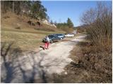
Access to the starting point:
From Ljubljana, take the motorway to Koper and take the Unec exit. At the junction, turn right towards Mountain pasture, where you will take a sharp left at the junction towards Postojna (you can also take the old road to get here). Continue through Mountain pasture and turn right at the place where you will see the signs for Strmca and Studeno (you can also take the old road to get here). Continue through Mountain pasture and at the place where you will see signs for Strmca and Studeno, turn right. The road soon leads to the next crossroads, where it says Postojna on the left, Strmca and Studeno on the right, and nothing on the right. Turn right here (towards the quarry) and drive only 30m to where a worse road branches off to the left, along which we park.
From Postojna take the old road towards Ljubljana. Shortly after the village of Mačkovec, the road to Strmca turns sharp right and turns left. This road then soon leads to the next crossroads, where you continue straight towards the quarry. Do not follow this road to the quarry as after 30m we leave it, because we turn left onto a worse road along which we park.
Path description:
From the parking lot, continue along the worse road, but only as far as a small waterworks building. Here, the cart track road branches off to the right and after a few metres climbs steeply. Cart track, which runs through the forest, is very steep at the beginning but the steepness eases after a few minutes. This is followed by a moderate climb up cart track, which after a while joins another wider one. Here continue left on cart track, which climbs slightly and after a few minutes joins the next cart track, which is almost a worse road. Here you can see some old military tunnels along the way. This road then leads quickly to the Church of St Mary.
At the church, we get onto a dirt road and continue our ascent. After a good 10 minutes of further walking, you will see cart track on the right-hand side, which leads to extensive grassy slopes. Cross these slopes and follow the slightly less steep cart track, which points slightly to the right. After some 10 steps of pleasant walking, the path leads us to a lookout point from which a wonderful view of the Planinsko polje opens up.
Near the lookout point, at the edge of the forest, we see an unmarked mountain path which points us sharp right and which we follow in a 3-minute walk up to the forested summit of Grmada.

Pictures:
 1
1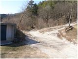 2
2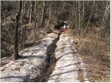 3
3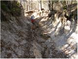 4
4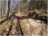 5
5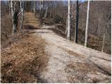 6
6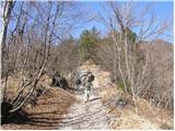 7
7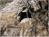 8
8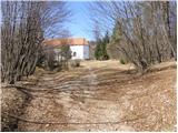 9
9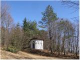 10
10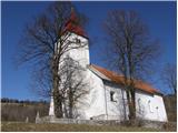 11
11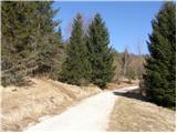 12
12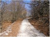 13
13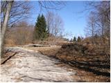 14
14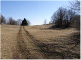 15
15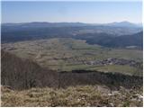 16
16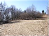 17
17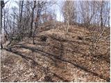 18
18 19
19
Discussion about the trail Planina - Grmada (Planinska gora)
|
| grega_p1. 02. 2010 |
Danes sem šel gor v prelepi zimski idili in delal gaz vsaj na začetku. Ker drugače ne poznam poti, sem malce zavil z običajne smeri in naredil manjši ovinek, kar sem opazil šele ob pristopu, tako da ne bo kakšen pohodnik za mano nujno upošteval mojih stopinj.. Izkoristite sončno snežne dni!
|
|
|
|
| lipnes3. 09. 2010 |
Jaz pa včeraj. V tretjem poiskusu v slabih dveh letih sem končno našel vrh.  Sem pa šel gor kar po cesti s kolesom in Laz skozi Planino in Lohačo. Fajn aerobni trening.
|
|
|
|
| jesihar5. 10. 2011 |
Gor šel v tekaških copatih, to odsvetujem. Pot sem si malo priredil in šel gor pri planinski cerkvi in jo "skajšal", tako da sem se podal naravnost gor po hribu in ne po gozdni poti. Tudi to odsvetujem, zaradi debele plasti listja in precej velike strmine. Na hrib se splača zaradi lepega razgleda na Planinsko polje.
|
|
|
|
| Lj28. 11. 2015 |
Prosila bi za informacijo, ali je Planinska gora drugo ime za Grmado? Namreč na zemljevidu Notranjski kras, je v bližini označen drug vrh z imenom Planinska gora (924 m) in me zanima, zakaj je v tem opisu tudi Grmada poimenovana enako?
|
|
|
|
| Lj28. 11. 2015 |
Hvala, torej tale moj zemljevid ni pravilen...
|
|
|