Planina Blato - Planina Lopučnica (via Štapce)
Starting point: Planina Blato (1147 m)
| Lat/Lon: | 46,3112°N 13,8501°E |
| |
Name of path: via Štapce
Time of walking: 3 h 45 min
Difficulty: partly demanding marked way
Altitude difference: 411 m
Altitude difference po putu: 850 m
Map: TNP 1:50.000
Recommended equipment (summer): helmet
Recommended equipment (winter): helmet, ice axe, crampons
Views: 2.161
 | 1 person likes this post |
Access to the starting point:
From the Ljubljana - Jesenice motorway, take the Lesce exit and follow the road towards Bled and on to Bohinjska Bistrica. Continue towards Bohinjsko jezero (Ribčev laz), at which you will come to a crossroads where you will turn right towards Stara Fužina. At Stara Fužina, at the crossroads by the chapel, turn sharp left onto the ascending road towards mountain pasture Blato, mountain pasture Vogar and the Voja valley. The road continues to the place where the toll and parking fees are collected, and we follow it to the next crossroads, where we continue to the left (right Voje). We then follow the road to the next crossroads (we drive for some time), where we take a sharp right in the direction of mountain pasture Blato (straight ahead mountain pasture Vogar). Follow this road to the parking lot in front of mountain pasture Blato.
Path description:
From the marked parking lot at mountain pasture Blato go back a few 10 steps, then take the wide and initially quite steep cart track in the direction of mountain pasture at Jezero. After 10 minutes of relatively steep ascent, you reach a marked crossroads where you continue along the left steep cart track (straight mountain pasture in Laz), only to be joined a little higher by the marked path with mountain pasture Vogar. Continue along the wide, partly stony cart track, which is crossable at a higher level and then climbs steeply through a small hairpin bend. Just ahead, the path bends sharply to the left and leads into a cold valley called Pungrat, where it crosses an abandoned pasture fence. The path ahead starts to climb steeply again, then turns to the right and lays completely flat. Just a few metres further on, we join the path with mountain pasture Vodični vrh on our left, and we continue straight on and after 5 minutes of further walking we arrive at mountain pasture near Jezero, in the middle of which stands a mountain hut.
From the mountain hut, continue slightly to the left and initially downhill to a marked crossroads, from which take the right path in the direction of Dednega polje (to the left mountain pasture Viševnik and Pršivec). The wide path continues, first gently and then climbing moderately to steeply through a sparse spruce forest. Higher up, a path branches off to the left across Krištofojca, leading towards mountain pasture Viševnik, and we continue along the wide path, which gently slopes upwards and then turns slightly to the right, where we see mountain pasture Dedno polje ahead. Here the path turns to the left and after a few further steps leads to mountain pasture Dedno polje, at the edge of which there is a marked crossroads.
Continue straight on towards Koča pri Triglavskih jezerih (right valley Za Kopica) on a path which continues to climb gently to moderately through mostly sparse forest. The path, from which we have a beautiful view of the Lower Bohinj Mountains, then descends and leads us to mountain pasture Ovčarija, where the next crossroads is located. Continue along the right-hand path in the direction Koča pri Triglavskih jezerih over Štapce (straight ahead over Prode). The way forward climbs moderately at first through a sparse larch forest, then climbs steeply and leads us over lane of dwarf pines to the scenic Štapce.
Here we continue down to the left towards the Double Lake, which is clearly visible below us (Mala Tičarica on the right). The trail starts descending steeply from Štapce on a perfectly protected path (the path is guarded by a rope ladder and in the lower part by a ladder). After less than 5 minutes of descent, the trail turns into a scree slope and then descends to the Double Lake, where we continue to the right towards the hut (left path over Prode and Black Lake). The gently sloping trail then bypasses the lake on the right and quickly leads us to the Hut at the Three Tiglav Lakes.
From the hut, continue sharp left in the direction Dom na Komni along the path which begins to climb crosswise along the western side of the Double Lake. After a short climb, you reach an indistinct ridge, from which the path turns right and begins to descend. After a half-hour's descent, the path leads to the mountain pasture Hatch, where there is a crossroads.

Pictures:
 1
1 2
2 3
3 4
4 5
5 6
6 7
7 8
8 9
9 10
10 11
11 12
12 13
13 14
14 15
15 16
16 17
17 18
18 19
19 20
20 21
21 22
22 23
23 24
24 25
25 26
26 27
27 28
28 29
29 30
30 31
31 32
32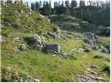 33
33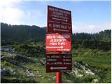 34
34 35
35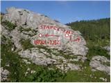 36
36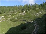 37
37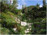 38
38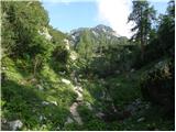 39
39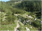 40
40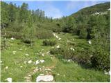 41
41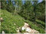 42
42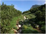 43
43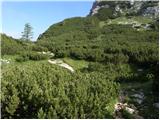 44
44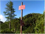 45
45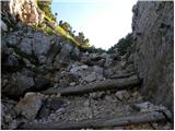 46
46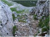 47
47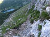 48
48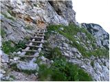 49
49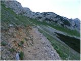 50
50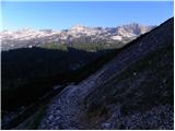 51
51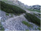 52
52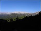 53
53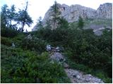 54
54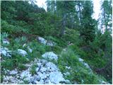 55
55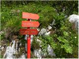 56
56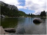 57
57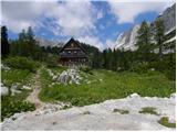 58
58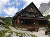 59
59 60
60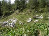 61
61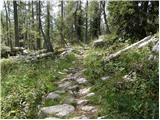 62
62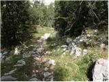 63
63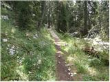 64
64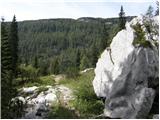 65
65 66
66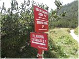 67
67
Discussion about the trail Planina Blato - Planina Lopučnica (via Štapce)