Planina Blato - Črno jezero
Starting point: Planina Blato (1147 m)
| Lat/Lon: | 46,3112°N 13,8501°E |
| |
Time of walking: 2 h 40 min
Difficulty: easy marked way
Altitude difference: 147 m
Altitude difference po putu: 500 m
Map: Triglav 1:25.000
Recommended equipment (summer):
Recommended equipment (winter): ice axe, crampons
Views: 29.891
 | 1 person likes this post |
Access to the starting point:
From the Ljubljana - Jesenice motorway, take the Lesce exit and follow the road towards Bled and on to Bohinjska Bistrica. Continue towards Bohinjsko jezero (Ribčev laz), at which you will come to a crossroads where you will turn right towards Stara Fužina. At Stara Fužina, at the crossroads by the chapel, turn sharp left onto the ascending road towards mountain pasture Blato, mountain pasture Vogar and the Voja valley. The road continues to the place where the toll and parking fees are collected, and we follow it to the next crossroads, where we continue to the left (right Voje). We then follow the road to the next crossroads (we drive for some time), where we take a sharp right in the direction of mountain pasture Blato (straight ahead mountain pasture Vogar). Follow this road to the parking lot above mountain pasture Blato.
Path description:
From the marked parking lot at mountain pasture Blato go back a few 10 steps, then take the wide and initially quite steep cart track in the direction of mountain pasture at Jezero. After 10 minutes of relatively steep ascent, you reach a marked crossroads where you continue along the left steep cart track (straight mountain pasture in Laz), only to be joined a little higher by the marked path with mountain pasture Vogar. Continue along the wide, partly rocky cart track, which is laid down transiently higher up and then climbs steeply through a small hairpin bend. Just ahead, the path bends sharply to the left and leads into a cold valley called Pungrat, where it crosses an abandoned pasture fence. The path ahead starts to climb steeply again, then turns to the right and lays completely flat. Just a few metres further on, we join the path with mountain pasture Vodični vrh on our left, and we continue straight on and after 5 minutes of further walking we arrive at mountain pasture near Jezero, in the middle of which stands a mountain hut.
From the mountain hut we descend to a marked crossroads, where the signs for mountain pasture Viševnik direct us left to an initially less visible path. The path then ascends cross-cuttingly and then passes into the forest, through which it climbs until it reaches mountain pasture Viševnik.
From mountain pasture Viševnik continue straight on in the direction of Črno jezero (slightly left Pršivec, right mountain pasture Sheepfold) along a path which begins to descend first gently and then steeply towards the valley Dol pod Stadorjem. Soon, below mountain pasture, the path enters a dense forest through which it descends all the way to the valley mentioned above. When you reach Dol pod Stadorjem, the forest thins out a few times, opening up some views of the surrounding peaks. The way forward quickly returns to the forest, and then past the spring, which is located slightly to the left of the path (3 minutes descent) leads us to a small scree slope, behind which we soon reach the Black Lake.

We can extend the trip to the following destinations: Dom na Komni,
Planina Ovčarija,
Koča pri Triglavskih jezerih,
Pršivec,
Jezero v Ledvicah,
Rušnata glava,
Zeleno jezero,
Rjavo jezero,
Zasavska koča na Prehodavcih,
Mala Tičarica,
Velika Tičarica,
Koča na Doliču,
Kopica,
Vodnikov Vršac (Vršac nad Zadnjico),
Čelo,
Mala Zelnarica,
Malo Špičje,
Velika Zelnarica,
Vrh Hribaric,
Veliko Špičje,
Vršaki (Vzhodni vrh),
Kanjavec,
Triglav
Pictures:
 1
1 2
2 3
3 4
4 5
5 6
6 7
7 8
8 9
9 10
10 11
11 12
12 13
13 14
14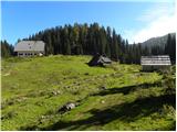 15
15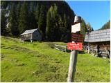 16
16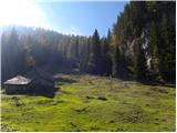 17
17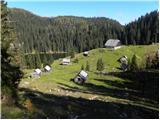 18
18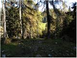 19
19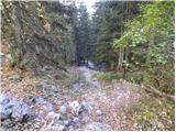 20
20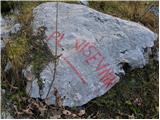 21
21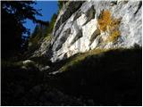 22
22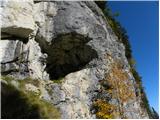 23
23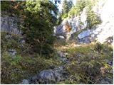 24
24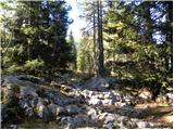 25
25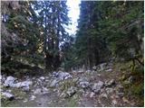 26
26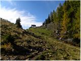 27
27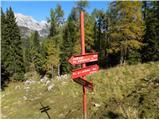 28
28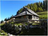 29
29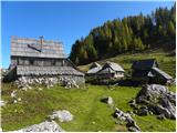 30
30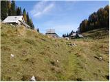 31
31 32
32 33
33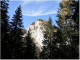 34
34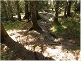 35
35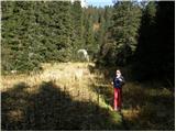 36
36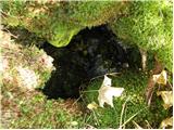 37
37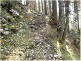 38
38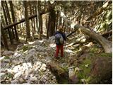 39
39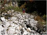 40
40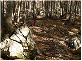 41
41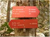 42
42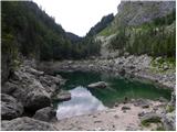 43
43
Discussion about the trail Planina Blato - Črno jezero
|
| B_U_R_I13. 04. 2013 |
Pozdravljeni, zanima kakšne so kaj trenutne razmere? Naslednji vikend bomo v Bohinjski Bistrici pa smo imeli v mislih ogled Črnega jezera. Je še kaj snega?
|
|
|
|
| simonz0r13. 04. 2013 |
če ga je še kaj? V Karavankah ga je na 1500m še 1,5 m, v Julijcih sigurno še nekaj več. Piše pa vse v poročilu o snežnih razmerah. Srečno!
|
|
|