Planica (Planinšek) - Planina Podvežak
Starting point: Planica (Planinšek) (1085 m)
| Lat/Lon: | 46,3299°N 14,6932°E |
| |
Time of walking: 1 h 25 min
Difficulty: easy marked way
Altitude difference: 479 m
Altitude difference po putu: 479 m
Map: Kamniške in Savinjske Alpe 1:50.000
Recommended equipment (summer):
Recommended equipment (winter): ice axe, crampons
Views: 9.166
 | 1 person likes this post |
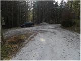
Access to the starting point:
a) First drive to Kamnik, then continue to Stahovica and the Črnivec Pass. A few 100 metres before the Črnivec Pass, leave the main road leading to Gornji Grad and drive sharp left in the direction of the Volovljek Pass (Kranjski Rak). From the above-mentioned pass, continue straight ahead (on the left the road leading to Velika planina, on the right the Štajerski Rak) and start descending towards Luče. Lower down, the road bends slightly and leads to the Podvolovljek valley. Continue past the road leading to the Lučka Bela valley, then past the bar at Gams. After the bar, pay attention, because just a few 100 metres further on, a road branches off to the left, leading to mountain pasture Podveža and Ravne and the Planinšek farm (at the point where you leave the main road, the road marking is approximately 11 km). Continue along the initially still asphalted road, which climbs further towards the Dleskovská plateau. Just above this, when the asphalt ends, the road continues straight ahead towards Luce, and we take a sharp left in the direction of Korošice. The road then climbs towards the Dleskovška plateau, and we follow it to a crossroads where the road to Planica or Planinšek Farm branches off to the right. Park in a suitable place at the crossroads.
b) First drive to Luce, then continue to Kamnik. When you see the road sign by the side of the road indicating 10. 5 km, pay attention to the right fork, as just a little further on the road to mountain pasture Podveža and Ravne and the Planinšek farm will fork off to the right. Continue along the initially still asphalted road, which climbs further towards the Dleskovški plateau. Just above this, when the asphalt ends, the road continues in a straight line towards Luce, and we take a sharp left in the direction of Korošice. The road then climbs towards the Dleskovška plateau, and we follow it to a crossroads where the road to Planica or Planinšek Farm branches off to the right. Park in a suitable place at the crossroads.
Path description:
From the starting point, continue along the road on the left in the direction of Korošica, mountain pasture Podveža and mountain pasture Ravne (Planinšek on the right). The road first climbs gently through lane of a forest and then leads to grassy hay meadows above the Planinšek farm. Leave the road here and continue left across the hay meadows and upwards. When we arrive at the edge of the forest, a beautiful passage opens up through the narrower "clearing", where we also see the first markings. At the top of the grassy tongue, continue right into the forest and follow the old cart track, which is already completely overgrown with grass. A little higher up, turn left and follow cart track up to a kind of ridge. Continue right here and continue climbing relatively steeply along a faint ridge. Higher up, leave the ridge as the sparse markings direct you left onto a rather overgrown path which climbs to the left. Continue cross-climbing for a while, then climb up to a nearby dirt road, which you follow to the left. The road continues the ascent and a nice view opens up for a short distance before it returns to the forest. A blind branch branches off from the road a little higher up to the left, and we walk along the road for only a short distance from here, as we then quickly reach a marked crossroads under mountain pasture Podvežak.
Here we continue to the right (we can also go a few 10 steps earlier, as the marked path leaves the road before the crossroads) and follow the road or the marked footpath up to mountain pasture Podvežak in 15 minutes.

Pictures:
 1
1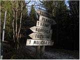 2
2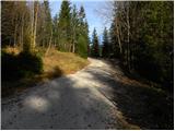 3
3 4
4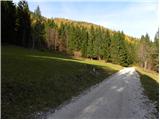 5
5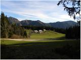 6
6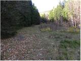 7
7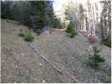 8
8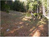 9
9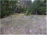 10
10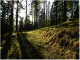 11
11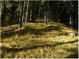 12
12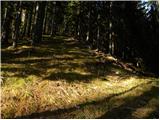 13
13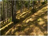 14
14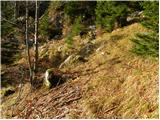 15
15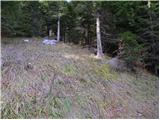 16
16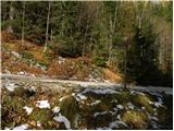 17
17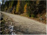 18
18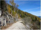 19
19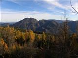 20
20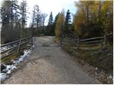 21
21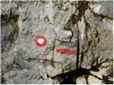 22
22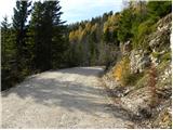 23
23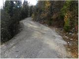 24
24 25
25 26
26 27
27 28
28 29
29 30
30 31
31
Discussion about the trail Planica (Planinšek) - Planina Podvežak
|
| žuli13. 07. 2021 09:26:16 |
Pozdravljeni. Ali to izhodišče še "obstaja" oz. je še v rabi? V soboto sem nameraval pot na Ojstrico začeti tukaj, namesto na parkirišču pod planino Podvežak, vendar je bilo "vse" drugače kot na slikah...Na sliki je makadam, v živo asfalt, na sliki so usmerjevalne table, v živo jih ni bilo. Občutek sem imel, da nisem na pravem mestu. Sedaj opažam, da sem bil, le da vse skupaj zgleda drugače. Če avtor tega opisa vidi moj komentar, mu lahko posredujem posnetek izhodišča.
|
|
|
|
| garmont13. 07. 2021 14:18:49 |
Imaš prav.  Asfaltna preobleka je tu že nekaj let, se pa ta res čez slab kilometer konča. Drugače, pa je to izhodišče bolj za pozimi, ko višje z avtom ne gre…
|
|
|
|
| žuli14. 07. 2021 13:01:55 |
Hvala za pojasnilo. Torej bi se dalo tudi poleti avto pustiti na tej točki? Ne bi bil komu "v napoto"?
|
|
|
|
| garmont14. 07. 2021 15:16:09 |
Da se, računaj pa s tem, da po tej cesti vozijo tovornjaki s hlodovino, ki pa potrebujejo veliko prostora. 
|
|
|
|
| žuli16. 07. 2021 13:11:16 |
Hvala za opozorilo
|
|
|