Nassfeld - Creta di Aip / Trogkofel (Uiberlacher Steig)
Starting point: Nassfeld (1540 m)
| Lat/Lon: | 46,5609°N 13,2758°E |
| |
Name of path: Uiberlacher Steig
Time of walking: 4 h 30 min
Difficulty: very difficult marked way
Altitude difference: 739 m
Altitude difference po putu: 830 m
Map: Tabacco 18
Recommended equipment (summer): helmet, self belay set
Recommended equipment (winter): helmet, self belay set, ice axe, crampons
Views: 11.358
 | 2 people like this post |
Access to the starting point:
Cross the border crossing at Ratece and drive through Trbiž / Tarvisio, Ukve / Ugovizzo to Tablja / Pontebba, where you turn right after the signs "Passo di Pramollo / Nassfeld" (Wetlands in Slovenian). At the pass, drive past the lake to the Austrian side, where you park in a large parking lot.
Path description:
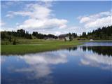
From the parking lot at the Mokrine/Nassfeld Pass, follow the dirt road after the Rosskofel and Trogkofel signs. After a few hundred metres, leave the road and the signs lead you left onto a track that leads through meadows and past an artificial lake for artificial snow. The path then passes through a sparse forest and crosses the ski area and numerous streams. Soon you come to a crossroads where signs direct you left onto a path that runs alongside the ski resort, climbs slightly steeper and leads you in 15 minutes to the road by the hut at Tressdorfer hohe.
At the crossroads, which is about 100 metres from the hut and from where there is a fine view towards our destination Creta di Aip, take the road to the right, which descends slightly. At the right-hand bend, leave the road and rejoin the footpath. The path continues to descend through a sparse forest and crosses a number of streams to reach a crossroads, where you turn right after the Trogkofel signs (route 413). Following a slightly overgrown path that runs alongside the streams, you reach a small mountain pasture and turn left onto the path that runs alongside the ski resort. The path climbs slightly steeper and after half an hour's walk over the ski slope you reach the border ridge between Itali and Austria, from where you have a very nice view of Creta di Aip, Konjski Spike / Monte Cavallo / Rosskofel and the Lomasti bivouac, which is only a few minutes' descent on the Italian side. At the border ridge, we turn right and the trail leads us again to the crossroads in gentle ascents and descents. Turn right onto the Uiberlacher Steig, which runs along the eastern face of the Veliki Koritnik. The trail is marked with orange and blue markers and first crosses the scree below the Veliki Koritnik in a gentle descent. Soon the path from the Rudnig Alm hut joins us from the right.
Here the path begins to climb steeply and soon leads us to the most difficult part of the trail. On the more exposed parts of the trail, the path is secured with a chain, and ladders are placed in some of the more difficult places. There is some more climbing on the broken rocks and just below the summit, the path from the Italian side (Via Ferrata Crete Rosse) joins us from the left. From here on, the path is no longer difficult and we have only a few minutes to reach the summit.

Pictures:
 1
1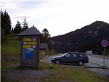 2
2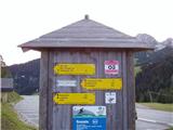 3
3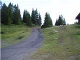 4
4 5
5 6
6 7
7 8
8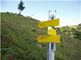 9
9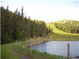 10
10 11
11 12
12 13
13 14
14 15
15 16
16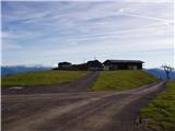 17
17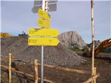 18
18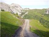 19
19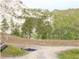 20
20 21
21 22
22 23
23 24
24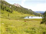 25
25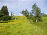 26
26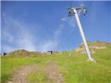 27
27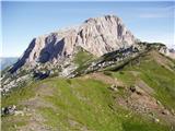 28
28 29
29 30
30 31
31 32
32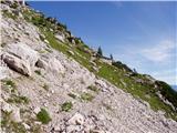 33
33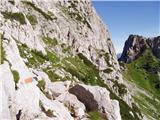 34
34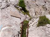 35
35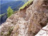 36
36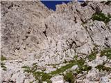 37
37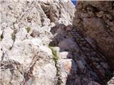 38
38 39
39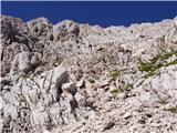 40
40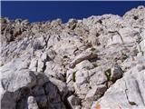 41
41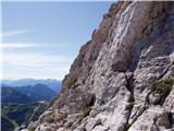 42
42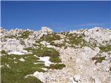 43
43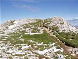 44
44 45
45
Discussion about the trail Nassfeld - Creta di Aip / Trogkofel (Uiberlacher Steig)
|
| VidPogacnik1. 06. 2009 |
Uiberlacher Steig je srednje zahtevna zavarovana plezalna pot (ferata), po lestvici za oceno ferat ocenjena s PP 2-3. Še bolj pa je moteča navedba, da gre za smučarsko smer. Sicer je ocena "zelo zahtevno", ampak res me zanima, ali je s tem mišljen navaden turni smuk, ali alpinistični smuk, in če slednje (kar bi glede na teren pričakoval), ali res v območju letne poti ali po kakšni drugi varianti. Sicer pa je celoten opis poti beden. Delu poti čez steno sta namenjena samo dva stavka. 
|
|
|
|
| jax29. 06. 2013 |
Na Uiberlacherju ni več verig, sedaj so tam nove debele zajle.
Sicer pa je pot kar prijetna, čeprav po lepoti ne dosega sosednje (težje) ferate Crete Rosse. Malo zahtevnejše je le eno mesto (čez dvojno lojtro), ostalo je v glavnem lahko poplezavanje po občasno tudi zelo krušljivem terenu, zaradi česar pa je vendarle potrebna previdnost.
|
|
|
|
| VanSims2. 11. 2014 |
Zanimivo da so vsem najtežje tiste lojtre. Celo na bergsteigen.at so označene z B ostalo pa z A. Pa bi lojtre bolj zaslužile recimo A/B, v ostalem pa bi se gotovo najdel še kak B. Več pa ne. Ocena B/C ki jo podajajo nekateri portali, je za feratni del poti pretirana.
Sicer pa je glavna težavnost tukaj prosto plezanje po izpostavljenem in kot je predhodnik tudi že povedal, krušljivem terenu. Res je potrebna previdnost.
Neplezalnega sestopa ni, še najlažje(subjektivno sicer), je po italijanski normalki. Od vrha sledimo oznaki ALTA VIA a po kake pol ure zavijemo levo kjer se začne plezalni del: kratek detalj morda I+, ostalo največ I, izpostavljenost ista, krušljivost morda le malenkost manjša. Potem gremo nazaj na avstrijsko stran - čez Rudnigsattel za Mokrine, za Rudnig Alm pa kake četrt ure prej(table), čez malo bolj zoprno skalnato pot do križišča kjer smo zapustili glavno cesto (glej naslednji odstavek).
Bližji dostop(prišparamo kako 1,5 ure) je iz Rudnig Alma(iz ceste za Mokrine zavijemo desno v Tröpolach, kjer je smerokaz) . Sedaj izven sezone ni bilo problema za parkiranje na sicer manjšem parkirišču, v sezoni morda je in vprašanje če ni dovoljeno le za goste. Ko se vzpenjamo proti začetku plezalnega dela je četr ure pred Rudnigsattel treba paziti, da zavijemo desno z glavne ceste(sicer tudi čez sedlo pridemo a izgubimo kake 15 min). Trenutno je orientacija, ciljni stebri smučarske piste, na katerih piše 'YOUR PHOTO' ali nekaj takega, par deset metrov prej se pot odcepi(neoznačeno, čez par metrov pa so spet markacije)
Sicer pa g. Pogačniku hvala za detaljnejši opis te poti in opis normalke na summitpost.org
|
|
|