Starting point: Moravče (379 m)
| Lat/Lon: | 46,1357°N 14,7446°E |
| |
Time of walking: 1 h 15 min
Difficulty: easy marked way
Altitude difference: 319 m
Altitude difference po putu: 330 m
Map: Ljubljana - okolica 1:50.000
Recommended equipment (summer):
Recommended equipment (winter): crampons
Views: 897
 | 5 people like this post |
Access to the starting point:
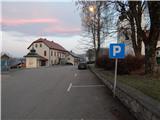
a) From the motorway Ljubljana - Maribor, take the exit Krtina and then continue in the direction of Moravče. At Moravče, turn right and park in the marked parking lot near the parish church.
b) From the direction of Zasavje, take the first exit to Izlake and from there continue towards Moravče. At Moravče, at the junction near the church, where the main road turns right, continue straight ahead and park in the marked parking lot near the parish church.
Path description:
From the Moravče centre, continue along the main road leading to Izlaki. At first, walk along the pavement, and a little beyond the Nissan Krulc company, turn slightly right, onto the road towards Ribče and Dešen and the Ušte - Žerenk Mountain Home. The way forward begins to climb along a slightly narrower asphalt road, from which, looking back, we have a beautiful view towards Limbarska gora, and with good visibility the views reach all the way to the highest peaks of the Kamniško Savinjske Alps. Shortly after Moravče ends, we reach the hamlet of Podbrdo, where we leave the asphalt road and continue left in the direction of the mountain home and St. Nicholas.
After the houses, which you pass on the left, the path goes into the forest and starts to climb a little more, but it also splits quite quickly.
Take the left path (St Nicholas on the right), which climbs crosswise to the left, and higher up widens into the newer cart track. Climb for a few minutes on the above-mentioned cart track, then again on the mountain path, which crosses a dirt road higher up, and a few 10 steps higher up, reaches an asphalt road, which is followed to the left. Follow the road to a small pass, where the marked path towards the Ušte - Žerenk Mountain Home turns left across a meadow, and we continue right on the cart track, which quickly turns into a forest across a meadow. A few minutes of gentle to moderate ascent through the forest is followed and we reach the top of Gorišca, where the conversion tower stands.
Description and pictures refer to 2018 (December).

Pictures:
 1
1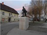 2
2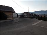 3
3 4
4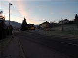 5
5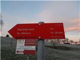 6
6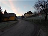 7
7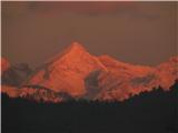 8
8 9
9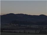 10
10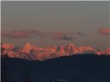 11
11 12
12 13
13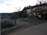 14
14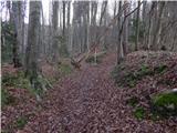 15
15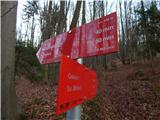 16
16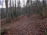 17
17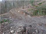 18
18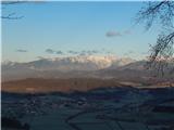 19
19 20
20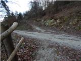 21
21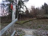 22
22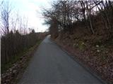 23
23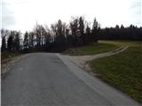 24
24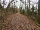 25
25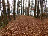 26
26 27
27
Discussion about the trail Moravče - Gorišca
|
| romankolar4. 09. 2022 09:47:59 |
Trenutno stanje: po strmem vzponu je "makadamska" potka iz slike 21 sedaj asfaltirana, naju je včeraj s punco zavedlo... Na tej točki je treba čez asfaltirano cesto in višje na drugi cesti zaviti levo. Na poti je zelo malo markacij, še posebej na razpotjih, se moraš kar zanašati na tla in nadaljevati tam, kjer ti zgleda shojeno. Tabla za Sv. Miklavž/Planinski dom na začetku poti v gozdu (slika 16) je tudi čudežno izginila  .
|
|
|