Mönichkirchen - Hochwechsel (via Steinerne Stiege)
Starting point: Mönichkirchen (1006 m)
| Lat/Lon: | 47,51217°N 16,03173°E |
| |
Name of path: via Steinerne Stiege
Time of walking: 3 h 30 min
Difficulty: easy marked way
Altitude difference: 737 m
Altitude difference po putu: 840 m
Map:
Recommended equipment (summer):
Recommended equipment (winter): ice axe, crampons
Views: 285
 | 1 person likes this post |
Access to the starting point:
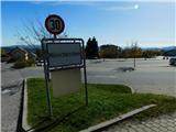
Exit the A2 motorway Graz / Graz - Vienna / Wien at the Pinggau, Friedberg exit, then take the exit from the nearby roundabout in the direction of the above-mentioned towns, Vienna and Graz. A few kilometres further on, at the junction of the regional roads, follow the signs for Vienna and Mönichkirchen. Continue along Wechsel Straße, leaving the mainly ascending road at the exit for Mönichkirchen. Then drive through the village to a large parking lot above the village, located at the foot of the ski slope.
Path description:
On the right, east side of the parking lot, the asphalt road continues, with a few more car parks alongside, and we follow it up by the ski slope. After a few minutes, we reach a marked crossroads where the path to Mönichkirchner-Schwaig splits into two.
Continue slightly to the left (straight ahead on the road) and continue along the right-hand side of the ski slope (the path across the ski slope leads past the Studentenkreuz cross). Then climb up the path, which leads along the edge of the forest, all the time close to the ski slope. At a higher altitude, cross the dirt road carefully, as during the summer season there are downhill runs with vehicles adapted for the use of the ski slopes on land.
Continue climbing along the edge of the ski slope for a few minutes before returning to the road, where you can turn left and walk to Berggasthof Mönichkirchner-Schwaig.
Continue in the direction of the Hallerhaus and Vorauer Schwaig huts and continue up the right-hand side of the second ski slope, where you will see very few signs. There are a few minutes of steeper climbing on cart track, which ascends the ski slope, before joining cart track, which continues along the ski slope. There are occasional fine views, and we follow the marked trail to the Hallerhaus hut.
Go around the hut on the left and follow the signs for Hochwechsell. The path continues through the forest, and at a few crossroads we follow the markings. Leave the forest at a slightly higher altitude and arrive at hut Kulinarik zur Stoa Alm, which offers a fine view, especially to the north-east.
Go around the hut and the upper cable car station on the left and return to the forest, through which you climb steeply for a few minutes. Higher up, the forest thins out and some views open up, and we continue a little further and arrive at the nondescript summit of Steinerne Stiege.
There is a bit of a descent through the forest, and then we reach a clearing where we can see the Schneeberg, which, with its second highest peak, the Kaiserstein, is the northernmost and also the easternmost two-thousand-peak peak in the Alps. The trail then returns to the forest and splits.
Continue straight ahead via cart track on the trail towards the Hochwechsel and Niederwechsel peaks (on the left after cart track hut Vorauer Schwaig. Continue ascending cross-country, briefly through the forest, then gradually up an increasingly exposed grassy slope. Higher up, we cross the pasture fence twice more, and follow the marked path to a crossroads near the top of Niederwechsel, where the path leading past hut Vorauer Schwaig joins from the left.
Here you go right and in a few steps climb to the rocky and scenic summit.
Continue north-west towards the summit of Hochwechsel, where you first descend gently down the grassy slopes. Lower down, we reach an indistinct saddle between the two peaks, and a few minutes further on we reach a marked crossroads where the path joins from the left, passing hut Vorauer Schwaig and a few other starting points.
Continue straight ahead and start climbing, first gently and then moderately. Follow this path to the Wetterkoglerhaus am Hochwechsel hut, where you join the road. Cross the road at the start of the car park and walk to the summit a few steps away.
Starting point - Mönichkirchner-Schwaig 0:35, Mönichkirchner-Schwaig - Hallerhaus 0:30, Hallerhaus - Stoa Alm 0:15, Stoa Alm - Steinerne Stiege 0:15, Steinerne Stiege - Niederwechsel 0:50, Niederwechsel - Hochwechsel 1:05.
Description and figures refer to the situation in October 2022.

Pictures:
 1
1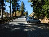 2
2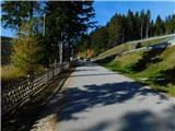 3
3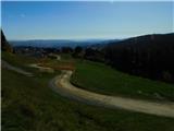 4
4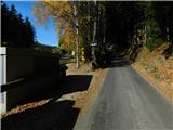 5
5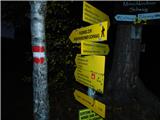 6
6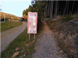 7
7 8
8 9
9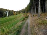 10
10 11
11 12
12 13
13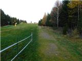 14
14 15
15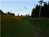 16
16 17
17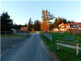 18
18 19
19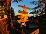 20
20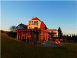 21
21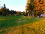 22
22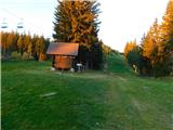 23
23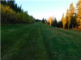 24
24 25
25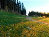 26
26 27
27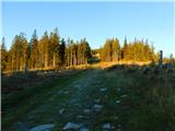 28
28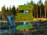 29
29 30
30 31
31 32
32 33
33 34
34 35
35 36
36 37
37 38
38 39
39 40
40 41
41 42
42 43
43 44
44 45
45 46
46 47
47 48
48 49
49 50
50 51
51 52
52 53
53 54
54 55
55 56
56 57
57 58
58 59
59 60
60 61
61 62
62 63
63 64
64 65
65 66
66 67
67 68
68 69
69 70
70 71
71 72
72 73
73 74
74 75
75 76
76 77
77 78
78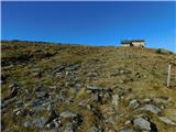 79
79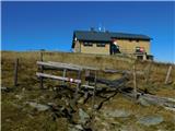 80
80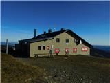 81
81 82
82 83
83 84
84
Discussion about the trail Mönichkirchen - Hochwechsel (via Steinerne Stiege)