Starting point: Mesnice (806 m)
| Lat/Lon: | 45,9066°N 14,4311°E |
| |
Time of walking: 55 min
Difficulty: easy marked way
Altitude difference: 158 m
Altitude difference po putu: 158 m
Map: Ljubljana - okolica 1:50.000
Recommended equipment (summer):
Recommended equipment (winter):
Views: 3.133
 | 2 people like this post |
Access to the starting point:
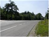
a) From the Ljubljana - Koper motorway, take the Brezovica exit, then continue in the direction of Podpeč (Podpeč can also be reached from Črna vas or Ig). In Podpeč, continue in the direction of Borovnica, Krimo and Rakitna, and continue along the edge of the Ljubljana Marshes for a short distance, then the signs for Rakitna direct you left onto a steeply ascending road. The road then leads through Preserje, where it also begins to descend. After a short descent, continue left in the direction of Krimo and Rakitna, and we then follow the mostly ascending road to a junction where the road to Krimo branches off to the left. There is plenty of space to park at the junction.
b) First take Cerknica, then continue in the direction of Begunje, and when you arrive in Begunje follow the signs for Rakitno. From Rakitna, continue along the main road towards Preserje, and follow it to the crossroads where the road to Krimo branches off to the right. There is plenty of space to park at the junction.
Path description:
From the starting point, continue along the macadam road in the direction of Krima, which is 8 km away according to the signs. The road quickly turns from scrub to forest and climbs relatively gently, first on the slopes of Reber Peak (923 m) and then on the slopes of Županov vrh (999 m). After about half an hour's walk, you reach a long left turn, where you almost imperceptibly cross the upper part of the forested Lepe Valley. From this turn, along the road, along which we have seen only a few old, partly faded markings since the starting point, we reach a marked crossroads, where the markings for Rakitna direct us to the right (straight on along the Krim road) to the ascending footpath, which continues through the forest. After a short climb, step on the fork cart track and follow it to the right. A little more caution is needed as it may happen that a motocross rider comes towards us. There are a few small forks, and we keep following the marked path towards Rakitna, but only as far as the marked fork at the saddle between Rotovc (964 m) on the left and Županov vrh (999 m) on the right.
From the crossroads at the saddle, located at 930 m, continue left towards the summit of Rotovci. The path continues along the edge of the forest, from where we occasionally get a nice view towards Rakitna, Novaška gora, the Avšnik ridge and part of the Inner Jutland hills. A moderately steep path, along which you can also see a few trail signs, takes you within a 5-minute walk from the crossroads at the saddle to the summit, which has a small bench and a registration box.

Pictures:
 1
1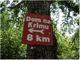 2
2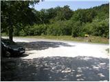 3
3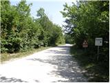 4
4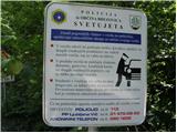 5
5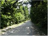 6
6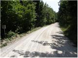 7
7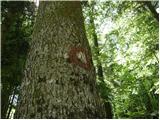 8
8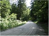 9
9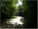 10
10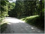 11
11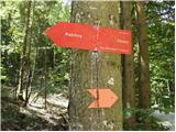 12
12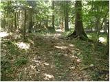 13
13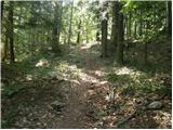 14
14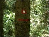 15
15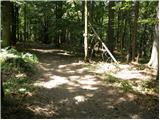 16
16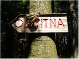 17
17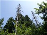 18
18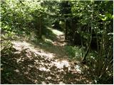 19
19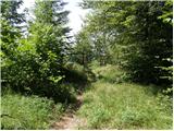 20
20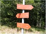 21
21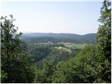 22
22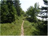 23
23 24
24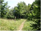 25
25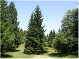 26
26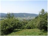 27
27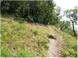 28
28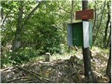 29
29
Discussion about the trail Mesnice - Rotovc