Medijske toplice - Kalanov hrib (Kalanček) (via Reber)
Starting point: Medijske toplice (275 m)
Name of path: via Reber
Time of walking: 45 min
Difficulty: easy marked way
Altitude difference: 351 m
Altitude difference po putu: 351 m
Map:
Recommended equipment (summer):
Recommended equipment (winter): crampons
Views: 4.653
 | 3 people like this post |
Access to the starting point:
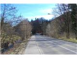
On the regional road Trojane - Izlake, turn right as soon as you see the sign for Izlake and park in the parking lot of the former Medijske topllice complex.
Path description:
For the sake of more parking space, I am indicating the following route, although it is also possible to park at the playground in Izlaki and continue via Gladež, where you join the route described below:
Leave the car at the parking lot at Medijas toplice and head towards the sandy area of the parking lot, where you can see two paths into the forest. Take the path on the right and continue along the track to the edge of the meadow, where you turn left. Walk along the edge of the wood and cross the meadow until you reach a dirt road. Turn left on this road, heading SE, and follow it to the Prašnikar farm. Turn right uphill and follow the forest road until it bends sharp right (the path through Zg. Rovn) and we continue straight on along the forest path. There is also a tree with a marker on the left. Follow the path all the way to the trail junction from Medija grad, then a 15-minute climb up the ridge of Kalanova hill. The path leads to a sloping peak, where a view opens up towards Menina, Golte and Čemšeniška mountain pasture. Continue straight on to a large clearing, where a registration box and a view of the Zasavje hills await us by the ruins of the old Kalanček house.
There are several ways back. You can go down to the south of the meadow and continue down the path towards the Medija Castle and the chapel with the remains of John Vajkard Valvasor, and then continue around the hill on the forest path, where you can also see the famous Valvazor Tunnel, which is said to connect Medija Toplice and Medija Castle. The trail leads to a dirt road which takes you back to the starting point of your climb.
You can also return via Anžlovar, where after the ruins of an old house you turn onto a forest path that leads you to Anžlovar, where you turn right downhill and arrive in the village of Podlipovica.

Pictures:
 1
1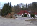 2
2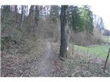 3
3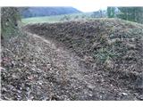 4
4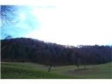 5
5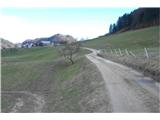 6
6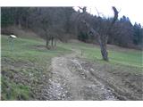 7
7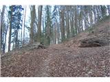 8
8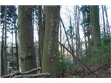 9
9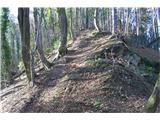 10
10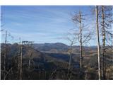 11
11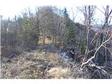 12
12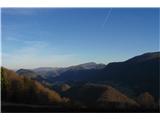 13
13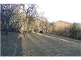 14
14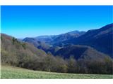 15
15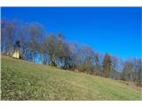 16
16
Discussion about the trail Medijske toplice - Kalanov hrib (Kalanček) (via Reber)
|
| grega_p4. 02. 2022 18:54:05 |
Hvala lepa za opis.
Stanje poti je trenutno takšno, da ji ne bi mogel več reči označena pot, saj sem videl samo eno obledelo markacijo. Poleg tega je na tistem ovinku v gozdu tudi precej podrtih dreves. Hotel spodaj pri parkirišču pa nažalost tudi zelo klavrno propada.
Drugače pa fajn izlet in zanimivi, reliefno zelo razgibani konci.
p.s. Pri spustu proti tovarni Eti (Medijski grad) ne izbrati preveč JV poti ob robu travnika, ker se kmalu konča in se je kasneje potrebno prebiti po strminah do označene poti.
|
|
|