Markova raven - Vrh Korena (marked way)
Starting point: Markova raven (980 m)
| Lat/Lon: | 46,2969°N 14,5618°E |
| |
Name of path: marked way
Time of walking: 3 h 15 min
Difficulty: easy marked way
Altitude difference: 1019 m
Altitude difference po putu: 1050 m
Map: Kamniške in Savinjske Alpe 1:50.000
Recommended equipment (summer):
Recommended equipment (winter): ice axe, crampons
Views: 17.617
 | 1 person likes this post |
Access to the starting point:
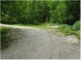
Drive into Kamnik and follow the road towards the Kamniška Bistrica valley. Just a few tens of metres before the bottom station of the pendulum, a forest road branches off to the left down into the Korošica valley. The road then crosses a bridge and shortly afterwards comes to a crossroads where you continue straight ahead. The road then leads to a crossroads again. 1. Turn left over the bridge and follow the road uphill. The Markovo level can be identified by a small parking lot, a stream and a wide cart track which heads up to the left and the road starts to descend steeply. 2. Continue straight ahead and climb the road which leads to the next crossroads. Continue along the road on the left, which becomes very steep, and follow it to the parking lot at the left-hand bend, from which a wide cart track turns off straight ahead. Park in the parking lot on the roadside.
Path description:
From the parking lot, take the wide cart track road, which after a few dozen metres leads to the next parking lot. Continue straight across the parking lot and continue up the cart track, which turns left. After a few minutes' walk, cart track has a crossroads where you take the marked cart track to the right. Follow this for a few minutes to where the footpath to Krvavec and mountain pasture Koren branches off to the right. The branch is not marked so you have to follow the signs carefully. The path continues up the right side of the torrent quite steeply. The path then leads us to a crossroads where we continue to the right in the route ZA VRATA. The way forward slowly passes into a less dense forest, so that we sometimes cross a small meadow or even a short scree slope. The views are also getting better. Next, the path leads us under the foot of a shorter wall from which an unmarked path branches off to the right up to mountain pasture Koren. Continue slightly up the left side of the wall. The path ahead descends gently and leads to a pleasant small spring. The path continues to the left side of the small spring and starts climbing again. The path then crosses a short lane of dwarf pines and then starts to climb on grass. Further on, the path is more difficult to follow as it quickly gets lost in the grass but the markings, which are more sparse, will help. After 20 minutes of climbing from the well, the path leads us to a wooden house. The path behind the cottage turns left into the forest and after a short climb joins the path with Kriška planina (Krvavec). Continue sharp right and without a significant ascent or descent cross the lane of the forest. Further on, the path starts to climb up slopes covered with dwarf pines and a few trees. After 20 minutes of ascent, the steepness eases and the shepherd's hut at mountain pasture Koren can be seen ahead. The path then descends past a watering point for animals to a shepherd's hut at mountain pasture.
Here our route continues slightly left (slightly right mountain pasture Košutna) through the meadows on the valley flor (the path is initially not very visible). The path then becomes steeper and steeper and after less than 30 minutes of walking leads us to a small puddle where there is a less well marked crossroads. Continue straight on (right Košutna) and follow the gently sloping path to the next crossroads, where you continue left in the direction of Vrh Korena (straight Kompotel). The way ahead starts to climb steeper and quickly leads us through the karst world to the place where we join the path from Veliki Zvoh to Vrh Korena (the ridge of Jez). Continue to the right and the path leads us in a few steps to a place where the path to Vrh Korena branches off to the right, which is reached after a minute's further walking. Markovo level - mountain pasture Koren 2:00, mountain pasture Koren - Vrh Korena 1:00.

Pictures:
 1
1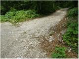 2
2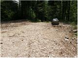 3
3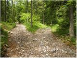 4
4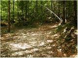 5
5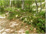 6
6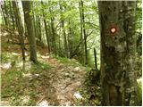 7
7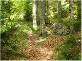 8
8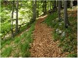 9
9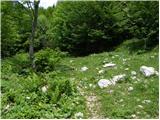 10
10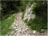 11
11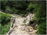 12
12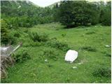 13
13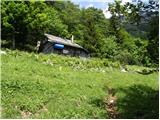 14
14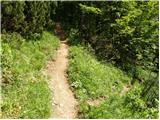 15
15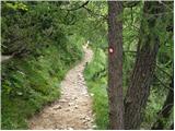 16
16 17
17 18
18 19
19 20
20 21
21 22
22 23
23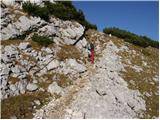 24
24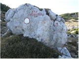 25
25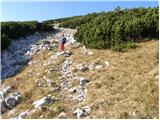 26
26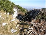 27
27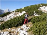 28
28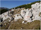 29
29 30
30 31
31 32
32 33
33
Discussion about the trail Markova raven - Vrh Korena (marked way)
|
| petruša1. 06. 2010 |
zanima me če je kdo pred kratkim hodil kaj po tej poti, če še je kaj snega ali je pot že kopna. Ker bi v soboto radi šli na Vrh Korena ali pa Košutno, po slikah in opisih sem gledala, da je to vse na enem koncu in bi lahko v enem dnevu vse prehodili. Če je že kdo hodil v tem delu mi naj prosim kaj pove. lp
|
|
|
|
| Pillar2. 06. 2010 |
V soboto (29.5.2010) smo prehodili krožno pot iz Kriške planine preko planine Koren, Košutne, Kompotele, Vrha Korena in Velikega Zvoha nazaj dol. Snega praktično ni več, razen nekaj zaplat južnega snega proti Vrhu Korena in Kompoteli. Prehodno brez težav, pa še tega v kratkem ne bo več. Tura je dolga okoli 6 ur, hoja nezahtevna, razen na dveh mestih, kjer so jeklenice. Prvo zahtevno mesto je na poti iz planine Koren proti Košutni, drugo pa na poti čez Ježa (od Vrha Korena proti V. Zvohu), kjer pa bi zaradi 20 meterskega spusta po krušljivem terenu priporočal čelado. Obeh mest se da izogniti, vendar je pot lepa s še lepšimi razgledi. Mi smo imeli precej megleno vreme, zato bo turo potrebno ponoviti. Z veseljem.
|
|
|
|
| petruša2. 06. 2010 |
Iz Košutne ste šli na Vrh Korena in od tam dalje na V. Zvoh? gledam po slikah in berem, da je vse to blizu, nevem pa če je označeno, ali moraš iz Košutne iti malo nazaj dol proti Planini Koren in nato dalje na Vrh Korena ali lahko kar iz Košutne nadaljuješ na Vrh Korena in nato dalje na V. Zvoh. lp. HVala že v naprej
|
|
|
|
| Pillar2. 06. 2010 |
Vsi vrhovi sestavljajo nekakšen greben v obliki črke U okoli planine Koren in sploh niso izraziti vrhovi. Ko prideš na Košutno, hodiš potem malce gor, malce dol (+/- 50 viš.m.) do V. Zvoha, kjer se nato spustiš po smučišču. Upoštevaj, da je bilo takrat precej oblačno oz. megleno in je v jasnem vremenu lahko videti nekoliko drugače. Pot je markirana, shojena, v lepem vremenu ni težav z orientacijo. Je pa vidnih več poti. Še enkrat bi opozoril na pot čez Ježa, ki je precej zračna in omenjeni spust, ki je sicer zavarovan z jeklenico in klini, uvršča to pot med zelo zahtevne (seveda po mojem mnenju). LP
|
|
|
|
| maucec407. 06. 2010 |
Včeraj 6.6.2010 sva jo z možem mahnila iz Markove ravni na vrh Korena. Malce prepozno sva odrinila in sonce naju je kar precej žgalo. Ja, bo treba zgodaj vstajati. Vročina je tu! Drugače je pa pot super označena vse do koče na Korenu, naprej pa malce slabše, vendar je kar precej pohodnikov, tako da ni problema. Razgled z vrha pa je bil nepozaben! Prečudovito vreme!
|
|
|
|
| trilko25. 08. 2012 |
Cesta do Markove ravni je v dokaj slabem stanju. Zadnjič sem se peljal tja marca 2012, takrat je bilo še dokaj ok. Danes (25.8. 2012) je bila cesta že res v slabem stanju, in to skoraj od začetka od spodnje postaje gondole na Veliko Planino. Če bi vedel, da je taka cesta, bi se raje zapeljal v Kokro in štartal od tam, ali pa s Kriške planine. Moj bogi avto don't like, je kar ornk praskalo in pokalo... 
|
|
|
|
| lanževica28. 11. 2012 |
Trenutno je cesta (po zadnjih poplavah) praktično neprevozna za osebne avtomobile. S tem je pot podaljšana skoraj za dve uri do Markove ravni.
|
|
|
|
| cerarblaz13. 12. 2015 |
Cesta je lepo prevozna z osebnim avtomobilom. Je popravljena in široka. V dobri uri sva prišla do planine Koreno (tam vas pri koči celo leto čaka "žgano" presenečenje). Vrh korena sva dosegla po točno dveh urah hoje. Nadeljevala sva na Kompotelo (cca 30 min), Skutno (cca 30 min) in skozi dolino Skutne zaključila krog do planine Koreno. Potem pa v Markovo raven do avta. LP
|
|
|
|
| franca14. 12. 2015 |
planina je Koren, vrh je Vrh Korena, Skutna je pa najbrž Košutna, dolina Skutne pa planina Košutna 
|
|
|
|
| Grenaleva15. 12. 2015 |
Je pot kopna, ali so kje kake snežne posebnosti?
|
|
|
|
| cerarblaz1. 01. 2016 |
Opa Franc...sem opazil napako, imaš prav, Košutna je ja, Hvala!!
|
|
|
|
| franjo6628. 03. 2017 |
Zanma me kaksna je cesta do izhodisca poti(sneg,led)
Hvala za odgovor!
|
|
|
|
| Hribovc9127. 03. 2022 23:03:24 |
27.3.2022 - Cesta (1.varianta) ni ravno v zglednem stanju (2. varianta na bi bila še slabša). Z avtomobili z višjim podvozjem ali manjšimi avti (Clio) še gre, drugače odsvetujem. Veliko padajočega, ostrega kamenja na cesti. Planinska pot od Markovne ravni dalje je sicer zelo lepa. Mogoče je boljše pustiti avto nekoliko nižje in narediti par 100m višincev več.
|
|
|