Markova raven - Košutna (marked way)
Starting point: Markova raven (980 m)
| Lat/Lon: | 46,2969°N 14,5618°E |
| |
Name of path: marked way
Time of walking: 2 h 50 min
Difficulty: partly demanding marked way
Altitude difference: 994 m
Altitude difference po putu: 1000 m
Map: Kamniške in Savinjske Alpe 1:50.000
Recommended equipment (summer): helmet
Recommended equipment (winter): helmet, ice axe, crampons
Views: 14.011
 | 3 people like this post |
Access to the starting point:
Drive into Kamnik and follow the road towards the Kamnik Bistrica valley. Just a few tens of metres before the bottom station of the pendulum, a forest road branches off to the left down into the Korošica valley. The road then crosses a bridge and shortly afterwards comes to a crossroads where you continue straight ahead. The road then leads to a crossroads again. 1. Turn left over the bridge and follow the road uphill. The Markovo level can be identified by a small parking lot, a stream and a wide cart track which heads up to the left and the road starts to descend steeply. 2. Continue straight on and climb the road which leads to the next crossroads. Continue along the road on the left, which becomes very steep, and follow it to the parking lot at the left-hand bend, from which a wide cart track turns off straight ahead. Park in the roadside parking lot.
Path description:
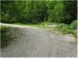
From the parking lot, take the wide cart track, which after a few dozen metres leads to the next parking lot. Continue straight across the parking lot and continue up the cart track, which turns left. After a few minutes' walk, cart track has a crossroads where you take the marked cart track to the right. Follow this for a few minutes to where the footpath to Krvavec and mountain pasture Koren branches off to the right. The branch is not marked so you have to follow the signs carefully. The path continues up the right side of the torrent quite steeply. The path then leads us to a crossroads where we continue to the right in the route ZA VRATA. The way forward slowly passes into a less dense forest, so that we sometimes cross a small meadow or even a short scree slope. The views are also getting better. Next, the path leads us under the foot of a shorter wall from which an unmarked path branches off to the right up to mountain pasture Koren. Continue slightly up the left side of the wall. The path ahead descends gently and leads to a pleasant small spring. The path continues to the left side of the small spring and starts climbing again. The path then crosses a short lane of dwarf pines and then starts to climb on grass. Further on, the path is more difficult to follow as it quickly gets lost in the grass but the markings, which are more sparse, will help. After 20 minutes of climbing from the well, the path leads us to a wooden house. The path behind the cottage turns left into the forest and after a short climb joins the path with Kriška planina (Krvavec). Continue sharp right and without a significant ascent or descent cross the lane of the forest. Further on, the path starts to climb up slopes covered with dwarf pines and a few trees. After 20 minutes of ascent, the steepness eases and the shepherd's hut at mountain pasture Koren can be seen ahead. The path then descends past a watering point for animals to a shepherd's hut at mountain pasture.
Here, at the hut, a path branches off slightly to the right (south-easterly direction) and leads to mountain pasture Košutna. The path initially crosses the slopes almost horizontally and then leads to a technically difficult place. The path climbs steeply over a short rock jump, where fixed safety gear is helpful. The path then lays down and leads us past the cross to mountain pasture Košutna, where the chapel and shepherd's hut stand. From mountain pasture continue on the less well worn path that goes along the left side of the chapel between dwarf pines. The path continues gently up the moderately steep and scenic slope Košutna. When the path is fully level, a path branches off to the right to the top of Košutna (the branch is marked, but the path is incorrectly marked). Follow this very poorly visible path all the way to the top, which is reached after 15 minutes of further walking (keep to the left-hand crossing, although the marking in the lower part directs you to the right).
The path is marked but in some places difficult to follow. If you lose the path, look for a crossing between dwarf pines, taking care not to get stuck in dwarf pines.
Markovo level - mountain pasture Rot 2:00, mountain pasture Rot - Košutna 50 minutes.

Pictures:
 1
1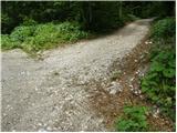 2
2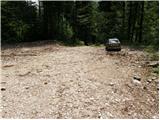 3
3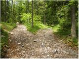 4
4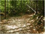 5
5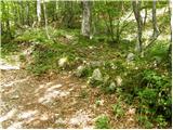 6
6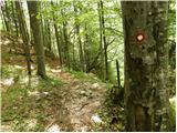 7
7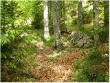 8
8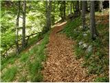 9
9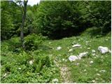 10
10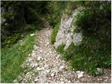 11
11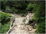 12
12 13
13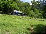 14
14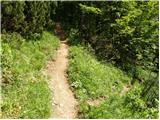 15
15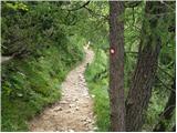 16
16 17
17 18
18 19
19 20
20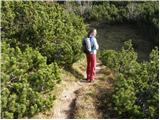 21
21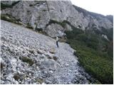 22
22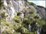 23
23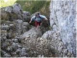 24
24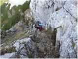 25
25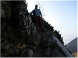 26
26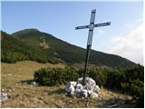 27
27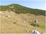 28
28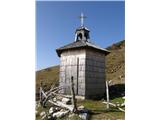 29
29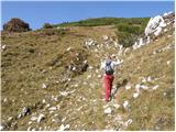 30
30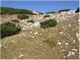 31
31 32
32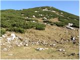 33
33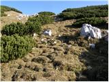 34
34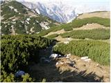 35
35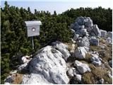 36
36
Discussion about the trail Markova raven - Košutna (marked way)
|
| grega_z_brega26. 10. 2015 |
Včeraj sem se odpravil na Košutno, z Markove ravni.
Za začetek, leva cesta je v boljšem stanju kot desna, je sicer čez podrto drevo, kar za nižji avtomobil ne prdstavlja ovire.
Skratka, vreme je bilo fantastično, toplo in v gorah je bilo veliko pohodnikov. Da sem se izognil gužvi sem v melišču malo pred napajalniki z vodo zavil desno na neoznačeno pot mimo Dedca.
Pot je slikovita in ponuja lepe razglede ter seveda ne srečaš žive duše.
Več pa v slikah.
...ko jih spravim v vrstni red..
|
|
|
|
| Kman5. 04. 2021 16:22:55 |
Pozdravljeni, danes sem na poti v dolino (predvidevam, da nekje v bližini hiške - 14. fotografija) izgubil klasične dereze Black Diamond Serac. Če je kdo naletel nanje, mi lahko piše/kliče na 070771324. Že vnaprej hvala. 
|
|
|
|
| Spelcarocket9. 06. 2023 18:05:18 |
Zelo lepa in samotna pot. Je pa cesta (leva po razcepu) zelo slaba in je ne priporočam za ne-terenska vozila.
|
|
|