Mačkin Kot (Enci) - Kranjska reber
Starting point: Mačkin Kot (Enci) (815 m)
| Lat/Lon: | 46,2998°N 14,7353°E |
| |
Time of walking: 1 h 45 min
Difficulty: easy unmarked way, easy marked way
Altitude difference: 620 m
Altitude difference po putu: 620 m
Map: Kamniške in Savinjske Alpe 1:50.000
Recommended equipment (summer):
Recommended equipment (winter): ice axe, crampons
Views: 1.930
 | 1 person likes this post |
Access to the starting point:
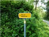
a) First, drive to Gornji grad, then continue in the direction of the Črnivec Pass and Kamnik. When you reach the settlement Šmiklavž, opposite the sign (cross), turn right in the direction of the path over Mačkin Kot, the Mizarske in tesarske služby Belaj Janez s. p. and Šmiklavža 16-26, 28-34. After crossing the Mačkovec stream, the road starts to climb steeply and we follow it to the Enci homestead, near which we park in a suitable place. There are no parking spaces at the starting point.
b) We drive into Kamnik, then continue to the Črnivec Pass and on to Gornji Grad. When you reach the settlement Šmiklavž, a few 100 metres further on from the 5 km road sign, turn left in the direction of the path over Mačkin Kot, the Mizarske in tesarske služby Belaj Janez s. p. and Šmiklavž 16-26, 28-34. Continue past individual houses, and then, after crossing the Mačkovec stream, the road begins to climb steeply, and we follow it to the Enci homestead, near which we park in a suitable place. There are no parking spaces at the starting point.
Path description:
From the crossroads by the Enci homestead, continue left and walk across the yard of the nearby homestead. After the houses, continue across the pasture, then the road turns right into the woods, and then climbs moderately. There are a few serpentines higher up, and at crossroads follow the road, not the tracks that branch off the road. Higher up, the road reaches an undistinguished forest ridge, where it bends slightly to the right, and in the middle of the bend a wider track branches off to the right, which can be followed towards Lepenatka, while we continue on the road until we reach the main ridge between Kranjska ridge and Lepenatka (saddle Kunšperk).
As soon as you reach the ridge, continue left on the marked footpath (right Lepenatka), which climbs first moderately and then steeply along the wooded ridge. During the ascent, the path leads over a short jump, then gradually flattens out and leads us higher up to a forest road.
When we reach the road, a view of the Kamnik Savinja Alps two-thousanders opens up to our right, and we continue along the road, which bypasses Kašni vrh on the left, but when, after a few minutes of cross-climbing, we reach the road leading from Črnivec Pass to Volovljek Pass, we continue a few steps to the right, and then, at the next crossroads, left upwards towards Kašna mountain pasture.
The way forward crosses a pasture fence, then the ascent continues along the road or along a marked shortcut. Wherever you continue, after 5 minutes you will reach the hut at Kašná mountain pasture.
From the hut, continue along the well-trodden path, which leads us in a moderate ascent and with beautiful views, in about 20 minutes of further walking to the top of Kranjska Ribra.
Description and pictures refer to the situation in 2016 (July).

Pictures:
 1
1 2
2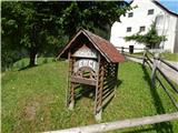 3
3 4
4 5
5 6
6 7
7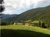 8
8 9
9 10
10 11
11 12
12 13
13 14
14 15
15 16
16 17
17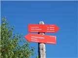 18
18 19
19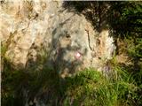 20
20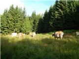 21
21 22
22 23
23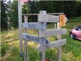 24
24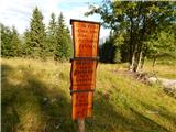 25
25 26
26 27
27 28
28 29
29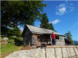 30
30 31
31 32
32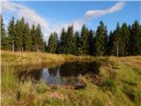 33
33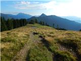 34
34 35
35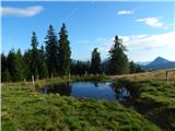 36
36 37
37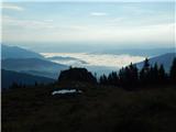 38
38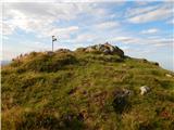 39
39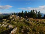 40
40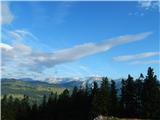 41
41
Discussion about the trail Mačkin Kot (Enci) - Kranjska reber
|
| Hribolazec8123. 07. 2022 17:16:54 |
Zanima me, kako je tale pot kaj sledljiva?  Hvala
|
|
|